199.167.246.246 - IP Lookup: Free IP Address Lookup, Postal Code Lookup, IP Location Lookup, IP ASN, Public IP
Country:
Region:
City:
Location:
Time Zone:
Postal Code:
ISP:
ASN:
language:
User-Agent:
Proxy IP:
Blacklist:
IP information under different IP Channel
ip-api
Country
Region
City
ASN
Time Zone
ISP
Blacklist
Proxy
Latitude
Longitude
Postal
Route
db-ip
Country
Region
City
ASN
Time Zone
ISP
Blacklist
Proxy
Latitude
Longitude
Postal
Route
IPinfo
Country
Region
City
ASN
Time Zone
ISP
Blacklist
Proxy
Latitude
Longitude
Postal
Route
IP2Location
199.167.246.246Country
Region
pennsylvania
City
titusville
Time Zone
America/New_York
ISP
Language
User-Agent
Latitude
Longitude
Postal
ipdata
Country
Region
City
ASN
Time Zone
ISP
Blacklist
Proxy
Latitude
Longitude
Postal
Route
Popular places and events near this IP address

Scalp Level, Pennsylvania
Borough in Pennsylvania, United States
Distance: Approx. 4005 meters
Latitude and longitude: 40.25111111,-78.83972222
Scalp Level is a borough in Cambria County, Pennsylvania, United States. It is part of the Johnstown, Pennsylvania Metropolitan Statistical Area. The population was 778 at the 2010 census.

Paint, Pennsylvania
Borough in Pennsylvania, United States
Distance: Approx. 3779 meters
Latitude and longitude: 40.24333333,-78.84611111
Paint is a borough in Somerset County, Pennsylvania, United States. The population was 907 at the 2020 census. It is part of the Johnstown, Pennsylvania Metropolitan Statistical Area.

Paint Township, Somerset County, Pennsylvania
Township in Pennsylvania, United States
Distance: Approx. 4209 meters
Latitude and longitude: 40.20152,-78.85181
Paint Township is a township in Somerset County, Pennsylvania, United States. The population was 3,038 at the 2020 census. It is part of the Johnstown, Pennsylvania, Metropolitan Statistical Area.

Windber, Pennsylvania
Borough in Pennsylvania, United States
Distance: Approx. 2204 meters
Latitude and longitude: 40.23527778,-78.83083333
Windber is a borough in Somerset County, Pennsylvania, United States, which is located approximately three miles (4.8 km) south of Johnstown. The population was 3,930 at the 2020 census. A former manufacturing town, Windber is part of the Johnstown, Pennsylvania Metropolitan Statistical Area.
Pennsylvania Highlands Community College
College in Johnstown, Pennsylvania, U.S.
Distance: Approx. 5113 meters
Latitude and longitude: 40.26407,-78.83693
Pennsylvania Highlands Community College is a public community college in Johnstown, Pennsylvania. Satellite sites are provided in Altoona (Blair County), Ebensburg (northern Cambria County), Somerset (Somerset County), and Huntingdon (Huntingdon County).

University of Pittsburgh at Johnstown
Public university in Johnstown, Pennsylvania, US
Distance: Approx. 5392 meters
Latitude and longitude: 40.267507,-78.834913
University of Pittsburgh at Johnstown (UPJ or Pitt-Johnstown) is a state-related college in the Johnstown, Pennsylvania area. It is a baccalaureate degree-granting regional campus of the University of Pittsburgh. The university is located in Richland Township, a suburban area near Johnstown city, and was founded in 1927 as one of the first regional campuses of a major university in the United States.

Richland Senior High School
School in Johnstown, Cambria County, Pennsylvania, United States of America
Distance: Approx. 5518 meters
Latitude and longitude: 40.2669,-78.8402
Richland High School is a small, rural public high school located at One Academic Avenue, Johnstown, Pennsylvania. In the 2016–2017, Richland High School enrollment was reported as 762 pupils in 7th through 12th grades. Richland High School is the sole high school operated by Richland School District.

Richland School District (Cambria County, Pennsylvania)
School district in Pennsylvania
Distance: Approx. 5690 meters
Latitude and longitude: 40.26874,-78.83988
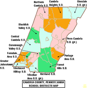
The Richland School District is a small, rural, public school district in Cambria County, Pennsylvania. It serves the borough of Geistown and the Township of Richland. It encompasses approximately 22 square miles.

Windber Historic District
Historic district in Pennsylvania, United States
Distance: Approx. 2336 meters
Latitude and longitude: 40.23611111,-78.83194444
Windber Historic District is a national historic district located at Paint Borough, Scalp Level, and Windber in Cambria County and Somerset County, Pennsylvania. The district includes 944 contributing buildings and 1 contributing site. It encompasses an area first developed by the Berwind-White Coal Company in 1897, and developed and between 1897 and 1930.
Windber Area High School
Public high school in Windber, Pennsylvania
Distance: Approx. 1431 meters
Latitude and longitude: 40.23044,-78.82424
Windber Area High School is a public High School on the Somerset-Cambria County Border, serving students from the Somerset County boroughs of Windber and Paint, also Scalp Level Borough in Cambria County. It also serves students in Paint and Ogle Townships in Somerset County. WAHS's feeder school, Windber Area Middle School is connected directly to the high school.

John P. Saylor Trail
Hiking trail system in Pennsylvania
Distance: Approx. 4986 meters
Latitude and longitude: 40.21611111,-78.75277778
The John P. Saylor Trail is a 17.5-mile (28.2 km) hiking trail system in southwestern Pennsylvania, consisting of two loops with a short cross-connector trail, through Gallitzin State Forest in Somerset County. The trail is named after Congressman John P. Saylor, who sponsored the National Scenic Trails Act while supporting national wilderness preservation. The main loop, which can be reached from the trailhead, is 12.0 miles around.
University of Pittsburgh (Johnstown), Pennsylvania
CDP in Pennsylvania, United States
Distance: Approx. 5461 meters
Latitude and longitude: 40.266349,-78.84014
University of Pittsburgh (Johnstown) (CDP) is a census-designated place in Richland Township, Cambria County, Pennsylvania, United States. It is located just off campus to University of Pittsburgh at Johnstown, approximately four miles east of the city of Johnstown. As of the 2010 census, the population was 1,572 residents.
Weather in this IP's area
mist
-1 Celsius
-7 Celsius
-1 Celsius
-0 Celsius
1017 hPa
93 %
1017 hPa
939 hPa
6437 meters
7.2 m/s
13.89 m/s
150 degree
100 %