199.165.203.15 - IP Lookup: Free IP Address Lookup, Postal Code Lookup, IP Location Lookup, IP ASN, Public IP
Country:
Region:
City:
Location:
Time Zone:
Postal Code:
IP information under different IP Channel
ip-api
Country
Region
City
ASN
Time Zone
ISP
Blacklist
Proxy
Latitude
Longitude
Postal
Route
Luminati
Country
ASN
Time Zone
America/Chicago
ISP
ROLLERNETWORK
Latitude
Longitude
Postal
IPinfo
Country
Region
City
ASN
Time Zone
ISP
Blacklist
Proxy
Latitude
Longitude
Postal
Route
IP2Location
199.165.203.15Country
Region
nevada
City
incline village
Time Zone
America/Los_Angeles
ISP
Language
User-Agent
Latitude
Longitude
Postal
db-ip
Country
Region
City
ASN
Time Zone
ISP
Blacklist
Proxy
Latitude
Longitude
Postal
Route
ipdata
Country
Region
City
ASN
Time Zone
ISP
Blacklist
Proxy
Latitude
Longitude
Postal
Route
Popular places and events near this IP address

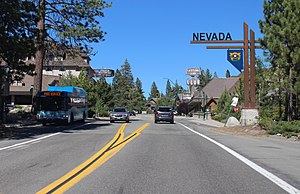
Incline Village, Nevada
Census-designated place in Nevada, United States
Distance: Approx. 1115 meters
Latitude and longitude: 39.24583333,-119.95
Incline Village is an upscale census-designated place (CDP) on the north shore of Lake Tahoe in Washoe County, Nevada, United States. The population was 8,777 at the 2010 census. It is part of the Reno−Sparks Metropolitan Statistical Area.
Ponderosa Ranch
Former US theme park in Nevada, US
Distance: Approx. 3184 meters
Latitude and longitude: 39.233531,-119.929743
The Ponderosa Ranch was a theme park based on the television western Bonanza, which housed the land, timber and livestock-rich Cartwright family. The amusement park operated in Incline Village, Nevada, near Lake Tahoe, from 1968 until 2004. Portions of the last five seasons of the TV series and three television films were also filmed at that location.
Diamond Peak (ski area)
Ski area in Nevada, United States
Distance: Approx. 2540 meters
Latitude and longitude: 39.254,-119.924
Diamond Peak is a ski resort in the western United States, located in Incline Village, Nevada. Near the northeast shore of Lake Tahoe, the resort has 6 chairlifts, 27 runs, and 14 open glades/tree skiing on its 655 acres (2.65 km2) of terrain. Its summit elevation is 8,540 feet (2,603 m) above sea level, yielding a vertical drop of 1,840 feet (561 m), sixth among the ski areas surrounding Lake Tahoe.

Crystal Bay, Nevada
Census-designated place in Nevada, United States
Distance: Approx. 5375 meters
Latitude and longitude: 39.22777778,-120.00444444
Crystal Bay is a census-designated place (CDP) located on the north shore of Lake Tahoe in Washoe County, Nevada, United States. The population was 305 at the 2010 census. It is part of the Reno−Sparks Metropolitan Statistical Area.
Mount Baldy (Nevada)
Mountain in Nevada, United States
Distance: Approx. 4767 meters
Latitude and longitude: 39.2784299,-120.0001144
Mount Baldy is located in Washoe County, Nevada in the Mount Rose Wilderness. The summit is at 9,271 feet (2,826 m), and it is 3.1 miles (5.0 km) north-northwest of Kings Beach, California and 2.4 miles (3.9 km) northwest of Incline Village, Nevada, both of which are on the north shore of Lake Tahoe. The highest point in Placer County, California is on the west ridge at elevation of about 9044 feet (2756 m) and about 0.3 miles (0.48 km) west-southwest of the summit.

Withers Log House
Historic house in Nevada, United States
Distance: Approx. 4631 meters
Latitude and longitude: 39.23638889,-120.00111111
The Withers Log House, at 344 Wassou in Crystal Bay, Nevada, is a historic house that was built in 1931. It was listed on the National Register of Historic Places in 2000. It was deemed significant as a good example of "a modest, but well-designed and beautifully detailed log vacation home" which was one of the first homes built in the Crystal Bay Corporation's subdivision in the north shore area of Lake Tahoe.

Cal-Vada Lodge Hotel
Historic hotel in Crystal Bay, Nevada, United States
Distance: Approx. 5411 meters
Latitude and longitude: 39.22722222,-120.00444444
The Cal-Vada Lodge Hotel is a historic hotel in Crystal Bay, Nevada, United States, at the California-Nevada border at the north end of Lake Tahoe, is a Bungalow/craftsman-style hotel that was built in 1935. It was listed on the National Register of Historic Places in 1994.

Incline Creek
River in Nevada, United States
Distance: Approx. 1948 meters
Latitude and longitude: 39.23861111,-119.9475
Incline Creek is a 5.2-mile (8.4 km) southward-flowing stream originating in the Carson Range, Sierra Nevada in the northeast Lake Tahoe Basin in Washoe County in western Nevada. Incline Creek flows through the Diamond Peak Ski Area on the way to Incline Village where it empties into Lake Tahoe.
Incline High School
Public high school
Distance: Approx. 125 meters
Latitude and longitude: 39.2552,-119.952
Incline High School is located in Incline Village, Nevada near Lake Tahoe. It is accredited by the Northwest Association of Secondary and Higher Schools. It is part of the Washoe County School District.

Sierra Nevada University
Defunct University near Lake Tahoe in Nevada, U.S.
Distance: Approx. 1764 meters
Latitude and longitude: 39.2444,-119.9388
Sierra Nevada University (SNU) was a private university in Incline Village, Nevada, in the Sierras. In 2022, it was announced that the school would no longer be independent and would be merged into the University of Nevada, Reno system.

Rose Knob Peak
Mountain in the American state of Nevada
Distance: Approx. 4247 meters
Latitude and longitude: 39.2935027,-119.9577945
Rose Knob Peak is a 9,710-foot-elevation mountain summit located in Washoe County, Nevada, United States.

Tahoe Biltmore
Distance: Approx. 5339 meters
Latitude and longitude: 39.2284,-120.0045
The Tahoe Biltmore is a closed hotel and casino in Crystal Bay, Nevada. It opened on June 30, 1948, after several years of delayed construction, a result of design changes and rising costs. Upon opening, the Tahoe Biltmore encountered further financial problems.
Weather in this IP's area
snow
2 Celsius
-1 Celsius
-0 Celsius
4 Celsius
1016 hPa
90 %
1016 hPa
797 hPa
3219 meters
2.68 m/s
99 degree
100 %
