199.16.127.217 - IP Lookup: Free IP Address Lookup, Postal Code Lookup, IP Location Lookup, IP ASN, Public IP
Country:
Region:
City:
Location:
Time Zone:
Postal Code:
ISP:
ASN:
language:
User-Agent:
Proxy IP:
Blacklist:
IP information under different IP Channel
ip-api
Country
Region
City
ASN
Time Zone
ISP
Blacklist
Proxy
Latitude
Longitude
Postal
Route
db-ip
Country
Region
City
ASN
Time Zone
ISP
Blacklist
Proxy
Latitude
Longitude
Postal
Route
IPinfo
Country
Region
City
ASN
Time Zone
ISP
Blacklist
Proxy
Latitude
Longitude
Postal
Route
IP2Location
199.16.127.217Country
Region
california
City
corona
Time Zone
America/Los_Angeles
ISP
Language
User-Agent
Latitude
Longitude
Postal
ipdata
Country
Region
City
ASN
Time Zone
ISP
Blacklist
Proxy
Latitude
Longitude
Postal
Route
Popular places and events near this IP address

Corona, California
City in California, United States
Distance: Approx. 3295 meters
Latitude and longitude: 33.86666667,-117.56666667
Corona (Spanish for "Crown") is a city in northwestern Riverside County, California, United States. Its current mayor is Jim Steiner. At the 2020 census, the city had a population of 157,136, up from 152,374 at the 2010 census.

Home Gardens, California
Census-designated place in California, United States
Distance: Approx. 2123 meters
Latitude and longitude: 33.87944444,-117.51194444
Home Gardens is a census-designated place (CDP) in Riverside County, California, United States. It is within the City of Corona's sphere of influence. The population was 11,203 at the 2020 census, down from 11,507 at the 2010 census.
Centennial High School (Corona, California)
Public high school in Corona, California, United States
Distance: Approx. 2545 meters
Latitude and longitude: 33.859,-117.5455
Centennial High School (commonly referred to as CHS or CeHS) is a California Distinguished, public high school in the city of Corona, California. It is one of eight high schools in the Corona-Norco Unified School District and is the only high school in the district that provides the International Baccalaureate program of study.

KWRM
Radio station in Corona, California
Distance: Approx. 711 meters
Latitude and longitude: 33.88111111,-117.5425
KWRM (1370 kHz, iCiti Radio Los Angeles) is a commercial AM radio station that broadcasts a Chinese language News radio format. It is owned by James Y. Su, through licensee EDI Media, Inc. The station is licensed to Corona, California.

Corona–North Main station
Train station in Corona, California, U.S.
Distance: Approx. 2644 meters
Latitude and longitude: 33.8822,-117.5634
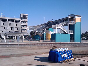
Corona–North Main station (also known as North Main Corona station) is a station on Metrolink's Inland Empire–Orange County and 91/Perris Valley Lines located in Corona, California. The station is located at 250 East Blaine Street, near North Main Street (after which the station is named), and is the second busiest station in the entire Metrolink system. Corona–North Main station consists of two side platforms serving two tracks.
Rancho La Sierra
Distance: Approx. 471 meters
Latitude and longitude: 33.88,-117.54
Rancho La Sierra (also called "La Sierra de Santa Ana") was a 17,774-acre (71.93 km2) Mexican land grant in present-day Riverside County, California, United States. In 1846 Governor Pio Pico issued the grant to Vicenta Sepulveda. The rancho includes the present-day city of Norco, and the western end of Riverside.

Grand Boulevard (Corona)
United States historic place
Distance: Approx. 3226 meters
Latitude and longitude: 33.86916667,-117.56722222
Grand Boulevard is a beltway in Corona, California that was recognized by the National Register of Historic Places in 2011 as a part of the Grand Boulevard Historic District. It is an ordinary surface street that circles the city's historic downtown area and is approximately half a mile from the city center. It is unusual for being perfectly circular.

The Young Americans College of the Performing Arts
College in Corona, CA
Distance: Approx. 2466 meters
Latitude and longitude: 33.858861,-117.542472
The Young Americans College of the Performing Arts (YACPA; formerly: California Pacific College of the Performing Arts) is a performing arts conservatory in the city of Corona, CA, which is in the Greater Los Angeles Area in the United States. The school was accredited in 2017 and will go through its next comprehensive review in 2024.
Corona Regional Medical Center
Hospital in California, United States
Distance: Approx. 3194 meters
Latitude and longitude: 33.87303,-117.56839
Corona Regional Medical Center is a for-profit hospital in Corona, California that is owned and operated by Universal Health Services. The hospital is a 238-bed community hospital network comprising a 160-bed acute care hospital and a 78-bed rehabilitation campus. It is certified by The Joint Commission, employs more than 1,000 trained healthcare workers, and has a medical staff of approximately 300 physicians representing more than 40 specialties.
Andrew Carnegie Library (Corona, California)
United States historic place
Distance: Approx. 2940 meters
Latitude and longitude: 33.87305556,-117.56555556
The Andrew Carnegie Library in Corona, California in Riverside County, California, at 8th and Main Streets, was a Carnegie library built in 1905–06. Known also as the Old Corona Public Library, it was listed on the National Register of Historic Places in 1977. The building was demolished in 1978, but apparently still remains listed on the National Register.

Corona Founders Monument
California Historic Landmark
Distance: Approx. 2018 meters
Latitude and longitude: 33.87507222,-117.55587778
The Corona Founders Monument is a monument built in 1936 to the founding fathers of the City of Corona in the Riverside County, California. The monument was designated a California Historic Landmark (No.738) on June 6, 1960. The monument is in the Corona City Park in the 100 block of 6th Street of Corona, California.

Woman's Improvement Club Clubhouse
United States historic place
Distance: Approx. 3096 meters
Latitude and longitude: 33.87,-117.56611111
The Woman's Improvement Club Clubhouse in Corona, California, at 1101 S. Main St., was built in 1913. It was listed on the National Register of Historic Places in 1988. It was designed by Los Angeles architect Thomas E. Preston in Craftsman style.
Weather in this IP's area
clear sky
8 Celsius
7 Celsius
6 Celsius
9 Celsius
1018 hPa
85 %
1018 hPa
979 hPa
10000 meters
1.54 m/s
80 degree