199.16.125.136 - IP Lookup: Free IP Address Lookup, Postal Code Lookup, IP Location Lookup, IP ASN, Public IP
Country:
Region:
City:
Location:
Time Zone:
Postal Code:
ISP:
ASN:
language:
User-Agent:
Proxy IP:
Blacklist:
IP information under different IP Channel
ip-api
Country
Region
City
ASN
Time Zone
ISP
Blacklist
Proxy
Latitude
Longitude
Postal
Route
db-ip
Country
Region
City
ASN
Time Zone
ISP
Blacklist
Proxy
Latitude
Longitude
Postal
Route
IPinfo
Country
Region
City
ASN
Time Zone
ISP
Blacklist
Proxy
Latitude
Longitude
Postal
Route
IP2Location
199.16.125.136Country
Region
california
City
orange
Time Zone
America/Los_Angeles
ISP
Language
User-Agent
Latitude
Longitude
Postal
ipdata
Country
Region
City
ASN
Time Zone
ISP
Blacklist
Proxy
Latitude
Longitude
Postal
Route
Popular places and events near this IP address

Angel Stadium
Baseball park in Anaheim, California
Distance: Approx. 1459 meters
Latitude and longitude: 33.80027778,-117.88277778
Angel Stadium is a ballpark in Anaheim, California, United States. Since its opening 59 years ago in 1966, it has been the home venue of the Los Angeles Angels of Major League Baseball (MLB). It was also the home of the Los Angeles Rams of the National Football League (NFL) from 1980 to 1994.

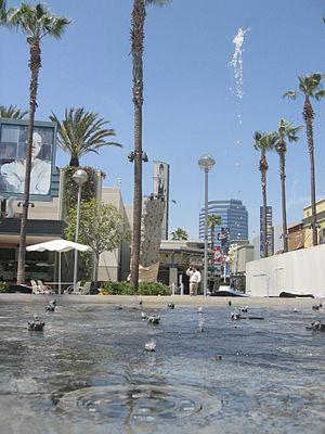
The Outlets at Orange
Shopping mall in Orange, California
Distance: Approx. 1547 meters
Latitude and longitude: 33.782644,-117.893076
The Outlets at Orange (former names The Block at Orange and The City Shopping Center) is an open-air outlet mall in the city of Orange, California, in northern Orange County developed by The Mills Corporation and now owned by Simon Property Group. The anchor stores in this outlet are Dave & Buster's, Guitar Center, AMC Theatres, Neiman Marcus Last Call, Saks Fifth Avenue, Nordstrom Rack, Gap, and Bloomingdale's.

Orange Crush interchange
Interchange in California
Distance: Approx. 881 meters
Latitude and longitude: 33.7801,-117.8792
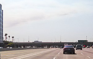
The Orange Crush interchange, frequently called The Crush, is a freeway interchange in the cities of Orange and Santa Ana, California, near the city limits of the cities of Anaheim, and Garden Grove. The Disneyland Resort, The Outlets at Orange, St. Joseph Hospital, Children's Hospital of Orange County, the UCI Medical Center, Westfield MainPlace, Angel Stadium of Anaheim, Honda Center, Platinum Triangle and the Lamaroux Justice Center of the Superior Court of California of the County of Orange are all located at or near the interchange.

UC Irvine Medical Center
Hospital in California, United States
Distance: Approx. 1015 meters
Latitude and longitude: 33.78781,-117.88857
The University of California, Irvine Medical Center (UCIMC or UCI Medical Center) is a major research hospital located in Orange, California. It is the teaching hospital for the University of California, Irvine School of Medicine.
California Coast University
Private for-profit online university in Santa Ana, California
Distance: Approx. 1153 meters
Latitude and longitude: 33.77914722,-117.87094167
California Coast University (CCU) is a private for-profit online university based in Santa Ana, California. It is accredited by the Distance Education Accrediting Commission and approved by the State of California. It enrolls approximately 8,000 students.
KEBN
Radio station in Garden Grove, California, United States
Distance: Approx. 1619 meters
Latitude and longitude: 33.781,-117.893
KEBN 94.3 FM, Garden Grove, California, KBUE 105.5 FM, Long Beach, California and KBUA 94.3 FM, San Fernando, California are a trimulcast comprising Que Buena 105.5/94.3 FM, a Spanish language regional Mexican music station owned by Estrella Media.

MainPlace Mall
Shopping mall in California, United States
Distance: Approx. 1594 meters
Latitude and longitude: 33.77523,-117.86957
MainPlace Mall (formerly known as Westfield MainPlace) is an enclosed shopping mall at the north edge of Santa Ana, California near Downtown Santa Ana, adjacent to the City of Orange and the Orange Crush interchange of the Santa Ana, Garden Grove and Orange freeways. The anchor stores are JCPenney, 24 Hour Fitness, Ashley HomeStore, Round 1 Entertainment, DXL Mens Apparel, and Macy's. There is 1 vacant anchor store that was once Nordstrom.

City National Grove of Anaheim
Music hall in Anaheim, California
Distance: Approx. 1856 meters
Latitude and longitude: 33.803164,-117.885681
The Grove of Anaheim is an indoor, live music venue in Anaheim, California, United States operated by Nederlander Concerts of Los Angeles. Its approximate capacity is 1,700. Less than two miles (3.2 km) from the Disneyland Resort, the Grove is just to the east of Interstate 5 on Katella Avenue.
South Coast College
For-profit technical college in California
Distance: Approx. 353 meters
Latitude and longitude: 33.7883835,-117.87383386
South Coast College is a private for-profit technical college in Orange, California. It offers certificates for career preparation in court reporting and medical assistant careers and a paralegal Associate of Arts degree. It is accredited by the Accrediting Commission of Career Schools and Colleges and approved by the Bureau for Private Postsecondary Education in the state of California, for court reporting, paralegal, and medical assistant programs.

Children's Hospital of Orange County
Hospital in California, United States
Distance: Approx. 1351 meters
Latitude and longitude: 33.78138889,-117.86527778
Children's Hospital of Orange County or CHOC is a pediatric healthcare system based in Orange County, California. Its flagship hospital, CHOC Hospital Main Campus – Orange, is a pediatric acute care hospital located in Orange, California. The hospital has 334 beds and is affiliated with the University of California, Irvine School of Medicine.

Anaheim Regional Transportation Intermodal Center
Transit center in Anaheim, California, United States
Distance: Approx. 1718 meters
Latitude and longitude: 33.80333333,-117.8775
The Anaheim Regional Transportation Intermodal Center (ARTIC) is a transit center in Anaheim, California, United States. The intermodal hub serves as a train station for Amtrak intercity rail and Metrolink commuter rail, as well as a bus station used by the Orange County Transportation Authority (OCTA), Anaheim Resort Transportation (ART), Greyhound, Megabus, Flixbus and Tres Estrellas de Oro. ARTIC opened in 2014 and replaced Anaheim–Stadium station, a nearby depot and train platforms used by Amtrak and Metrolink that first opened in 1984.
Bristol University (California)
University in Anaheim, California, United States
Distance: Approx. 972 meters
Latitude and longitude: 33.795556,-117.882647
Bristol University was a private university in Anaheim, California. It was established in 1991 as Kensington College. It became a university in 2011 and was renamed Bristol University.
Weather in this IP's area
broken clouds
9 Celsius
9 Celsius
8 Celsius
11 Celsius
1018 hPa
87 %
1018 hPa
1011 hPa
10000 meters
1.54 m/s
90 degree
75 %