199.16.124.48 - IP Lookup: Free IP Address Lookup, Postal Code Lookup, IP Location Lookup, IP ASN, Public IP
Country:
 USA
USARegion:
City:
Location:
Time Zone:
Postal Code:
ISP:
ASN:
language:
User-Agent:
Proxy IP:
Blacklist:
IP information under different IP Channel
ip-api
Country
Region
City
ASN
Time Zone
ISP
Blacklist
Proxy
Latitude
Longitude
Postal
Route
db-ip
Country
Region
City
ASN
Time Zone
ISP
Blacklist
Proxy
Latitude
Longitude
Postal
Route
IPinfo
Country
Region
City
ASN
Time Zone
ISP
Blacklist
Proxy
Latitude
Longitude
Postal
Route
IP2Location
199.16.124.48Country
usRegion
california
City
san jose
Time Zone
America/Los_Angeles
ISP
Language
User-Agent
Latitude
Longitude
Postal
ipdata
Country
Region
City
ASN
Time Zone
ISP
Blacklist
Proxy
Latitude
Longitude
Postal
Route
Popular places and events near this IP address

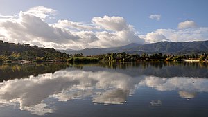
Blossom Valley, San Jose
Neighborhood of San Jose in Santa Clara, California, United States
Distance: Approx. 2525 meters
Latitude and longitude: 37.256041,-121.85851
Blossom Valley is a neighborhood of San Jose, California, located in South San Jose.
South San Jose
Place
Distance: Approx. 772 meters
Latitude and longitude: 37.238635,-121.838336
South San Jose is the southern region of San Jose, California. The name "South Side" refers to an area bounded roughly by Hillsdale Avenue and Capitol Expressway to the North, Camden Avenue to the West, Highway 101 and Hellyer Avenue on the east, the border with the city of Morgan Hill towards the south, and Los Gatos, to the west. The area is expansive with a mix of businesses, green space, and parks.

Oak Grove High School (San Jose, California)
School in San Jose, California, United States
Distance: Approx. 1540 meters
Latitude and longitude: 37.2528,-121.8199
Oak Grove High School is a comprehensive public secondary school located in the Edenvale neighborhood of San Jose, California, United States, which serves students in grades 9–12. Average enrollment is 1450 students, compared to the state average of 1413. The school is part of the East Side Union High School District and its mascot is the eagle.

Frontier Village
Former amusement park in San Jose, California
Distance: Approx. 2331 meters
Latitude and longitude: 37.262055,-121.819376
Frontier Village was a 39-acre (16 ha) amusement park in San Jose, California, that operated from 1961 to September 1980. It was located at 4885 Monterey Road, at the intersection with Branham Lane.

Blossom Hill station (VTA)
VTA light rail station in San Jose, California
Distance: Approx. 1141 meters
Latitude and longitude: 37.252945,-121.841372
Blossom Hill station is a light rail station operated by Santa Clara Valley Transportation Authority (VTA). The station is served by the Blue Line of the VTA light rail system. Blossom Hill station is located in the median of State Route 85, just north of Blossom Hill Road in San Jose, California.

Snell station
VTA light rail station in San Jose, California
Distance: Approx. 449 meters
Latitude and longitude: 37.247744,-121.830719
Snell station is a light rail station operated by Santa Clara Valley Transportation Authority (VTA). The station is served by the Blue Line of the VTA light rail system. It was part of the original Guadalupe Line, the first segment of light rail from Santa Teresa to Tasman.

Santa Teresa High School
Public high school in San Jose, Santa Clara County, California, United States
Distance: Approx. 1084 meters
Latitude and longitude: 37.235377,-121.829959
Santa Teresa High School (also referred to as STHS) is a public high school located in the suburban Santa Teresa neighborhood of southern San Jose, California. The school is a member of the East Side Union High School District and serves students from grades 9 through 12. The average student enrollment is 2,300 students, with an average ratio of 25 students for every teacher.

Hayes Mansion
Historic house in California, United States
Distance: Approx. 2290 meters
Latitude and longitude: 37.26231389,-121.82076667
The Hayes Mansion is a historic mansion estate in the Edenvale neighborhood of San Jose, California. The mansion currently operates as a hotel resort and is currently known as Hayes Mansion San Jose, Curio Collection by Hilton. The hotel has been a member of Historic Hotels of America, the official program of the National Trust for Historic Preservation, since 2019.

Edenvale, San Jose
Neighborhood of San Jose in Santa Clara, California, United States
Distance: Approx. 2685 meters
Latitude and longitude: 37.266084,-121.820136
Edenvale is a neighborhood of San Jose, California, in South San Jose.
Rancho Santa Teresa
Distance: Approx. 2202 meters
Latitude and longitude: 37.25,-121.81
Rancho Santa Teresa was a 9,647-acre (39.04 km2) Mexican land grant in present-day Santa Clara County, California given in 1834 by Governor José Figueroa to José Joaquín Bernal. The grant extended west from Coyote Creek to the Santa Teresa Hills, and included present-day Santa Teresa.
Martial Cottle Park
Park in San Jose, California, U.S.
Distance: Approx. 2027 meters
Latitude and longitude: 37.2627,-121.8364
Martial Cottle Park is a park developed as a collaboration between the California Department of Parks and Recreation and Santa Clara County Parks.
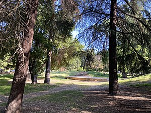
Edenvale Gardens Regional Park
Park in San Jose, California, United States
Distance: Approx. 2542 meters
Latitude and longitude: 37.265,-121.821
Edenvale Gardens Regional Park (originally Edenvale Garden Park) is a city park in San Jose, California, occupying 19.5 acres (7.9 ha) in the Edenvale neighborhood. The site originally was developed by Rudolph Ulrich as the 40-acre (16 ha) formal park adjoining Hayes Mansion starting from approximately 1887. In 1954, the mansion and property was sold; the site next was used for the Frontier Village amusement park between 1961 and 1980, and when that park closed, approximately half the land was redeveloped into housing, with the rest preserved as the present-day city park after San Jose purchased the remaining land in 1987.
Weather in this IP's area
clear sky
3 Celsius
3 Celsius
1 Celsius
6 Celsius
1021 hPa
74 %
1021 hPa
987 hPa
10000 meters