199.16.124.187 - IP Lookup: Free IP Address Lookup, Postal Code Lookup, IP Location Lookup, IP ASN, Public IP
Country:
 USA
USARegion:
City:
Location:
Time Zone:
Postal Code:
ISP:
ASN:
language:
User-Agent:
Proxy IP:
Blacklist:
IP information under different IP Channel
ip-api
Country
Region
City
ASN
Time Zone
ISP
Blacklist
Proxy
Latitude
Longitude
Postal
Route
db-ip
Country
Region
City
ASN
Time Zone
ISP
Blacklist
Proxy
Latitude
Longitude
Postal
Route
IPinfo
Country
Region
City
ASN
Time Zone
ISP
Blacklist
Proxy
Latitude
Longitude
Postal
Route
IP2Location
199.16.124.187Country
usRegion
california
City
morgan hill
Time Zone
America/Los_Angeles
ISP
Language
User-Agent
Latitude
Longitude
Postal
ipdata
Country
Region
City
ASN
Time Zone
ISP
Blacklist
Proxy
Latitude
Longitude
Postal
Route
Popular places and events near this IP address

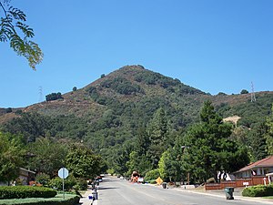
Morgan Hill, California
City in the United States
Distance: Approx. 2382 meters
Latitude and longitude: 37.13055556,-121.62388889
Morgan Hill is a city in Santa Clara County, California, located at the southern end of Silicon Valley within the San Francisco Bay Area. It is a residential community known for its connection to the region’s high-tech industry, serving as a home to various companies.

Morgan Hill Unified School District
Public school district in the United States
Distance: Approx. 2035 meters
Latitude and longitude: 37.111683,-121.634604
The Morgan Hill Unified School District (MHUSD) is a public school district operating eight elementary schools, two middle schools, and three high schools in southern Santa Clara County, California. Its jurisdiction covers all of Morgan Hill, California, and San Martin, California, as well as Coyote Valley and the Santa Teresa district of San Jose, California. Alongside its traditional schools, MHUSD, in special partnership with The Tech Interactive and Stanford University, operates four specialized public "focus academies", in STEAM, mathematics and music, engineering, and health sciences.

Morgan Hill station
Train station in Morgan Hill, California, U.S.
Distance: Approx. 465 meters
Latitude and longitude: 37.12944444,-121.65055556
Morgan Hill station is a Caltrain station located in the downtown area of Morgan Hill, California. The station is only served during weekday peak hours, with northbound trains in the morning and southbound trains in the evening. The original Southern Pacific station opened in 1899 as Morganhill.

Santa Clara Valley AVA
Appelation that designates wine in San Francisco Bay Area, California
Distance: Approx. 3372 meters
Latitude and longitude: 37.11678495,-121.68635418
Santa Clara Valley is an American Viticultural Area (AVA) located mostly in Santa Clara County, California. The area served an important role in the early history of California wine and was home to the pioneer winemakers Paul Masson and Charles Lefranc. It was established on April 27, 1989 by the Bureau of Alcohol, Tobacco and Firearms (ATF), Treasury after evaluating the petition proposing a viticultural area in Santa Clara, San Benito, San Mateo and Alameda Counties that extends from lower San Francisco Bay with the cities of San Jose, Santa Clara, Menlo Park, Mountain View and Fremont toward the southern boundary near Gilroy and Morgan Hill, outlining the viticultural area named "Santa Clara Valley." It includes the historic winegrowing areas of Santa Clara County not already within the Santa Cruz Mountains viticultural area, plus the area near Mission San José in Alameda County and a small part of San Benito County.

Live Oak High School (Morgan Hill, California)
High school in Morgan Hill, California
Distance: Approx. 2802 meters
Latitude and longitude: 37.1477,-121.6355
Live Oak High School (LOHS) is a public high school in Morgan Hill, California. Designated as a California Gold Ribbon School in 2015, Live Oak is part of the Morgan Hill Unified School District.

Oakwood School, Morgan Hill
Private, non-sectarian school in Morgan Hill, California, USA
Distance: Approx. 2788 meters
Latitude and longitude: 37.1038,-121.6338
Oakwood School is a private, non-sectarian college preparatory school in the south Silicon Valley community of Morgan Hill, in Santa Clara County, California.

Rancho Ojo del Agua de la Coche
Mexican land grant in California
Distance: Approx. 2750 meters
Latitude and longitude: 37.15,-121.65
Rancho Ojo de Agua de la Coche was a 8,927-acre (3,613 ha) Mexican land grant in present-day Santa Clara County, California given in 1835 by Governor José Figueroa to Juan María Hernandez. The name means "pig's spring". The grant extended south from Rancho Laguna Seca (Alvires) between Coyote Creek and Llagas Creek, and encompassed present-day Morgan Hill.
El Toro (California)
Hill in the state of California
Distance: Approx. 2133 meters
Latitude and longitude: 37.120691,-121.67322474
El Toro (Spanish for "The Bull") is a prominent hill located along the eastern foothills of the Santa Cruz Mountains in southwest Santa Clara County, California. The iconic landmark is partially owned by the city of Morgan Hill, and its silhouette is incorporated in the city logo.

Villa Mira Monte
Historic house in California, United States
Distance: Approx. 1158 meters
Latitude and longitude: 37.13444444,-121.65611111
Villa Mira Monte is a historic villa in Morgan Hill, California, United States, which is listed on the National Register of Historic Places. It was built for Hiram Morgan Hill, founder of Morgan Hill, and his wife Diana Murphy Hill, a Californio heiress.

Madrone, Morgan Hill, California
Neighborhood of Morgan Hill in Santa Clara, California, United States
Distance: Approx. 3975 meters
Latitude and longitude: 37.154493,-121.675701
Madrone is a neighborhood of Morgan Hill, California, located at the base of the Santa Cruz Mountains. Once an independent town within Santa Clara County, the City of Morgan Hill annexed the Town of Madrone in 1959, turning the town into Morgan Hill's northern district, bordering San Jose, California. Today, Madrone is primarily an affluent residential area, home to numerous luxury developments and landed estates.

Mushroom Mardi Gras Festival
Festival in Morgan Hill, California
Distance: Approx. 122 meters
Latitude and longitude: 37.12638889,-121.64972222
The Mushroom Mardi Gras Festival (rebranded as Morgan Hill Mushroom Festival for 2024) is an annual festival held in the downtown area of Morgan Hill, California. It is hosted by the nonprofit organization Morgan Hill Mushroom Mardi Gras, Inc. The festival was established in 1980 by Brad Spencer, and several sponsors supply mushrooms to create mushroom-themed dishes.

21-Mile House
Template for California Historical Landmarks in Santa Clara County.
Distance: Approx. 1464 meters
Latitude and longitude: 37.11305556,-121.64388889
The 21-Mile House was a tavern and stagecoach rest stop located 21 miles away from San Jose, California along the route to Monterey. The house evolved into a station stop for the Butterfield Overland Stage. The 21-Mile-House, constructed in 1852 by William Host beneath an oak tree later known as the Vásquez Tree, changed ownership to William Tennant in November 1852.
Weather in this IP's area
clear sky
0 Celsius
-2 Celsius
-0 Celsius
3 Celsius
1021 hPa
69 %
1021 hPa
982 hPa
10000 meters
1.75 m/s
1.35 m/s
7 degree
1 %