199.16.124.172 - IP Lookup: Free IP Address Lookup, Postal Code Lookup, IP Location Lookup, IP ASN, Public IP
Country:
 USA
USARegion:
City:
Location:
Time Zone:
Postal Code:
ISP:
ASN:
language:
User-Agent:
Proxy IP:
Blacklist:
IP information under different IP Channel
ip-api
Country
Region
City
ASN
Time Zone
ISP
Blacklist
Proxy
Latitude
Longitude
Postal
Route
db-ip
Country
Region
City
ASN
Time Zone
ISP
Blacklist
Proxy
Latitude
Longitude
Postal
Route
IPinfo
Country
Region
City
ASN
Time Zone
ISP
Blacklist
Proxy
Latitude
Longitude
Postal
Route
IP2Location
199.16.124.172Country
usRegion
california
City
el monte
Time Zone
America/Los_Angeles
ISP
Language
User-Agent
Latitude
Longitude
Postal
ipdata
Country
Region
City
ASN
Time Zone
ISP
Blacklist
Proxy
Latitude
Longitude
Postal
Route
Popular places and events near this IP address
El Monte, California
City in California, United States
Distance: Approx. 1286 meters
Latitude and longitude: 34.07333333,-118.0275
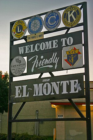
El Monte is a city in Los Angeles County, California, United States. The city lies in the San Gabriel Valley, east of the city of Los Angeles. El Monte's slogan is "Welcome to Friendly El Monte" and is historically known as "The End of the Santa Fe Trail".

San Gabriel Valley Airport
Airport in El Monte, California, United States
Distance: Approx. 1178 meters
Latitude and longitude: 34.08611111,-118.03472222
San Gabriel Valley Airport (IATA: EMT, ICAO: KEMT, FAA LID: EMT) — formerly El Monte Airport — is a public airport in El Monte, in Los Angeles County, California, United States. In November 2014, its name was changed from El Monte Airport to San Gabriel Valley Airport. The Federal Aviation Administration (FAA) National Plan of Integrated Airport Systems for 2019–2023 categorized it as a regional reliever general aviation facility.

El Monte Station
Transit center in Los Angeles, California
Distance: Approx. 617 meters
Latitude and longitude: 34.07166667,-118.04333333
El Monte Station is a large regional bus station in the city of El Monte, California, United States, adjacent to Interstate 10, serving the Metro J Line, Foothill Transit, Greyhound Lines, and El Monte Transit. It is the Metro J Line's eastern terminus.

Gay's Lion Farm
Tourist attraction in El Monte, California, United States (1925–1942)
Distance: Approx. 1378 meters
Latitude and longitude: 34.0689,-118.0293
Gay's Lion Farm was a public selective breeding facility and tourist attraction just west of the south-east junction of Peck Road and Valley Boulevard in El Monte, California. It operated from 1925 through 1942, when it was closed temporarily due to wartime meat shortages. It never reopened.

Arroyo High School (El Monte, California)
Public school in El Monte, California, United States
Distance: Approx. 2665 meters
Latitude and longitude: 34.09388889,-118.02055556
Arroyo High School, located in El Monte, California, United States, is a school in the El Monte Union High School District. The attendance area served by Arroyo High School consists of four different communities: El Monte, Temple City, Arcadia, and an unincorporated area of Los Angeles County. Arroyo High School's main rival is Rosemead High School.

El Monte High School
Public school in El Monte, California
Distance: Approx. 1513 meters
Latitude and longitude: 34.064642,-118.033456
El Monte High School in El Monte, California, is a public high school of the El Monte Union High School District. It is one of the oldest high schools in the San Gabriel Valley. Founded in 1901, it began operation in a single, upstairs classroom in the old Lexington Avenue Grammar School, with an enrollment of 12-15 students.

El Monte station (Metrolink)
Train rail station in El Monte, California, US
Distance: Approx. 479 meters
Latitude and longitude: 34.0768,-118.0356
El Monte station is a train station on Metrolink's San Bernardino Line in El Monte, California. It is at 10925 Railroad Street between Santa Anita and Tyler Avenues north of Valley Boulevard. It has 238 parking spaces.

Savannah, California
Former settlement in California, United States
Distance: Approx. 2078 meters
Latitude and longitude: 34.07666667,-118.06333333
Savannah (also, Savanna) is a former settlement in Los Angeles County, California, USA. The rail depot of that name was located on the line of the Southern Pacific Railroad between San Gabriel and El Monte, at an elevation of 276 feet (84 m). Savannah was promoted with considerable dignity in 1887–88 but vanished, nevertheless; the neighborhood of the depot has been absorbed by Rosemead. The name survives in Savanna High School and Savanna School District of Orange County, which seceded from Los Angeles County in 1889.
Rancho San Francisquito (Dalton)
Distance: Approx. 2584 meters
Latitude and longitude: 34.1,-118.04
Rancho San Francisquito was a 8,894-acre (35.99 km2) Mexican land grant in present day Los Angeles County, California given in 1845 by Governor Pio Pico to Henry Dalton. The grant included present day cities of El Monte, Irwindale, and Temple City.

Savannah Memorial Park
California Historic Landmark No. 1046
Distance: Approx. 2533 meters
Latitude and longitude: 34.08111111,-118.06777778
Savannah Memorial Park Cemetery also known as El Monte Memorial Park and the Savannah Pioneer Cemetery is the oldest American non-sectarian cemetery in Southern California. The park is located in Rosemead, California, part of the park is in the neighboring city of El Monte. The park has been in continuous operation since its founding in 1850.

Santa Fe Trail Historical Park
California historic landmark
Distance: Approx. 274 meters
Latitude and longitude: 34.07444444,-118.04166667
Santa Fe Trail Historical Park, also called Pioneer Park, is located on the bank of the Rio Hondo River in El Monte, California. The location was designated a California Historic Landmark (No. 975) on Aug.
El Monte Shopping Center
Shopping center in El Monte, CA
Distance: Approx. 1375 meters
Latitude and longitude: 34.0729196,-118.0266374
The El Monte Shopping Center was a major shopping center, for decades the largest shopping center in El Monte, California, at 400 Peck Road just north of the San Bernardino Freeway. It opened in phases in 1958 and 1959 and was initially anchored by a 263,951-square-foot (24,521.9 m2) Sears plus its 20,000-square-foot (1,900 m2) automotive center as well as a 39,000-square-foot (3,600 m2) Food Giant supermarket, a F. W. Woolworth five and dime, and a Bond's clothing store. In 1989 Katersky Financial bought the center and at that time tenants included a Home Club home improvement superstore (later HomeBase/Longo Lexus dealership), Tianguis (later Big Kmart/Sears Essentials/Outlet), the Longo Toyota dealership, Thrifty Drug Stores (later Dearden's Furniture), Sizzler, and Big 5 Sporting Goods.
Weather in this IP's area
broken clouds
9 Celsius
9 Celsius
8 Celsius
11 Celsius
1018 hPa
80 %
1018 hPa
975 hPa
10000 meters
1.2 m/s
1.49 m/s
101 degree
53 %