199.127.108.209 - IP Lookup: Free IP Address Lookup, Postal Code Lookup, IP Location Lookup, IP ASN, Public IP
Country:
Region:
City:
Location:
Time Zone:
Postal Code:
ISP:
ASN:
language:
User-Agent:
Proxy IP:
Blacklist:
IP information under different IP Channel
ip-api
Country
Region
City
ASN
Time Zone
ISP
Blacklist
Proxy
Latitude
Longitude
Postal
Route
db-ip
Country
Region
City
ASN
Time Zone
ISP
Blacklist
Proxy
Latitude
Longitude
Postal
Route
IPinfo
Country
Region
City
ASN
Time Zone
ISP
Blacklist
Proxy
Latitude
Longitude
Postal
Route
IP2Location
199.127.108.209Country
Region
ontario
City
mcnaught
Time Zone
America/Toronto
ISP
Language
User-Agent
Latitude
Longitude
Postal
ipdata
Country
Region
City
ASN
Time Zone
ISP
Blacklist
Proxy
Latitude
Longitude
Postal
Route
Popular places and events near this IP address

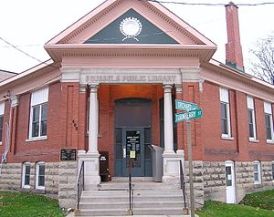
Brussels, Ontario
Unincorporated Community in Ontario, Canada
Distance: Approx. 665 meters
Latitude and longitude: 43.7444,-81.2498
Brussels is a community within the Municipality of Huron East in Huron County, Ontario, Canada. It held village status prior to 2001. The most recent population estimate was 993 residents in 2021.
Brussels (Armstrong Field) Airport
Airport in Brussels, Ontario
Distance: Approx. 980 meters
Latitude and longitude: 43.75,-81.23333333
Brussels (Armstrong Field) Airport (TC LID: CPD4) is located adjacent to Brussels, Ontario, Canada.
Ethel Airport
Airport in Ethel, Ontario
Distance: Approx. 5516 meters
Latitude and longitude: 43.74472222,-81.17722222
Ethel Airport (TC LID: CPD2) is located 2 nautical miles (3.7 km; 2.3 mi) northwest of Ethel, Ontario, Canada.
Morris-Turnberry
Municipality in Ontario, Canada
Distance: Approx. 8674 meters
Latitude and longitude: 43.825,-81.2722
The Municipality of Morris-Turnberry is a municipality in Huron County, Ontario, Canada. It is located in the north portion of Huron County, near the Bruce County border, southeast of Wingham. It was formed as an amalgamation of the former Morris and Turnberry townships in 2001 in an Ontario-wide local government restructuring imposed by the government of that time.
Ethel, Ontario
Hamlet in northern Huron County, Ontario, Canada
Distance: Approx. 9107 meters
Latitude and longitude: 43.722343,-81.13869
Ethel is a hamlet located in northern Huron County, Ontario, Canada. It has a population of nearly two hundred. It is in the municipality of Huron East in the Grey Ward, formerly Grey Township.
Jamestown, Ontario
Distance: Approx. 7782 meters
Latitude and longitude: 43.81,-81.197
Jamestown is a community in Ontario, Canada. Jamestown is the name given to a small settlement, circa 1850, that sprang up along the boundary between Morris and Grey Townships, along the Maitland River in Southwestern Ontario, north of present-day Brussels. Apparently, James' Town derived its name from the number of men in the local community with the name of James - James Aitchison, James Lynn, James Strachan, James Simpson, James Forrest and James Moses.

Walton Raceway
Distance: Approx. 8520 meters
Latitude and longitude: 43.6793,-81.28769
Walton Raceway is an off road vehicle motorsport park located just outside the hamlet of Walton, part of the Municipality of Huron East in Huron County Ontario, Canada. It is on a 200-acre site which includes several ponds, wetlands, reforested areas, hardwood forest, rolling hills and an agricultural acreage owned by the Lee family since 1965. The race track began operating in the early 1970s as the home track for the Maitland Dirt Riders club.
Cranbrook, Ontario
Distance: Approx. 6583 meters
Latitude and longitude: 43.70361111,-81.19388889
Cranbrook is a community and unincorporated area in the municipality of Huron East, Huron County, Ontario, Canada. It is located at the intersection of McNabb Line and Cranbrook Road in geographic Grey Township. Cranbrook is a pre-Confederation settlement with at least one house, of limestone construction, that dates back to 1869, and is part of the former Huron Tract.
Sunshine, Ontario
Dispersed rural community in Ontario, Canada
Distance: Approx. 8132 meters
Latitude and longitude: 43.78277778,-81.33555556
Sunshine is a dispersed rural community in the municipality of Morris-Turnberry, Huron County, Ontario, Canada. Sunshine prospered as a milling and manufacturing town from the 1850s to the 1880s.
Weather in this IP's area
light snow
-7 Celsius
-14 Celsius
-7 Celsius
-7 Celsius
1024 hPa
86 %
1024 hPa
980 hPa
660 meters
5.81 m/s
9.12 m/s
259 degree
100 %