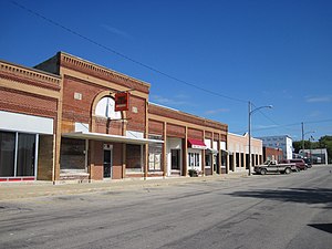
Country:
Region:
City:
Latitude and Longitude:
Time Zone:
Postal Code:
IP information under different IP Channel
ip-api
Country
Region
City
ASN
Time Zone
ISP
Blacklist
Proxy
Latitude
Longitude
Postal
Route
Luminati
Country
Region
ia
City
centerpoint
ASN
Time Zone
America/Chicago
ISP
EIDG-AS1
Latitude
Longitude
Postal
IPinfo
Country
Region
City
ASN
Time Zone
ISP
Blacklist
Proxy
Latitude
Longitude
Postal
Route
db-ip
Country
Region
City
ASN
Time Zone
ISP
Blacklist
Proxy
Latitude
Longitude
Postal
Route
ipdata
Country
Region
City
ASN
Time Zone
ISP
Blacklist
Proxy
Latitude
Longitude
Postal
Route
Popular places and events near this IP address

Urbana, Iowa
City in Iowa, United States
Distance: Approx. 9199 meters
Latitude and longitude: 42.22416667,-91.87805556
Urbana is a city in Benton County, Iowa, United States. The population was 1,554 at the time of the 2020 census. It is part of the Cedar Rapids Metropolitan Statistical Area.

Center Point, Iowa
City in Iowa, United States
Distance: Approx. 1386 meters
Latitude and longitude: 42.19055556,-91.7825
Center Point is a city in Linn County, Iowa, United States. The population was 2,579 at the 2020 census. It is part of the Cedar Rapids Metropolitan Statistical Area.

Walker, Iowa
City in Iowa, United States
Distance: Approx. 9755 meters
Latitude and longitude: 42.28722222,-91.78138889
Walker is a city in Linn County, Iowa. The population was 688 at the 2020 census. It is part of the Cedar Rapids, Iowa metropolitan area.
James Greer McQuilkin Round Barn
United States historic place
Distance: Approx. 7420 meters
Latitude and longitude: 42.26416667,-91.79527778
The James Greer McQuilkin Round Barn is a historic building located near Eagle Center in rural Benton County, Iowa, United States. It was built in 1918 for James Greer McQuilkin. He farmed and sold barns that were designed by Johnston Brothers' Clay Works.
Washington Township, Linn County, Iowa
Township in Linn County, Iowa, U.S.
Distance: Approx. 2945 meters
Latitude and longitude: 42.1736,-91.7675
Washington Township is a township in Linn County, Iowa.
Grant Township, Linn County, Iowa
Township in Linn County, Iowa, U.S.
Distance: Approx. 5837 meters
Latitude and longitude: 42.2514,-91.7581
Grant Township is a township in Linn County, Iowa.

Walker station
Distance: Approx. 9664 meters
Latitude and longitude: 42.28633333,-91.78230556
Walker Station is a historic building located in Walker, Iowa, United States. The two-story frame building with bracketed eaves was completed in 1873 along the Burlington, Cedar Rapids, and Minnesota Railway tracks. The depot also served its successor railroads: the Burlington, Cedar Rapids and Northern, and the Chicago, Rock Island and Pacific.

WCF & N Center Point Depot and Substation
United States historic place
Distance: Approx. 1155 meters
Latitude and longitude: 42.19269444,-91.78147222
The WCF & N Center Point Depot and Substation, also known as the Center Point Depot Museum, is a historic building located in Center Point, Iowa, United States. The Mission Revival building was constructed in 1914 by the Waterloo, Cedar Falls and Northern Railway, an interurban line that ran between the Waterloo – Cedar Falls area and Cedar Rapids. Passenger service ended here in 1956, and rail freight was discontinued in 1973.
Center Point–Urbana Community School District
Public school district in Center Point Iowa, United states
Distance: Approx. 2111 meters
Latitude and longitude: 42.188145,-91.791484
Center Point–Urbana Community School District (CPU) is a rural public school district headquartered in Center Point. The district is in Linn and Benton counties, and serves Center Point and Urbana.
Pleasant Creek State Recreation Area
Protected area in Iowa, United States
Distance: Approx. 9426 meters
Latitude and longitude: 42.11916667,-91.80583333
Pleasant Creek State Recreation Area is a 1,927-acre (780 ha) state recreation area in Linn County, Iowa, United States, near the city of Palo. The recreation area is home to the 410-acre (170 ha) Pleasant Creek Lake. Both the lake and the park were formed in the 1960s to provide eastern Iowa with a large recreational lake.
Weather in this IP's area
scattered clouds
7 Celsius
6 Celsius
6 Celsius
8 Celsius
1014 hPa
85 %
1014 hPa
983 hPa
10000 meters
2.51 m/s
6.54 m/s
338 degree
38 %
06:46:57
16:54:33