Country:
Region:
City:
Latitude and Longitude:
Time Zone:
Postal Code:
IP information under different IP Channel
ip-api
Country
Region
City
ASN
Time Zone
ISP
Blacklist
Proxy
Latitude
Longitude
Postal
Route
Luminati
Country
Region
va
City
vienna
ASN
Time Zone
America/New_York
ISP
BMSL-2-ARIN
Latitude
Longitude
Postal
IPinfo
Country
Region
City
ASN
Time Zone
ISP
Blacklist
Proxy
Latitude
Longitude
Postal
Route
db-ip
Country
Region
City
ASN
Time Zone
ISP
Blacklist
Proxy
Latitude
Longitude
Postal
Route
ipdata
Country
Region
City
ASN
Time Zone
ISP
Blacklist
Proxy
Latitude
Longitude
Postal
Route
Popular places and events near this IP address

Dunn Loring, Virginia
Census-designated place in Virginia
Distance: Approx. 1827 meters
Latitude and longitude: 38.89194444,-77.23111111
Dunn Loring is a census-designated place (CDP) in Fairfax County, Virginia, United States. The population was 9,464 as of the 2020 census. This suburban area is bordered by Merrifield to the south, Vienna to the west, Tysons to the north, and Idylwood to the east.

Merrifield, Virginia
Census-designated place in Virginia, United States
Distance: Approx. 2263 meters
Latitude and longitude: 38.87305556,-77.24305556
Merrifield is a census-designated place (CDP) in Fairfax County, Virginia, United States. The population was 20,488 at the 2020 census.

Vienna, Virginia
Town in Virginia, United States
Distance: Approx. 1531 meters
Latitude and longitude: 38.9,-77.26666667
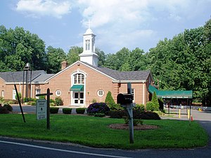
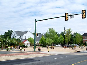
Vienna () is a town in Fairfax County, Virginia, United States. As of the 2020 U.S. census, Vienna has a population of 16,473. Significantly more people live in ZIP codes with the Vienna postal addresses (22180, 22181, and 22182), bordered approximately by Interstate 66 on the south, Interstate 495 on the east, Route 7 to the north, and Hunter Mill Road to the west, than in the town itself.

Vienna station (Washington Metro)
Washington Metro station
Distance: Approx. 2374 meters
Latitude and longitude: 38.8776013,-77.2722884
Vienna station is a Washington Metro station on the Orange Line in Fairfax, Virginia. The station is in the median of Interstate 66 at Nutley Street, also known as Virginia State Route 243, in Fairfax. The station can be accessed from I-66 without merging onto Nutley Street by a series of ramps that transport commuters to the station's north and south side parking complexes.

Dunn Loring station
Washington Metro station
Distance: Approx. 2303 meters
Latitude and longitude: 38.8833529,-77.22812
Dunn Loring station is a Washington Metro station in Fairfax County, Virginia, on the Orange Line. The station is in Merrifield, with a Vienna mailing address. The station is in the median of Interstate 66 at Gallows Road, just outside the Capital Beltway, and is accessed by a footbridge over the eastbound lanes.

James Madison High School (Fairfax County, Virginia)
Public high school in Vienna, Virginia, United States
Distance: Approx. 2349 meters
Latitude and longitude: 38.89583333,-77.27888889
James Madison High School (JMHS) is a public high school in Vienna, Virginia, United States. It is part of the Fairfax County Public Schools district. According to Newsweek magazine's 2014 list of the top U.S. high schools, Madison was ranked 93.

International Tennis Club of Washington
Distance: Approx. 2095 meters
Latitude and longitude: 38.9108154,-77.2547452
The International Tennis Club of Washington plays real tennis on Prince's Court at the Westwood Country Club in Vienna, Virginia, 12 miles (19 km) from Washington, D.C. With its Grand Opening on November 4, 2022 with Prince Edward as the guest of honor, Prince's Court, (along with its predecessor in McLean, Virginia that was dedicated on October 11, 1997) was at the time the only new real tennis venue to be constructed in the United States since the Racquet Club of Chicago was built in 1923. (The Chicago court has since been renovated and renewed.) A new court at Sand Valley in Nekoosa, Wisconsin has scheduled its Grand Opening for July 2024.[1] Prince's Court was originally built in Washington DC due to the efforts of financial supporter and club co-founder Frederick "Freddy" Prince. The ITCW wanted to honor Freddy's efforts, but he repeatedly modestly declined recognition.

Terrorist Screening Center
US FBI special division
Distance: Approx. 1341 meters
Latitude and longitude: 38.9033,-77.2465
The Terrorist Screening Center (TSC) is a division of the National Security Branch of the Federal Bureau of Investigation. It is the duty of the TSC to identify suspected or potential terrorists. Though housed within the FBI, the TSC is a multi-agency organization, including representatives from the United States Department of Justice, the United States Department of State, the United States Department of Homeland Security, the United States Department of Defense, the United States Postal Service, and various private contractors.
Fairfax County Economic Development Authority
Distance: Approx. 1532 meters
Latitude and longitude: 38.90111,-77.26556
The Fairfax County Economic Development Authority (FCEDA) is an independent authority in Fairfax County, Virginia, created under Virginia state law in 1964 and funded by Fairfax County government. FCEDA exists to promote investment and business growth in Fairfax County in order to expand the commercial tax base that helps pay for public services such as the county school system, police and fire departments, parks, libraries and social services. The FCEDA does this by managing marketing programs that encourage businesses to expand or relocate to the county.

Louise Archer Elementary School
Elementary school in Vienna, Virginia
Distance: Approx. 2303 meters
Latitude and longitude: 38.89915,-77.27718889
Louise Archer Elementary School is an elementary school in Vienna, Virginia, United States, and is part of Fairfax County Public Schools. It was founded in 1867 as a school for African-American children. It is designated by Fairfax County as an elementary school center for advanced academic programs.

Battle of Vienna, Virginia
1861 engagement during the American Civil War
Distance: Approx. 1039 meters
Latitude and longitude: 38.9008351,-77.2564224
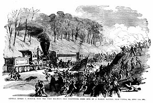
The Battle of Vienna, Virginia was a minor engagement between Union and Confederate forces on June 17, 1861, during the early days of the American Civil War. The Union was trying to protect the areas of Virginia opposite Washington, D.C., and established a camp at Vienna, at the end of a 15-mile (24.1 km) railroad to Alexandria. As Union Brig.

Freeman Store and Museum (Vienna, Virginia)
Historic commercial building in Virginia, United States
Distance: Approx. 1671 meters
Latitude and longitude: 38.90333333,-77.265
The Freeman House Store, formerly the Lydecker Store, is a historic general store located in the Town of Vienna in Fairfax County, Virginia. The house lies in Northern Virginia near the District of Columbia. Built in 1859 for Abram Lydecker, both Confederate and Union Army troops occupied the house during the American Civil War.
Weather in this IP's area
clear sky
8 Celsius
8 Celsius
6 Celsius
9 Celsius
1020 hPa
69 %
1020 hPa
1006 hPa
10000 meters
0.89 m/s
2.68 m/s
120 degree
10 %
06:53:27
16:54:35