199.114.231.3 - IP Lookup: Free IP Address Lookup, Postal Code Lookup, IP Location Lookup, IP ASN, Public IP
Country:
Region:
City:
Location:
Time Zone:
Postal Code:
ISP:
ASN:
language:
User-Agent:
Proxy IP:
Blacklist:
IP information under different IP Channel
ip-api
Country
Region
City
ASN
Time Zone
ISP
Blacklist
Proxy
Latitude
Longitude
Postal
Route
db-ip
Country
Region
City
ASN
Time Zone
ISP
Blacklist
Proxy
Latitude
Longitude
Postal
Route
IPinfo
Country
Region
City
ASN
Time Zone
ISP
Blacklist
Proxy
Latitude
Longitude
Postal
Route
IP2Location
199.114.231.3Country
Region
colorado
City
crestone
Time Zone
America/Denver
ISP
Language
User-Agent
Latitude
Longitude
Postal
ipdata
Country
Region
City
ASN
Time Zone
ISP
Blacklist
Proxy
Latitude
Longitude
Postal
Route
Popular places and events near this IP address
Crestone, Colorado
Town in Saguache County, Colorado, United States
Distance: Approx. 319 meters
Latitude and longitude: 37.994497,-105.696273
The Town of Crestone is a Statutory Town in Saguache County, Colorado. According to the 2020 United States Census, the town's population was 141. Crestone is located at the foot of the western slope of the Sangre de Cristo Range, in the northern part of the San Luis Valley.

Kit Carson Peak
Mountain in the state of Colorado
Distance: Approx. 8673 meters
Latitude and longitude: 37.9797219,-105.6025089
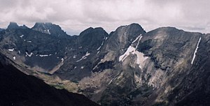
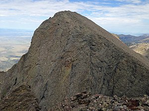
Kit Carson Peak is a high mountain summit of the Crestones in the Sangre de Cristo Range of the Rocky Mountains of North America. Officially designated Kit Carson Mountain, the 14,165.2-foot (4,318 m) fourteener is located 5.2 miles (8.4 km) ESE (bearing 102°) of the Town of Crestone in Saguache County, Colorado, United States. The name Kit Carson Mountain is used for both the massif with three summits (Columbia Point, Kit Carson Peak and Challenger Point), or to describe the main summit only.
Challenger Point
Mountain in Colorado, United States
Distance: Approx. 8303 meters
Latitude and longitude: 37.9802775,-105.6066757
Challenger Point is a high mountain summit of the Crestones in the Sangre de Cristo Range of the Rocky Mountains of North America. The 14,087-foot (4,294 m) fourteener is located 5.0 miles (8.1 km) east by south (bearing 102°) of the Town of Crestone in Saguache County, Colorado, United States. The summit is on the northwest shoulder of Kit Carson Mountain, and is a subpeak of the latter.

Columbia Point
Mountain summit in Colorado, United States
Distance: Approx. 9074 meters
Latitude and longitude: 37.9788886,-105.5980644
Columbia Point is a high mountain summit of the Crestones in the Sangre de Cristo Range of the Rocky Mountains of North America. The 13,986-foot (4,263 m) thirteener is located 5.5 miles (8.8 km) east by south (bearing 102°) of the Town of Crestone in Saguache County, Colorado, United States. The Crestones are a cluster of high summits in the Sangre de Cristo Range, comprising Crestone Peak, Crestone Needle, Kit Carson Peak, Challenger Point, Humboldt Peak, and Columbia Point.

Mount Adams (Colorado)
Mountain in Colorado, United States of America
Distance: Approx. 8371 meters
Latitude and longitude: 38.0074996,-105.6047306
Mount Adams is a high mountain summit of the Crestones in the Sangre de Cristo Range of the Rocky Mountains of North America. The 13,937-foot (4,248 m) thirteener is located in the Sangre de Cristo Wilderness, 5.1 miles (8.2 km) east by north (bearing 81°) of the Town of Crestone, Colorado, United States, on the drainage divide separating San Isabel National Forest and Custer County from Rio Grande National Forest and Saguache County.
Sangre de Cristo Wilderness
Wilderness area in Colorado, United States
Distance: Approx. 8254 meters
Latitude and longitude: 37.98833333,-105.60555556
The Sangre de Cristo Wilderness is a long and narrow wilderness area covering 220,803 acres (893.56 km2) of the Sangre de Cristo Range centered about Saguache and Custer counties, Colorado. Smaller areas are located in Fremont, Alamosa, and Huerfano counties. The wilderness area is located on in the San Isabel and Rio Grande National Forests and Great Sand Dunes National Park and Preserve.
Willow Lake (Saguache County, Colorado)
Distance: Approx. 7947 meters
Latitude and longitude: 37.99409,-105.60856
Willow Lake, also known as the lower Willow Creek Lake, is an alpine lake in Saguache County, Colorado, United States, located in the Sangre de Cristo Range within the Sangre de Cristo Wilderness in Rio Grande National Forest. The lake is accessed from the Willow Lake Trail (trail 865) at the South Crestone Lake Trailhead east of Crestone, Colorado. Willow Lake is directly north of Challenger Point and south of Mount Adams.
Crestone School
United States historic place
Distance: Approx. 41 meters
Latitude and longitude: 37.99666667,-105.69916667
The Crestone School, also known as the Crestone Community Building, at Cottonwood St. and Carbonate Ave. in Crestone, Colorado, was built in 1880 and was listed on the National Register of Historic Places in 1986.

Fluted Peak (Colorado)
Mountain in the state of Colorado
Distance: Approx. 9124 meters
Latitude and longitude: 38.0244548,-105.6014082
Fluted Peak is a 13,554-foot (4,131 m) mountain summit on the boundary shared by Custer and Saguache counties, in Colorado, United States.
Weather in this IP's area
clear sky
-14 Celsius
-20 Celsius
-14 Celsius
-14 Celsius
1034 hPa
51 %
1034 hPa
733 hPa
10000 meters
2.68 m/s
3.92 m/s
297 degree
3 %


