Country:
Region:
City:
Latitude and Longitude:
Time Zone:
Postal Code:
IP information under different IP Channel
ip-api
Country
Region
City
ASN
Time Zone
ISP
Blacklist
Proxy
Latitude
Longitude
Postal
Route
Luminati
Country
ASN
Time Zone
America/Chicago
ISP
STERLING
Latitude
Longitude
Postal
IPinfo
Country
Region
City
ASN
Time Zone
ISP
Blacklist
Proxy
Latitude
Longitude
Postal
Route
db-ip
Country
Region
City
ASN
Time Zone
ISP
Blacklist
Proxy
Latitude
Longitude
Postal
Route
ipdata
Country
Region
City
ASN
Time Zone
ISP
Blacklist
Proxy
Latitude
Longitude
Postal
Route
Popular places and events near this IP address
InFocus
American company
Distance: Approx. 1445 meters
Latitude and longitude: 45.42511,-122.745008
InFocus Corporation is a privately owned American company based in the state of Oregon. Founded in 1986, the company develops, manufactures, and distributes DLP and LCD projectors and accessories as well as large-format touch displays, software, LED televisions, tablets and smartphones. InFocus also offers video calling services.
Portland Seminary
Multi-denominational, university-based school in Portland, Oregon
Distance: Approx. 1737 meters
Latitude and longitude: 45.42788333,-122.74695833
Portland Seminary at George Fox University is a multi-denominational, university-based school that offers a variety of master's degree and postgraduate degree programs in theology and ministry, located in Portland, Oregon. The Association of Theological Schools in the United States and Canada granted the seminary full accreditation in 1974. It remains a fully accredited member to present.
Stash Tea Company
Distance: Approx. 1331 meters
Latitude and longitude: 45.4004,-122.7497
Stash Tea Company is a privately owned specialty tea and herbal tea company formerly headquartered in Tigard, a suburb of Portland in Oregon, USA. In the summer of 2022, Stash Tea Company closed their headquarters office with an announced relocation to downtown Portland, Oregon’s historic Galleria building. This move was to be completed by the end of 2022. However, as of February 2024 no new physical location for their retail store nor offices has been opened, with no further information regarding an alternative location or date.

Portland Oregon Temple
Distance: Approx. 1521 meters
Latitude and longitude: 45.425345,-122.742224
The Portland Oregon Temple is a temple of the Church of Jesus Christ of Latter-day Saints (LDS Church) located on 7 acres (28,000 m2) of land near the intersection of Highway 217 and I-5 in Lake Oswego, Oregon. The intent to build the temple was announced on April 7, 1984 by church president Spencer W. Kimball, during the church's general conference. Dedicated in 1989, the Portland Oregon Temple was the church's first temple in Oregon and the 42nd in the church.

Tigard High School
Public school in Tigard, Oregon, United States
Distance: Approx. 1833 meters
Latitude and longitude: 45.403272,-122.767617
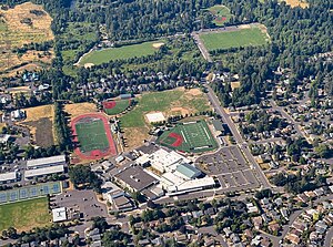
Tigard High School (THS) is a public high school located in Tigard, Oregon, United States. It is one of two high schools in the Tigard-Tualatin School District and educates students in grades 9–12.

Bridgeport Village (Oregon)
Shopping mall in Oregon, United States
Distance: Approx. 1841 meters
Latitude and longitude: 45.396,-122.752
Bridgeport Village is a lifestyle center located in Tualatin and Tigard, Oregon, United States, operated by CenterCal Properties. The center opened on May 19, 2005, and is located in one of the Portland metropolitan area's most affluent areas. The center has a variety of services, including valet service, restaurant reservations, a courtesy shuttle to vehicles, and umbrellas available to borrow for free.
Oregon State Bar
Bar Association
Distance: Approx. 905 meters
Latitude and longitude: 45.404476,-122.751145
The Oregon State Bar (OSB) is a public corporation and instrumentality of the Oregon Judicial Department in the U.S. state of Oregon. Founded in 1890 as the private Oregon Bar Association, it became a public entity in 1935 that regulates the legal profession. The public corporation is part of the Oregon Judicial Department.

Durham Education Center
Alternative public school in Oregon, US
Distance: Approx. 1321 meters
Latitude and longitude: 45.4039341,-122.7599859
Durham Education Center, also known as Durham Center was a public alternative school in Tigard, Oregon, United States. As of 2019, Durham Center became Creekside Community High School.
Jean, Oregon
Unincorporated community in the state of Oregon, United States
Distance: Approx. 1713 meters
Latitude and longitude: 45.39805556,-122.73972222
Jean is an unincorporated community in Clackamas County, Oregon, United States.
Tigard Public Library
Library in Tigard, Oregon, U.S.
Distance: Approx. 1753 meters
Latitude and longitude: 45.42266,-122.7649
Tigard Public Library is the library within Washington County Cooperative Library Services serving Tigard in the U.S. state of Oregon. Established in 1963, the current 48,000-square-foot (4,500 m2) building opened in 2004 on Hall Boulevard. As of 2012, Margaret Barnes was the director of the library that had a collection of about 230,000 items making 1.5 million loans of those items.

Bonita, Oregon
Unincorporated community in the state of Oregon, United States
Distance: Approx. 1425 meters
Latitude and longitude: 45.41694444,-122.765
Bonita is a former unincorporated community in Washington County, Oregon, United States, now located within the boundaries of the city of Tigard.
Creekside Community High School
Public school in Tigard, , Oregon, United States
Distance: Approx. 1325 meters
Latitude and longitude: 45.403922,-122.760034
Creekside Community High School is a public high school located in Tigard, Oregon, United States. Formerly the Durham Education Center, the alternative high school accepts students in grades 9–12, while also a part of the Tigard-Tualatin School District. The school formally opened for the 2019–2020 school year.
Weather in this IP's area
broken clouds
10 Celsius
10 Celsius
9 Celsius
12 Celsius
1023 hPa
93 %
1023 hPa
1017 hPa
10000 meters
1.54 m/s
250 degree
75 %
06:53:53
16:55:10

