199.102.215.179 - IP Lookup: Free IP Address Lookup, Postal Code Lookup, IP Location Lookup, IP ASN, Public IP
Country:
 USA
USARegion:
City:
Location:
Time Zone:
Postal Code:
ISP:
ASN:
language:
User-Agent:
Proxy IP:
Blacklist:
IP information under different IP Channel
ip-api
Country
Region
City
ASN
Time Zone
ISP
Blacklist
Proxy
Latitude
Longitude
Postal
Route
db-ip
Country
Region
City
ASN
Time Zone
ISP
Blacklist
Proxy
Latitude
Longitude
Postal
Route
IPinfo
Country
Region
City
ASN
Time Zone
ISP
Blacklist
Proxy
Latitude
Longitude
Postal
Route
IP2Location
199.102.215.179Country
usRegion
iowa
City
osage
Time Zone
America/Chicago
ISP
Language
User-Agent
Latitude
Longitude
Postal
ipdata
Country
Region
City
ASN
Time Zone
ISP
Blacklist
Proxy
Latitude
Longitude
Postal
Route
Popular places and events near this IP address

Mitchell, Iowa
City in Iowa, United States
Distance: Approx. 6191 meters
Latitude and longitude: 43.32111111,-92.87027778
Mitchell is a city in Mitchell County, Iowa, United States. The population was 124 at the time of the 2020 census.

Orchard, Iowa
City in Iowa, United States
Distance: Approx. 7109 meters
Latitude and longitude: 43.22694444,-92.77444444
Orchard is a city in Mitchell County, Iowa, United States. The population was 68 at the time of the 2020 census.
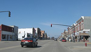
Osage, Iowa
City in Iowa, United States
Distance: Approx. 79 meters
Latitude and longitude: 43.28472222,-92.81222222
Osage is a city and the county seat of Mitchell County, Iowa, United States. The population was 3,627 at the time of the 2020 census.

Cedar Valley Seminary
United States historic place
Distance: Approx. 208 meters
Latitude and longitude: 43.28611111,-92.81361111
Cedar Valley Seminary is a historic seminary building currently at N. 7th and Chase Streets in Osage, Iowa. Prior to June 2016, it had been located at N. 6th and Mechanic Streets. It was built in 1869 and added to the National Register of Historic Places in 1977.

Burr Oak Township, Mitchell County, Iowa
Township in Mitchell County, Iowa, U.S.
Distance: Approx. 7906 meters
Latitude and longitude: 43.315,-92.725
Burr Oak Township is a township in Mitchell County, Iowa, United States.
West Lincoln Township, Mitchell County, Iowa
Township in Mitchell County, Iowa, U.S.
Distance: Approx. 7445 meters
Latitude and longitude: 43.2372,-92.7478
West Lincoln Township is a township in Mitchell County, Iowa, United States.
Mitchell Township, Mitchell County, Iowa
Township in Mitchell County, Iowa, U.S.
Distance: Approx. 6031 meters
Latitude and longitude: 43.3347,-92.8403
Mitchell Township is a township in Mitchell County, Iowa, United States.
Osage Township, Mitchell County, Iowa
Township in Mitchell County, Iowa, U.S.
Distance: Approx. 1144 meters
Latitude and longitude: 43.2883,-92.8
Osage Township is a township in Mitchell County, Iowa, United States.
Mitchell Powerhouse and Dam
United States historic place
Distance: Approx. 6675 meters
Latitude and longitude: 43.31833333,-92.88083333
Mitchell Powerhouse and Dam is a historic structure located in Mitchell, Iowa, United States. The west side of town along the Cedar River developed into a processing and manufacturing area, and its mills were powered by the river's current. They all became obsolete and closed around the turn of the 20th-century.

Nathaniel Cobb and Lucetia Baily Deering House
Historic house in Iowa, United States
Distance: Approx. 467 meters
Latitude and longitude: 43.28305556,-92.8075
The Nathaniel Cobb and Lucretia Baily Deering House is a historic building located in Osage, Iowa, United States. The house served as the residence for a prominent politician. Nathaniel Cobb Deering, for whom this house was named, was involved in a variety of pursuits from his native Maine to the California Gold Rush to his adoptive state of Iowa.
Osage Commercial Historic District
Historic district in Iowa, United States
Distance: Approx. 160 meters
Latitude and longitude: 43.28388889,-92.81111111
The Osage Commercial Historic District is a nationally recognized historic district located in Osage, Iowa, United States. It was listed on the National Register of Historic Places in 2002. At the time of its nomination it contained 50 resources, which included 46 contributing buildings, one contributing structure, and three non-contributing buildings.

Osage Community School District
Public school district in Osage, Iowa, United States
Distance: Approx. 787 meters
Latitude and longitude: 43.27759,-92.809954
Osage Community School District is a rural public school district headquartered in Osage, Iowa. The district occupies sections of Mitchell and Floyd counties, and in addition to Osage, it includes Mitchell and Orchard. In 2015, Barb Schwamman became the superintendent of the Osage district.
Weather in this IP's area
overcast clouds
-0 Celsius
-7 Celsius
-0 Celsius
1 Celsius
1021 hPa
76 %
1021 hPa
978 hPa
10000 meters
9.08 m/s
17.09 m/s
146 degree
100 %