Country:
 USA
USARegion:
City:
Latitude and Longitude:
Time Zone:
Postal Code:
IP information under different IP Channel
ip-api
Country
Region
City
ASN
Time Zone
ISP
Blacklist
Proxy
Latitude
Longitude
Postal
Route
IPinfo
Country
Region
City
ASN
Time Zone
ISP
Blacklist
Proxy
Latitude
Longitude
Postal
Route
MaxMind
Country
Region
City
ASN
Time Zone
ISP
Blacklist
Proxy
Latitude
Longitude
Postal
Route
Luminati
Country
USASN
Time Zone
America/Chicago
ISP
GCI
Latitude
Longitude
Postal
db-ip
Country
Region
City
ASN
Time Zone
ISP
Blacklist
Proxy
Latitude
Longitude
Postal
Route
ipdata
Country
Region
City
ASN
Time Zone
ISP
Blacklist
Proxy
Latitude
Longitude
Postal
Route
Popular places and events near this IP address

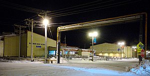
Utqiagvik, Alaska
City in Alaska, United States
Distance: Approx. 15 meters
Latitude and longitude: 71.29055556,-156.78861111
Utqiagvik ( UUT-kee-AH-vik; Inupiaq: Utqiaġvik, IPA: [utqe.ɑʁvik]), formerly known as Barrow ( BARR-oh), is the borough seat and largest city of the North Slope Borough in the U.S. state of Alaska. Located north of the Arctic Circle, it is one of the northernmost cities and towns in the world and the northernmost in the United States, with nearby Point Barrow as the country's northernmost point. Utqiagvik's population was 4,927 at the 2020 census, an increase from 4,212 in 2010.
Iḷisaġvik College
Public tribal community college in Utqiaġvik, Alaska
Distance: Approx. 5444 meters
Latitude and longitude: 71.325,-156.68055556
Iḷisaġvik College (Inupiaq: [iʎisɑʁvik]) is a public tribal land-grant community college in Utqiaġvik (formerly Barrow), Alaska. Operated by the North Slope Borough, a home rule government of the Iñupiat, it is the only tribally controlled college in Alaska, and it is the northernmost accredited community college in the United States. The college is located within the boundaries of the North Slope.

Iñupiat Heritage Center
Museum in Alaska, U.S.
Distance: Approx. 1555 meters
Latitude and longitude: 71.29861111,-156.75333333
The Iñupiat Heritage Center is a museum in Utqiaġvik in the U.S. state of Alaska. Dedicated in February 1999, it is an affiliated area of New Bedford Whaling National Historical Park in New Bedford, Massachusetts, and recognizes the contributions of Alaska Natives to the history of whaling. It houses exhibits, artifact collections, a library, a gift shop, and a traditional room where traditional crafts are demonstrated and taught.

Wiley Post–Will Rogers Memorial Airport
Airport serving Utqiaġvik, Alaska, United States
Distance: Approx. 992 meters
Latitude and longitude: 71.28555556,-156.76611111
Wiley Post–Will Rogers Memorial Airport, (IATA: BRW, ICAO: PABR, FAA LID: BRW) often referred to as Post/Rogers Memorial, is a public airport located in Utqiaġvik (formerly Barrow), the largest city and borough seat of the North Slope Borough of the U.S. state of Alaska. The airport is owned by the state. Situated on the Chukchi Sea at a latitude of 71.29°N, the airport is the farthest north of any in US territory.
KBRW-FM
Radio station in Utqiaġvik, Alaska
Distance: Approx. 1102 meters
Latitude and longitude: 71.28888889,-156.75861111
KBRW-FM is a non-commercial radio station in Utqiaġvik, Alaska, broadcasting on 91.9 MHz FM, and is located at 1695 Okpik Street, in a building that also contains studios for KBRW/680. The FM station airs public radio programming from the National Public Radio and WFMT networks. KBRW-FM also airs locally originated programming.
Barrow High School
Public high school in Utqiaġvik, Alaska, United States
Distance: Approx. 774 meters
Latitude and longitude: 71.28916667,-156.76777778
Barrow High School is a public high school in Utqiaġvik (formerly Barrow), Alaska, United States, operated by the North Slope Borough School District. As of the 2016–2017 school year, the school had 232 students.

Utkeagvik Church Manse
United States historic place
Distance: Approx. 318 meters
Latitude and longitude: 71.29278,-156.78326
The Utkeagvik Church Manse, also known as the Utkeagvik Presbyterian Church Manse and The Pastor's House, is a historic church parsonage at 1268 Church Street in Utqiaġvik, Alaska. It is a two-story wood frame gambrel-roofed Dutch Colonial, and is distinctive as the only building of this style in Utqiaġvik. Built in 1930, it was also the first two-story building in the community, and the first to be built from a kit, a building method later widely adopted in Arctic Alaska.

Point Barrow Refuge Station
United States historic place
Distance: Approx. 1037 meters
Latitude and longitude: 71.29839,-156.77305
The Point Barrow Refuge Station is a historic building in the Browerville section of Utqiaġvik, Alaska (formerly Barrow). Built in 1889, it is the oldest wood-frame building in Utqiaġvik. Its main portion is a rectangular structure with a steeply-pitched gable roof, to which a number of additions have been made.
Naval Arctic Research Laboratory
Distance: Approx. 5444 meters
Latitude and longitude: 71.325,-156.68055556
The Naval Arctic Research Laboratory (NARL) was an Office of Naval Research research facility located at Point Barrow in Utqiaġvik, Alaska. The site is the present day location of Iḷisaġvik College.
Weather in this IP's area
overcast clouds
-8 Celsius
-12 Celsius
-8 Celsius
-8 Celsius
1014 hPa
87 %
1014 hPa
1014 hPa
10000 meters
2.23 m/s
2.52 m/s
229 degree
97 %
10:09:13
18:14:26