198.62.93.36 - IP Lookup: Free IP Address Lookup, Postal Code Lookup, IP Location Lookup, IP ASN, Public IP
Country:
Region:
City:
Location:
Time Zone:
Postal Code:
IP information under different IP Channel
ip-api
Country
Region
City
ASN
Time Zone
ISP
Blacklist
Proxy
Latitude
Longitude
Postal
Route
Luminati
Country
Region
nj
City
saddlebrook
ASN
Time Zone
America/New_York
ISP
ZS-ASSOCIATES
Latitude
Longitude
Postal
IPinfo
Country
Region
City
ASN
Time Zone
ISP
Blacklist
Proxy
Latitude
Longitude
Postal
Route
IP2Location
198.62.93.36Country
Region
illinois
City
evanston
Time Zone
America/Chicago
ISP
Language
User-Agent
Latitude
Longitude
Postal
db-ip
Country
Region
City
ASN
Time Zone
ISP
Blacklist
Proxy
Latitude
Longitude
Postal
Route
ipdata
Country
Region
City
ASN
Time Zone
ISP
Blacklist
Proxy
Latitude
Longitude
Postal
Route
Popular places and events near this IP address

Evanston, Illinois
City in Illinois, United States
Distance: Approx. 1198 meters
Latitude and longitude: 42.04638889,-87.69472222
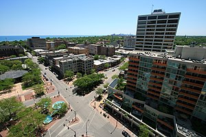
Evanston ( EV-ən-stən) is a city in Cook County, Illinois, United States, situated on the North Shore along Lake Michigan. A suburb of Chicago, Evanston is 12 miles (19 km) north of Downtown Chicago, bordered by Chicago to the south, Skokie to the west, Wilmette to the north, and Lake Michigan to the east. Evanston had a population of 78,110 as of 2020.

Ryan Field (stadium)
Stadium in Evanston, Illinois
Distance: Approx. 1171 meters
Latitude and longitude: 42.06555556,-87.6925
Ryan Field was a stadium in the central United States, located in Evanston, Illinois, a suburb north of Chicago. Near the campus of Northwestern University, it was primarily used for American football, and was the home field of the Northwestern Wildcats of the Big Ten Conference. Before its demolition in 2024, it was the only FBS stadium without permanent lighting, and its final seating capacity was 47,130.

Ladd Arboretum
Botanical garden in Evanston, Illinois
Distance: Approx. 82 meters
Latitude and longitude: 42.0568,-87.7006
The Edward R. Ladd Arboretum is an arboretum located at 2024 McCormick Boulevard, Evanston, Illinois, occupying 23 acres (9.3 ha) in a narrow .75 miles (1.21 km) stretch between McCormick Boulevard and the North Shore Channel on land leased from the Metropolitan Water Reclamation District of Greater Chicago. The first tree, a ginkgo, was planted by the Evanston Review in the memory of Edward Rixon Ladd (1883–1956), its founder, publisher, and editor. The Arboretum was formally dedicated the following year, on June 10, 1960, after many other trees were planted.

Chicago Zen Center
Distance: Approx. 1069 meters
Latitude and longitude: 42.0551,-87.6869
The Chicago Zen Center (CZC) is a Harada-Yasutani Zen practice center located in Evanston, Illinois near Northwestern University currently led by Abbot Shodhin Geiman. Established in 1974, the Chicago Zen Center formed around an interested group of students who had attended a workshop given by Philip Kapleau in the early 1970s. For many years, the center was an affiliate of the Rochester Zen Center in Rochester New York, which sent teachers there throughout the year to hold sesshins, including Kapleau himself as well as his successor Bodhin Kjolhede.

Evanston Central Street station
Commuter rail station in Evanston, Illinois
Distance: Approx. 842 meters
Latitude and longitude: 42.063964,-87.698041
Evanston Central Street is the northernmost of the three commuter railroad stations in Evanston, Illinois. It is an elevated station at Green Bay Road and Central Street, surrounded by a neighborhood of stores, restaurants and multi-story apartment buildings. Just north of the station, the tracks descend to grade and pass through Wilmette on ground level.

Northwestern Field
Defunct American football stadium in Evanston, Illinois (1905–1925)
Distance: Approx. 1110 meters
Latitude and longitude: 42.06527778,-87.69333333
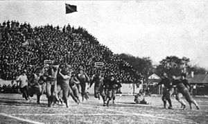
Northwestern Field was a football stadium in Evanston, Illinois. It opened in 1905 and was home to the Northwestern Wildcats football team prior to the Dyche Stadium (now known as Ryan Field) opening in 1926. It had a capacity of 10,000 people.

Central Street (Evanston, Illinois)
Road in Evanston, Illinois
Distance: Approx. 979 meters
Latitude and longitude: 42.0644,-87.7049
Central Street is the principal east-west artery in the far north of Evanston, Illinois and is a major thoroughfare in other northern and northwest suburbs of Chicago. It is the longest east-west road in the city of Evanston, where it stretches for over two miles (3 km) from the city limits west of Crawford Avenue to its eastern intersection with Sheridan Road near the historic Grosse Point Lighthouse. West of Evanston, the street begins in Glenview and runs westward intermittently through various municipalities, where it is alternately known as Central Road, Central Parkway, and Central Street.
Fanny's
Restaurant in Illinois from 1946 to 1987
Distance: Approx. 443 meters
Latitude and longitude: 42.0559,-87.6944
Fanny's Restaurant was a notable eatery located at 1601 Simpson Street Evanston, IL US (the first suburb north of the Chicago City Limits) between 1946 and 1987. It was an anomaly in that it was located in a working-class neighborhood and yet known the world over. Patrons included the Marshall Field Family, of department store fame.

Evanston Civic Center
United States historic place
Distance: Approx. 1031 meters
Latitude and longitude: 42.05666667,-87.68722222
The Evanston Civic Center, historically known as Marywood Academy, is a historic building located at 2100 Ridge Avenue in Evanston, Illinois. The building was built in 1900 as Visitation Academy to serve as a girls' Catholic school led by the Visitation Sisters. Architect Henry J. Schlacks gave the building a Georgian Revival design that featured a tripartite massing with a base, middle, and cornice; limestone quoins and belt courses; and Doric pilasters and an architrave molding around the entrance.
Evanston Art Center
Distance: Approx. 927 meters
Latitude and longitude: 42.06457,-87.69694
The Evanston Art Center is an arts center in Evanston, Illinois offering classes, lectures, exhibitions, and community outreach. It is among the oldest and largest arts centers in Illinois.

Buildings at 2517, 2519, and 2523 Central Street
United States historic place
Distance: Approx. 1175 meters
Latitude and longitude: 42.06472222,-87.70861111
The Buildings at 2517, 2519, and 2523 Central Street are three related apartment buildings at 2517, 2519, and 2523 Central Street in Evanston, Illinois. The three two-flats were built as part of one development project in 1927. Architect Arthur Jacobs designed all three buildings using a consistent theme, so that the three buildings would have different designs but appear as parts of a complex.

Charles A. Brown House
Building in Illinois, designed by F.L. Wright
Distance: Approx. 986 meters
Latitude and longitude: 42.0630609,-87.7077091
The Charles A. Brown House is a two-story home on 2420 Harrison Street, in Evanston, Illinois, designed in 1905 by American architect Frank Lloyd Wright. The building is a two-story clapboard home with four-bedrooms and one-bathroom on the second floor. The structure also has sash windows; one of the last times that the architect would make this choice for window design.
Weather in this IP's area
overcast clouds
1 Celsius
-3 Celsius
-1 Celsius
2 Celsius
1028 hPa
82 %
1028 hPa
1006 hPa
10000 meters
3.09 m/s
30 degree
100 %