198.60.241.35 - IP Lookup: Free IP Address Lookup, Postal Code Lookup, IP Location Lookup, IP ASN, Public IP
Country:
Region:
City:
Location:
Time Zone:
Postal Code:
IP information under different IP Channel
ip-api
Country
Region
City
ASN
Time Zone
ISP
Blacklist
Proxy
Latitude
Longitude
Postal
Route
Luminati
Country
Region
or
City
ontario
ASN
Time Zone
America/Boise
ISP
TVCC-5-AS
Latitude
Longitude
Postal
IPinfo
Country
Region
City
ASN
Time Zone
ISP
Blacklist
Proxy
Latitude
Longitude
Postal
Route
IP2Location
198.60.241.35Country
Region
oregon
City
ontario
Time Zone
America/Boise
ISP
Language
User-Agent
Latitude
Longitude
Postal
db-ip
Country
Region
City
ASN
Time Zone
ISP
Blacklist
Proxy
Latitude
Longitude
Postal
Route
ipdata
Country
Region
City
ASN
Time Zone
ISP
Blacklist
Proxy
Latitude
Longitude
Postal
Route
Popular places and events near this IP address

Ontario, Oregon
City in Oregon, United States
Distance: Approx. 3099 meters
Latitude and longitude: 44.02694444,-116.96861111
Ontario is the largest city in Malheur County, Oregon, United States. It lies along the Snake River at the Idaho border. The population was 11,645 at the 2020 census.

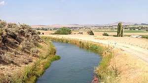
Malheur River
River in Oregon, United States
Distance: Approx. 1043 meters
Latitude and longitude: 44.05916667,-116.97527778
The Malheur River ( MAL-hure) is a 190-mile-long (306 km) tributary of the Snake River in eastern Oregon in the United States. It drains a high desert area, between the Harney Basin, the Blue Mountains and the Snake. In the past Malheur Lake (located in the enclosed Harney Basin to the southwest) outflowed into the river.

Treasure Valley
Metropolitan area and river valley in southwestern Idaho
Distance: Approx. 4296 meters
Latitude and longitude: 44.04027778,-116.93333333
The Treasure Valley is a valley in the western United States, primarily in southwestern Idaho, where the Payette, Boise, Weiser, Malheur, and Owyhee rivers drain into the Snake River. It includes all the lowland areas from Vale in rural eastern Oregon to Boise, and is the most populated area in Idaho. Historically, the valley had been known as the Lower Snake River Valley or the Boise River Valley.
Treasure Valley Community College
Public college in Ontario, Oregon, US
Distance: Approx. 3877 meters
Latitude and longitude: 44.0185,-116.9732
Treasure Valley Community College is a public community college in Ontario, Oregon, at the western edge of the Treasure Valley. Its service area is sections of Malheur and Baker counties.

Ontario Municipal Airport
Airport in Ontario, Oregon, US
Distance: Approx. 4331 meters
Latitude and longitude: 44.01944444,-117.01305556
Ontario Municipal Airport (IATA: ONO, ICAO: KONO, FAA LID: ONO) is three miles west of Ontario, in Malheur County, Oregon. The National Plan of Integrated Airport Systems for 2011–2015 categorized it as a general aviation facility. The first airline flights were Empire Airlines Boeing 247Ds in late 1946; successors West Coast, Air West and Hughes Airwest served Ontario until 1973.
Ontario High School (Oregon)
Public school in Oregon, United States
Distance: Approx. 2573 meters
Latitude and longitude: 44.02972222,-116.97805556
Ontario High School is a public high school located in Ontario, Oregon, United States. It is a part of Ontario School District 8C. As of 2009 some students in the Juntura area, who are within Juntura School District 12, a K-8 school district, move on to Ontario High for high school.
Ontario State Recreation Site
State park in Oregon, United States
Distance: Approx. 1427 meters
Latitude and longitude: 44.0443302,-116.9704387
Ontario State Recreation Site is a state park in the U.S. state of Oregon, administered by the Oregon Parks and Recreation Department.

Ontario station (Oregon)
Former railway station in Ontario, Oregon, United States
Distance: Approx. 3652 meters
Latitude and longitude: 44.02366667,-116.96227778
The Ontario station is a former train station located in Ontario, Oregon, United States that is listed on the National Register of Historic Places as the Oregon Short Line Railroad Depot. It was constructed in 1907 by the Union Pacific Railroad (UP) for its subsidiary, the Oregon Short Line Railroad (OSL), to replace an 1885 OSL depot that had been located just to the south and had been a simple wood-frame structure. The building is made of concrete block cast to imitate stone, and with red brick trim and other ornamental features.

James Rowley and Mary J. Blackaby House
Historic house in Oregon, United States
Distance: Approx. 3766 meters
Latitude and longitude: 44.020688,-116.967916
The James Rowley and Mary J. Blackaby House is a historic residence located in Ontario, Oregon, United States. The house was listed on the National Register of Historic Places in 2001.

J. C. Palumbo Fruit Company Packing and Warehouse Building
United States historic place
Distance: Approx. 4374 meters
Latitude and longitude: 44.072844,-116.937608
The J.C. Palumbo Fruit Company Packing and Warehouse Building is a historic packing house in Payette, Idaho that was built in 1928. It was designed by architects Tourtellotte & Hummel. The building was listed on the U.S. National Register of Historic Places in 1982.
Treasure Valley Christian School
School in Oregon, US
Distance: Approx. 2339 meters
Latitude and longitude: 44.03138889,-116.98444444
Treasure Valley Christian School (TVCS) is a private pre-K-12 Christian school in Ontario, Oregon, United States. Although it is non-denominational, it is located on the campus of and sponsored by Treasure Valley Baptist Church. TVCS is a member of the Association of Christian Schools International and teaches using A Beka curriculum.

N. A. Jacobsen Building
United States historic place
Distance: Approx. 4596 meters
Latitude and longitude: 44.07361111,-116.935
The N. A. Jacobsen Building is a historic two-story building in Payette, Idaho. It was designed by architect John E. Tourtellotte, and built in 1908 for N. A. Jacobsen. It has been listed on the National Register of Historic Places since November 17, 1982.
Weather in this IP's area
broken clouds
8 Celsius
7 Celsius
8 Celsius
8 Celsius
1030 hPa
49 %
1030 hPa
943 hPa
10000 meters
2.57 m/s
340 degree
75 %