198.60.183.167 - IP Lookup: Free IP Address Lookup, Postal Code Lookup, IP Location Lookup, IP ASN, Public IP
Country:
Region:
City:
Location:
Time Zone:
Postal Code:
ISP:
ASN:
language:
User-Agent:
Proxy IP:
Blacklist:
IP information under different IP Channel
ip-api
Country
Region
City
ASN
Time Zone
ISP
Blacklist
Proxy
Latitude
Longitude
Postal
Route
db-ip
Country
Region
City
ASN
Time Zone
ISP
Blacklist
Proxy
Latitude
Longitude
Postal
Route
IPinfo
Country
Region
City
ASN
Time Zone
ISP
Blacklist
Proxy
Latitude
Longitude
Postal
Route
IP2Location
198.60.183.167Country
Region
arizona
City
tucson
Time Zone
America/Phoenix
ISP
Language
User-Agent
Latitude
Longitude
Postal
ipdata
Country
Region
City
ASN
Time Zone
ISP
Blacklist
Proxy
Latitude
Longitude
Postal
Route
Popular places and events near this IP address
University of Arizona
Public university in Tucson, Arizona, US
Distance: Approx. 281 meters
Latitude and longitude: 32.2319,-110.9527
The University of Arizona (Arizona, U of A, UArizona, or UA) is a public land-grant research university in Tucson, Arizona, United States. Founded in 1885 by the 13th Arizona Territorial Legislature, it was the first university established in the Arizona Territory. The University of Arizona is one of three universities governed by the Arizona Board of Regents.

Steward Observatory
Observatory in Tucson, Arizona (US)
Distance: Approx. 235 meters
Latitude and longitude: 32.2333,-110.949
Steward Observatory is the research arm of the Department of Astronomy at the University of Arizona (UArizona). Its offices are located on the UArizona campus in Tucson, Arizona (US). Established in 1916, the first telescope and building were formally dedicated on April 23, 1923.

Arizona Stadium
Outdoor college football stadium in Tucson, Arizona
Distance: Approx. 267 meters
Latitude and longitude: 32.229,-110.949
Arizona Stadium is an outdoor college football stadium in the southwestern United States, located on the campus of the University of Arizona in Tucson, Arizona. It is the home field of the Arizona Wildcats of the Big 12 Conference. Originally constructed in 1929 to hold 7,000 spectators, the stadium's seating capacity has been expanded numerous times since.

McKale Center
University of Arizona athletic arena in Tucson
Distance: Approx. 146 meters
Latitude and longitude: 32.23,-110.95
McKale Memorial Center is an athletic arena in the southwest United States, located on the campus of the University of Arizona in Tucson, Arizona. As the home of the university's Wildcats basketball team of the Big 12 Conference, it is primarily used for basketball, but also has physical training and therapy facilities. Its construction is marked with a large copper cap that has oxidized brown.

Lunar and Planetary Laboratory
Lab at University of Arizona
Distance: Approx. 275 meters
Latitude and longitude: 32.232,-110.947
The Lunar and Planetary Laboratory (LPL) is a research center for planetary science located in Tucson, Arizona. It is also a graduate school, constituting the Department of Planetary Sciences at the University of Arizona. LPL is one of the world's largest programs dedicated exclusively to planetary science in a university setting.

University of Arizona Mineral Museum
Museum in Tucson, Arizona
Distance: Approx. 239 meters
Latitude and longitude: 32.2325,-110.9477
The University of Arizona Mineral Museum (UAMM) is a mineralogy museum located in the Pima County Courthouse in downtown Tucson, Arizona.
Laboratory of Tree-Ring Research
Dendrochronology laboratory in Arizona
Distance: Approx. 333 meters
Latitude and longitude: 32.2292032,-110.9523167
The Laboratory of Tree-Ring Research (LTRR) was established in 1937 by A.E. Douglass, founder of the modern science of dendrochronology. The LTRR is a research unit in the College of Science at the University of Arizona in Tucson. Since its founding, visiting scholars and faculty at the lab have done notable work in the areas of climate change, fire history, ecology, archeology and hydrology.

Wyant College of Optical Sciences
Division of the University of Arizona
Distance: Approx. 261 meters
Latitude and longitude: 32.23139,-110.94703
The University of Arizona College of Optical Sciences, considered the largest institute for optics education in the United States, is dedicated to research and education in optics with an emphasis on optical engineering. The college offers more than 90 courses in optical sciences, and a Bachelor of Science degree in Optical Sciences and Engineering, Masters and Doctoral degree programs in Optical Sciences, as well as a dual master's degree in Optical Sciences and Business Administration. The college also offers comprehensive distance learning courses leading to a Professional Graduate Certificate or a master's degree and markets non-credit short courses on DVD to optics professionals.

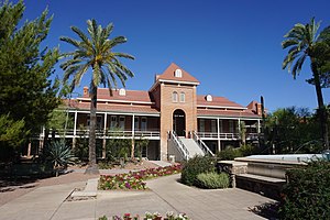
Old Main, University of Arizona
United States historic place
Distance: Approx. 289 meters
Latitude and longitude: 32.23194444,-110.95277778
Old Main, University of Arizona, originally known as the University of Arizona, School of Agriculture building, was the first building constructed on the University of Arizona campus in Tucson, Arizona, United States. Old Main is one of the oldest surviving educational structures in the western United States. It was placed on the National Register of Historic Places in 1972.

Bear Down Gym
Historic multi-purpose arena in Tucson, Arizona
Distance: Approx. 28 meters
Latitude and longitude: 32.23111111,-110.95
Bear Down Gym, originally known as Men's Gymnasium, is a 300-seat multi-purpose arena in Tucson, Arizona. It opened in 1926. It was home to the University of Arizona Wildcats basketball team.

Flandrau Science Center and Planetarium
Science museum in Tucson, Arizona
Distance: Approx. 233 meters
Latitude and longitude: 32.2324,-110.9477
The Flandrau Science Center & Planetarium is a science museum and planetarium in Tucson, Arizona. It is part of the University of Arizona. It is named after American author Grace Flandrau.
UA Field
College baseball stadium in Tucson, Arizona
Distance: Approx. 88 meters
Latitude and longitude: 32.23111111,-110.94888889
UA Field was a college baseball park in the southwestern United States, located on the campus of the University of Arizona in Tucson, Arizona. It served as the home field of the Arizona Wildcats baseball team from 1929 to 1966.
Weather in this IP's area
clear sky
12 Celsius
10 Celsius
10 Celsius
15 Celsius
1016 hPa
16 %
1016 hPa
921 hPa
10000 meters
2.57 m/s
180 degree