198.56.12.48 - IP Lookup: Free IP Address Lookup, Postal Code Lookup, IP Location Lookup, IP ASN, Public IP
Country:
Region:
City:
Location:
Time Zone:
Postal Code:
IP information under different IP Channel
ip-api
Country
Region
City
ASN
Time Zone
ISP
Blacklist
Proxy
Latitude
Longitude
Postal
Route
Luminati
Country
Region
wi
City
lacrosse
ASN
Time Zone
America/Chicago
ISP
DPCLAX
Latitude
Longitude
Postal
IPinfo
Country
Region
City
ASN
Time Zone
ISP
Blacklist
Proxy
Latitude
Longitude
Postal
Route
IP2Location
198.56.12.48Country
Region
wisconsin
City
eau claire
Time Zone
America/Chicago
ISP
Language
User-Agent
Latitude
Longitude
Postal
db-ip
Country
Region
City
ASN
Time Zone
ISP
Blacklist
Proxy
Latitude
Longitude
Postal
Route
ipdata
Country
Region
City
ASN
Time Zone
ISP
Blacklist
Proxy
Latitude
Longitude
Postal
Route
Popular places and events near this IP address

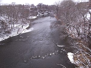
Eau Claire River (Chippewa River tributary)
River in Eau Claire, Wisconsin
Distance: Approx. 384 meters
Latitude and longitude: 44.81166667,-91.50333333
The Eau Claire River is a tributary of the Chippewa River in west-central Wisconsin in the United States. It is one of three rivers by this name in Wisconsin. Via the Chippewa River, it is part of the Mississippi River watershed.

Christ Church Cathedral (Eau Claire, Wisconsin)
Historic church in Wisconsin, United States
Distance: Approx. 272 meters
Latitude and longitude: 44.80921667,-91.49668889
Christ Church Cathedral, built in 1916 to replace the earlier 1874 building, is the Episcopal cathedral in Eau Claire, Wisconsin. It is the mother church for the Episcopal Diocese of Eau Claire, the see of which is located in Eau Claire. The cathedral and parish house were added to the National Register of Historic Places in 1982.

Schlegelmilch-McDaniel House
Distance: Approx. 285 meters
Latitude and longitude: 44.809373,-91.496128
The Schlegelmilch-McDaniel House is a house-turned-museum in Eau Claire, Wisconsin. The house was built in 1871, one year before Eau Claire became a city. Today, the house, located at 517 S. Farwell St., directly across Farwell St.
WHYS-LP
Radio station in Eau Claire, Wisconsin
Distance: Approx. 113 meters
Latitude and longitude: 44.81083333,-91.49722222
WHYS-LP (96.3 FM) is a radio station located in the Eau Claire, Wisconsin media market. The station is currently owned by Northern Thunder, Inc. The station presents a wide variety of music and public affairs programming including the syndicated weekly radio news magazines Democracy Now!

State Theatre (Eau Claire, Wisconsin)
Distance: Approx. 189 meters
Latitude and longitude: 44.81253,-91.50015
The State Theatre is a venue for the performing arts and entertainment, located in downtown Eau Claire, Wisconsin, with seating for 1100 people.

Eau Claire Masonic Temple
United States historic place
Distance: Approx. 115 meters
Latitude and longitude: 44.810278,-91.498333
The Eau Claire Masonic Temple at the corner of South Barstow and Main Streets in Eau Claire, Wisconsin was built in 1899 and listed on the National Register of Historic Places in 2007. In 1927 the Masonic bodies that met there relocated to their recently completed Temple of Free Masonry on Graham Avenue. It is a three-story brick building.

United States Post Office and Courthouse (Eau Claire, Wisconsin)
United States historic place
Distance: Approx. 269 meters
Latitude and longitude: 44.80888889,-91.49833333
The U.S. Post Office and Courthouse in Eau Claire, Wisconsin, was built in 1907. It was listed on the National Register of Historic Places in 1991. It is designed in Classical Revival architecture style.
Confluence Commercial Historic District
Historic district in Wisconsin, United States
Distance: Approx. 192 meters
Latitude and longitude: 44.81222222,-91.50055556
The Confluence Commercial Historic District is located in Eau Claire, Wisconsin. It was added to the National Register of Historic Places in 2007.
First Methodist Episcopal Church (Eau Claire, Wisconsin)
Historic church in Wisconsin, United States
Distance: Approx. 184 meters
Latitude and longitude: 44.81027778,-91.49666667
First Methodist Episcopal Church is a Neogothic Revival-styled church built in 1911 in Eau Claire, Wisconsin. It was added to the National Register of Historic Places in 1999 for its architectural significance. The congregation that became First Methodist Episcopal began meeting in 1857, praying in the home of D.S. Hastings.
Union Auto Company
United States historic place
Distance: Approx. 230 meters
Latitude and longitude: 44.80935,-91.49754
The Union Auto Company is located in Eau Claire, Wisconsin. In 2007, the building was added to the National Register of Historic Places.
Barnes Block
United States historic place
Distance: Approx. 264 meters
Latitude and longitude: 44.81277778,-91.50111111
The Barnes Block is located in Eau Claire, Wisconsin.

Eau Claire Public Library
United States historic place
Distance: Approx. 80 meters
Latitude and longitude: 44.81194444,-91.49805556
The Eau Claire Public Library building is located in Eau Claire, Wisconsin.
Weather in this IP's area
mist
-3 Celsius
-7 Celsius
-3 Celsius
-2 Celsius
1003 hPa
95 %
1003 hPa
967 hPa
3219 meters
3.6 m/s
170 degree
100 %


