Country:
Region:
City:
Latitude and Longitude:
Time Zone:
Postal Code:
IP information under different IP Channel
ip-api
Country
Region
City
ASN
Time Zone
ISP
Blacklist
Proxy
Latitude
Longitude
Postal
Route
Luminati
Country
ASN
IPinfo
Country
Region
City
ASN
Time Zone
ISP
Blacklist
Proxy
Latitude
Longitude
Postal
Route
db-ip
Country
Region
City
ASN
Time Zone
ISP
Blacklist
Proxy
Latitude
Longitude
Postal
Route
ipdata
Country
Region
City
ASN
Time Zone
ISP
Blacklist
Proxy
Latitude
Longitude
Postal
Route
Popular places and events near this IP address

Tysons, Virginia
Census-designated place in Virginia, United States
Distance: Approx. 1611 meters
Latitude and longitude: 38.91861111,-77.22972222
Tysons, also known as Tysons Corner, is a census-designated place (CDP) in Fairfax County, Virginia, United States, spanning from the corner of SR 123 (Chain Bridge Road) and SR 7 (Leesburg Pike). It is part of the Washington metropolitan area and located in Northern Virginia between McLean and Vienna along the I-495. Tysons is home to two super-regional shopping malls, Tysons Corner Center and Tysons Galleria, and the corporate and administrative headquarters of Alarm.com, Appian, Booz Allen Hamilton, Capital One, Freddie Mac, Gannett, Hilton Worldwide, ID.me, Intelsat, M.C. Dean, Inc., MicroStrategy, and Tegna Inc.

Tysons Corner Center
Shopping mall in Virginia, United States
Distance: Approx. 1538 meters
Latitude and longitude: 38.91713,-77.22224
Tysons Corner Center is a shopping mall in the unincorporated area of Tysons in Fairfax County, Virginia, United States (between McLean and Vienna, Virginia). It opened to the public in 1968, becoming one of the first fully enclosed, climate-controlled shopping malls in the Washington metropolitan area. The mall's anchor department stores are Macy's, Nordstrom, and Bloomingdale's.

National Counterterrorism Center
U.S. government organization responsible for national and international counterterrorism efforts
Distance: Approx. 1296 meters
Latitude and longitude: 38.933,-77.205
The National Counterterrorism Center (NCTC) is a United States government organization responsible for national and international counterterrorism efforts. It is based in Liberty Crossing in McLean, Virginia. NCTC advises the United States on terrorism.

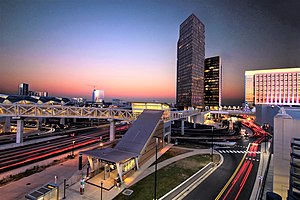
McLean station
Washington Metro station
Distance: Approx. 1075 meters
Latitude and longitude: 38.92434,-77.21048
McLean station (preliminary names Tysons East, Tysons–McLean) is a Washington Metro station in Fairfax County, Virginia, on the Silver Line. The station is located in Tysons, with a McLean postal address. It began operation on July 26, 2014.
Tycon Center
Distance: Approx. 1821 meters
Latitude and longitude: 38.91444444,-77.21944444
Tycon Center is a development at 8000 Towers Crescent Drive in Vienna, VA, built and initially owned by developers James T. Lewis, Roy Mitchell and Don Moore, known as Tycon Development The complex is also known as Tycon Towers 1 and consists of a postmodern 17-story brick clad building designed by John Burgee Architects with Philip Johnson.

Odricks Corner, Virginia
Unincorporated community in Virginia, United States
Distance: Approx. 1334 meters
Latitude and longitude: 38.93861111,-77.23138889
Odricks Corner is an unincorporated community in Fairfax County, Virginia, United States. Odricks Corner lies north of the Dulles Toll Road (State Route 267) at the intersection of Spring Hill and Lewinsville Roads. Odricks Corner takes its name from Alfred Odrick, a former slave and carpenter who in 1872 purchased 30 acres and built a house on the southern side of Lewinsville Road.

Tysons Galleria
Shopping mall in Virginia, United States
Distance: Approx. 896 meters
Latitude and longitude: 38.92391,-77.22505
Tysons Galleria is a three-level super-regional mall owned by Brookfield Properties located at 2001 International Drive in Tysons, Virginia. It is the second-largest mall in Tysons, and one of the largest in the Washington metropolitan area.
National Automobile Dealers Association
American trade organization
Distance: Approx. 1422 meters
Latitude and longitude: 38.925834,-77.234824
The National Automobile Dealers Association (NADA) is an American trade organization representing nearly 16,500 franchised new car and truck dealerships, both domestic and foreign. Established in 1917, the organization is based in Tysons Corner, Virginia. As the automotive retail industry's primary trade association, NADA monitors federal legislation and regulation affecting dealerships and publishes forecasts and reports about industry trends.

National Counterproliferation Center
Mission center of the United States Intelligence Community
Distance: Approx. 1296 meters
Latitude and longitude: 38.933,-77.205
The National Counterproliferation and Biosecurity Center (NCBC) is the primary organization within the United States Intelligence Community for combating the spread of weapons of mass destruction and their delivery systems. NCBC works with the Intelligence Community (IC) to identify critical intelligence gaps in counter-proliferation collection or analysis and then develops solutions to help close those gaps. NCBC also works to find and fund new technologies to help combat proliferation.

Tysons Corner Communications Tower
Distance: Approx. 1464 meters
Latitude and longitude: 38.920248,-77.229781
Tysons Corner Communications Tower, also known as Site E, is a classified United States military microwave tower located in Tysons Corner, Virginia. The tower is administered by the United States Army from Fort Belvoir.
IQ Business Group
Distance: Approx. 1386 meters
Latitude and longitude: 38.9325,-77.23555556
The iQ Business Group, Inc. (IQBG) is an American multinational corporation headquartered in McLean, Virginia.

Capital One Tower (Virginia)
High-rise office building in Capital One Center in Tysons, Virginia
Distance: Approx. 813 meters
Latitude and longitude: 38.92611111,-77.2125
Capital One Tower is a high-rise office building in Capital One Center, a mixed-use development adjacent to the McLean station in Tysons, Virginia. Capital One Tower is the tallest occupied building in the Washington metropolitan area at 470 feet (143 m) in height and the second-tallest building in Virginia. Ground was broken on the tower in November 2014 and it was completed in 2018.
Weather in this IP's area
clear sky
12 Celsius
11 Celsius
11 Celsius
13 Celsius
1018 hPa
58 %
1018 hPa
1006 hPa
10000 meters
0.45 m/s
337 degree
06:53:24
16:54:22