Country:
Region:
City:
Latitude and Longitude:
Time Zone:
Postal Code:
IP information under different IP Channel
ip-api
Country
Region
City
ASN
Time Zone
ISP
Blacklist
Proxy
Latitude
Longitude
Postal
Route
Luminati
Country
ASN
Time Zone
America/Chicago
ISP
TELX-LEGACY
Latitude
Longitude
Postal
IPinfo
Country
Region
City
ASN
Time Zone
ISP
Blacklist
Proxy
Latitude
Longitude
Postal
Route
db-ip
Country
Region
City
ASN
Time Zone
ISP
Blacklist
Proxy
Latitude
Longitude
Postal
Route
ipdata
Country
Region
City
ASN
Time Zone
ISP
Blacklist
Proxy
Latitude
Longitude
Postal
Route
Popular places and events near this IP address
Country Estates, Florida
Neighborhood in Broward, Florida, United States
Distance: Approx. 4235 meters
Latitude and longitude: 26.04944444,-80.40888889
Country Estates was a census-designated place (CDP) in Broward County, Florida, United States. The population was 1,910 at the 2000 census. It is now a neighborhood incorporated into the town of Southwest Ranches, Florida in 2000.
Rolling Oaks, Florida
Neighborhood in Broward, Florida, United States
Distance: Approx. 4280 meters
Latitude and longitude: 26.04055556,-80.38861111
Rolling Oaks was a census-designated place (CDP) in Broward County, Florida, United States. The population was 1,291 at the 2000 census. It was incorporated into the town of Southwest Ranches, Florida in 2000, and is now a neighborhood.
Pembroke Pines Charter High School
School in Pembroke Pines, Florida, United States
Distance: Approx. 4786 meters
Latitude and longitude: 26.03194444,-80.375
Pembroke Pines Charter High School is a charter school in the United States. It is funded and administered by the City of Pembroke Pines, as opposed to the Broward County School Board. In 2005-06, PPCHS received an A grade from the State of Florida, after the school's D grade the previous year.
Hollywood Sportatorium
Arena in Pembroke Pines, Florida, U.S.
Distance: Approx. 4245 meters
Latitude and longitude: 26.00901944,-80.37521944
The Hollywood Sportatorium was an indoor arena in Pembroke Pines, Florida (originally Hollywood), located at 17171 Pines Boulevard (originally 16661 West Hollywood Boulevard). The Sportatorium was 26 miles (42 km) from downtown Miami and 23 miles (37 km) from downtown Fort Lauderdale. During its 18 years of operation, it was the only venue of its kind in heavily populated South Florida.

Miami-Hollywood Motorsports Park
Distance: Approx. 4811 meters
Latitude and longitude: 26.008803,-80.369556
The Miami-Hollywood Motorsports Park was an auto racing complex in Pembroke Pines, Florida. Opened in March 1966, it was located east of the Hollywood Sportatorium near the corner of 172nd Avenue and what was then Hollywood Boulevard (now Pines Boulevard). The speedway featured a quarter-mile (0.4 km) dragstrip as well as an 0.375 mile (0.6 km) oval track.

Everglades High School
Public school in Miramar, Florida, United States
Distance: Approx. 6308 meters
Latitude and longitude: 25.9714812,-80.3736634
Everglades High School is a public school located in Miramar, Florida, United States. The school serves approximately 2,425 students from Miramar and Pembroke Pines in grades 9 through 12. The current school hours are from 7:40 a.m.
Saint Edward Catholic Church, Pembroke Pines
Distance: Approx. 1617 meters
Latitude and longitude: 26.0056,-80.4031
Saint Edward Catholic Church in Pembroke Pines, Florida, was established in 1995 and constructed in 1999. Part of the Roman Catholic Archdiocese of Miami, this charismatic parish is located in western Broward County. Located on 190th Avenue, it was the first church ever built west of Interstate 75 in Broward County and in the City of Pembroke Pines.
Broward Correctional Institution
Distance: Approx. 2361 meters
Latitude and longitude: 26.03333333,-80.41944444
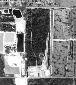
The Broward Correctional Institution (BCI) was a correctional facility located in the former Country Estates CDP, and later in Southwest Ranches, Florida, operated by the Florida Department of Corrections. The Region IV Correctional Facility Office was located on the grounds of Broward Correctional Institution. The prison was in proximity to Pembroke Pines.
West Broward High School
Public school in Pembroke Pines, Florida
Distance: Approx. 1217 meters
Latitude and longitude: 26.011539,-80.429645
West Broward High School is a secondary school located in Pembroke Pines, Florida serving students in grades 9 through 12. The school is a part of the Broward County Public Schools district. West Broward High has an FCAT school grade of "A" for the 2009–2010 academic year.

Segadores de Vida
Church in Florida, United States
Distance: Approx. 5381 meters
Latitude and longitude: 26.05981,-80.42679
Segadores de Vida is a Non-denominational Christian church located in Southwest Ranches, Florida. The senior pastor of the church is Ruddy Gracia.
Somerset Academy High School
School in Pembroke Pines, Florida
Distance: Approx. 968 meters
Latitude and longitude: 26.015153,-80.4266
Somerset Academy is a high school located in Pembroke Pines, Florida which teaches grades K-12. The school is operated by Academica, an education management organization, on behalf of Somerset Academy Inc., a charter management organization.
Everglades Holiday Park
Distance: Approx. 5990 meters
Latitude and longitude: 26.06,-80.445
Everglades Holiday Park is an attraction park situated on 29 acres of wetlands in the Everglades in Fort Lauderdale, Florida. The park is located on the western end of Griffin Road, off U.S. 27 in Fort Lauderdale, Florida. Everglades Holiday Park is not affiliated with Everglades National Park.
Weather in this IP's area
clear sky
26 Celsius
26 Celsius
24 Celsius
27 Celsius
1013 hPa
71 %
1013 hPa
1013 hPa
10000 meters
1.54 m/s
330 degree
06:40:27
17:32:31