Country:
 USA
USARegion:
City:
Latitude and Longitude:
Time Zone:
Postal Code:
IP information under different IP Channel
ip-api
Country
Region
City
ASN
Time Zone
ISP
Blacklist
Proxy
Latitude
Longitude
Postal
Route
IPinfo
Country
Region
City
ASN
Time Zone
ISP
Blacklist
Proxy
Latitude
Longitude
Postal
Route
MaxMind
Country
Region
City
ASN
Time Zone
ISP
Blacklist
Proxy
Latitude
Longitude
Postal
Route
Luminati
Country
USRegion
tx
City
houston
ASN
Time Zone
America/Chicago
ISP
PSLIGHTWAVE
Latitude
Longitude
Postal
db-ip
Country
Region
City
ASN
Time Zone
ISP
Blacklist
Proxy
Latitude
Longitude
Postal
Route
ipdata
Country
Region
City
ASN
Time Zone
ISP
Blacklist
Proxy
Latitude
Longitude
Postal
Route
Popular places and events near this IP address

Sheldon Lake
Reservoir on Carpenters Bayou in Texas, United States
Distance: Approx. 3232 meters
Latitude and longitude: 29.87033333,-95.17283333
Sheldon Lake is a reservoir on Carpenters Bayou in the San Jacinto River basin, 16 miles (26 km) northeast of downtown Houston, Texas. The reservoir was created in 1943 when the federal government built a dam to provide fresh water for shipbuilding and shipping industries on the Houston Ship Channel during World War II. After the war, the management of the reservoir was assumed by the City of Houston. In 1952, after the construction of the dam that creates Lake Houston, the city sold the reservoir to the Texas Parks and Wildlife Department for use as a waterfowl sanctuary and public fishing site.
Galena Park ISD Stadium
Distance: Approx. 6768 meters
Latitude and longitude: 29.808267,-95.17635
Galena Park ISD Stadium is a stadium situated on Galena Park ISD Sports Complex property in the Cloverleaf CDP of unincorporated Harris County, Texas, United States. The Galena Park Independent School District property is primarily used for American football and soccer, and is the home field of North Shore Senior High School, and Galena Park High School. It hosted the college football all-star game North-South All-Star Classic in 2007.

North Shore Senior High School (Texas)
Public secondary school in the United States
Distance: Approx. 6637 meters
Latitude and longitude: 29.8092003,-95.1772661
North Shore Senior High School is a secondary school located in unincorporated Harris County, Texas, United States in Greater Houston. The school includes grades 9 through 12 on three campuses, and is part of the Galena Park Independent School District (GPISD). In 2022, the school was given an Overall Accountability Rating of 'B' (88) by the Texas Education Agency, with distinctions earned for Mathematics, Science, Social Studies, Comparative Academic Growth, Postsecondary Readiness, and Comparative Closing the Gaps.
Beaumont Place, Texas
Unincorporated community in Texas, US
Distance: Approx. 2987 meters
Latitude and longitude: 29.83722222,-95.19972222
Beaumont Place is an unincorporated community in east central Harris County, Texas, United States. It is located along Beaumont Highway (U.S. Highway 90) and the Southern Pacific Railroad. It is 2 miles (3.2 km) southwest of the Sheldon Reservoir.
Houmont Park, Texas
Unincorporated community in Harris County, Texas
Distance: Approx. 2351 meters
Latitude and longitude: 29.8425,-95.20638889
Houmont Park is an unincorporated area in east central Harris County, Texas, United States. It is located along Beaumont Highway (U.S. Highway 90) and the Southern Pacific Railroad, 2 miles (3.2 km) southwest of the Sheldon Reservoir. The subdivision developed during the 1950s and the 1960s, as Greater Houston expanded in size.
Dyersdale, Texas
Unincorporated community in Texas, US
Distance: Approx. 5943 meters
Latitude and longitude: 29.89166667,-95.25777778
Dyersdale is an unincorporated community in Harris County, Texas, United States. The name originates from Clement C. Dyer, one of the "Old Three Hundred" of Stephen F. Austin's colonists. A post office opened in 1913.

North Forest High School
Public school in Texas, United States
Distance: Approx. 5269 meters
Latitude and longitude: 29.866957,-95.259842
North Forest High School (NFHS) is a secondary school located in Houston, Texas, United States. The school is a part of the Houston Independent School District (HISD); it was a part of the North Forest Independent School District (NFISD) until the district closed on July 1, 2013.

East Houston
Human settlement in Houston, Texas, United States of America
Distance: Approx. 5462 meters
Latitude and longitude: 29.84,-95.255
East Houston is a community in Houston, Texas, United States.
C.E. King High School
Public school in Houston, Harris County, Texas, United States
Distance: Approx. 1686 meters
Latitude and longitude: 29.8485,-95.2068
C.E. King High School is a secondary school located in unincorporated Harris County, Texas, United States and serves grades 9 through 12. It is the only high school in the Sheldon Independent School District. The school serves unincorporated areas of northeast Harris County including the Sheldon CDP and several nearby communities (Beaumont Place, Houmont Park) and subdivisions.
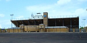
Crenshaw Memorial Stadium
Distance: Approx. 1648 meters
Latitude and longitude: 29.849238,-95.209529
J.H. Crenshaw Memorial Stadium is a multi-purpose stadium in unincorporated Harris County located northeast of Houston, Texas. The stadium is owned and operated by Sheldon Independent School District and is composed of a track and field which are used for various sports. The stadium is situated in the space between C.E. King Middle School and C.E. King High School and is shared by C.E. King Middle school and Michael R. Null Middle School.
Halls Bayou
Distance: Approx. 3976 meters
Latitude and longitude: 29.83815,-95.23429
Halls Bayou is a bayou in the northern part of Houston, Texas. It begins just north of W Mt Houston Road and flows for 17 miles (27 km). It empties into Greens Bayou in Brock Park and Golf Course.

Sheldon Lake State Park and Environmental Learning Center
State park in Texas, United States
Distance: Approx. 3232 meters
Latitude and longitude: 29.87033333,-95.17283333
Sheldon Lake State Park and Environmental Learning Center is a 2,800-acre outdoor education and recreation facility in northeast Harris County managed by the Texas Parks and Wildlife Department. The site is located along Sheldon Lake reservoir. The federal government constructed the reservoir on Carpenter's Bayou in 1942 in order to support growing war-related industries along the Houston Ship Channel.
Weather in this IP's area
clear sky
30 Celsius
37 Celsius
29 Celsius
32 Celsius
1010 hPa
74 %
1010 hPa
1008 hPa
10000 meters
4.03 m/s
6.33 m/s
158 degree
07:07:51
19:21:05