198.29.253.114 - IP Lookup: Free IP Address Lookup, Postal Code Lookup, IP Location Lookup, IP ASN, Public IP
Country:
Region:
City:
Location:
Time Zone:
Postal Code:
ISP:
ASN:
language:
User-Agent:
Proxy IP:
Blacklist:
IP information under different IP Channel
ip-api
Country
Region
City
ASN
Time Zone
ISP
Blacklist
Proxy
Latitude
Longitude
Postal
Route
db-ip
Country
Region
City
ASN
Time Zone
ISP
Blacklist
Proxy
Latitude
Longitude
Postal
Route
IPinfo
Country
Region
City
ASN
Time Zone
ISP
Blacklist
Proxy
Latitude
Longitude
Postal
Route
IP2Location
198.29.253.114Country
Region
illinois
City
joliet
Time Zone
America/Chicago
ISP
Language
User-Agent
Latitude
Longitude
Postal
ipdata
Country
Region
City
ASN
Time Zone
ISP
Blacklist
Proxy
Latitude
Longitude
Postal
Route
Popular places and events near this IP address

Washington Street Tunnel (Chicago)
Road tunnel
Distance: Approx. 136 meters
Latitude and longitude: 41.88319444,-87.63805556
The Washington Street Tunnel was the first traffic tunnel under the Chicago River. J.L. Lake was awarded the contract to construct the tunnel in July 1867 and its construction was completed January 1, 1869. This tunnel was 1605 feet long, from Franklin Street west to Clinton Street, and cost $517,000.

Gage Group Buildings
United States historic place
Distance: Approx. 145 meters
Latitude and longitude: 41.88121111,-87.63694722
The Gage Group Buildings consist of three buildings located at 18, 24 and 30 S. Michigan Avenue, between Madison Street and Monroe Street, in Chicago, Illinois. They were built from 1890–1899, designed by Holabird & Roche for the three millinery firms - Gage, Keith and Ascher. The building at 18 S. Michigan Avenue has an ornamental façade designed by Louis Sullivan.

One North Wacker
Skyscraper in Chicago
Distance: Approx. 50 meters
Latitude and longitude: 41.882249,-87.636205
One North Wacker, UBS Tower is a 50-story (199 m (653 ft)) skyscraper at One North Wacker Drive in downtown Chicago, Illinois. The tower was built from 1999 to 2002 to accommodate Swiss investment bank UBS AG's Chicago headquarters. Originally UBS Tower, as it was solely known then, housed four different branches of the bank including its investment banking, wealth management advisory, asset management, and private banking businesses.

Civic Opera House (Chicago)
Opera house in Chicago
Distance: Approx. 54 meters
Latitude and longitude: 41.8823,-87.6373
The Civic Opera House, also called Lyric Opera House is an opera house located at 20 North Wacker Drive in Chicago. The Civic's main performance space, named for Ardis Krainik, seats 3,563, making it the second-largest opera auditorium in North America, after the Metropolitan Opera House. Built for the Chicago Civic Opera, it has been home to the Lyric Opera of Chicago since 1954 and the Joffrey Ballet since 2021.

Chicago Mercantile Exchange Center
Building in Chicago
Distance: Approx. 159 meters
Latitude and longitude: 41.8812,-87.6375
Chicago Mercantile Exchange Center is an office complex of two towers in Chicago, Illinois, US. They were completed in 1987 and have 40 floors. Fujikawa Johnson designed the buildings, which are the 87th tallest in Chicago. "The Merc" is also known by its address, 30 South Wacker.

One South Wacker
Office in Chicago, Illinois
Distance: Approx. 108 meters
Latitude and longitude: 41.8816,-87.6362
One South Wacker is a 550 ft (168 m) tall 40-floor skyscraper in Chicago, Illinois, United States, designed by Murphy/Jahn, Inc. Architects, and constructed from 1979 to 1982. The building is tied for the 72nd tallest building in Chicago.
American College of Education
College based in Indianapolis, Indiana
Distance: Approx. 54 meters
Latitude and longitude: 41.88230278,-87.6373
American College of Education (ACE) is a private for-profit online college based in Indianapolis, Indiana, focused on education, healthcare, nursing, and business. American College of Education is a certified B Corporation and a subsidiary of ACE Holdco PBC of Dallas, Texas.

Civic Opera Building
Building in Chicago, Illinois, US
Distance: Approx. 64 meters
Latitude and longitude: 41.882506,-87.637475
The Civic Opera Building is a 45-story office tower (plus two 22-story wings) located at 20 North Wacker Drive in Chicago. The building opened November 4, 1929, and has an Art Deco interior. It contains a 3,563-seat opera house, the Civic Opera House, which is the second-largest opera auditorium in North America.
Madison Street Bridge (Chicago)
Bridge in Chicago, Illinois, U.S.
Distance: Approx. 141 meters
Latitude and longitude: 41.881897,-87.638195
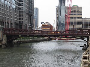
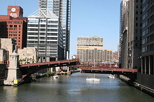
The Madison Street Bridge, also known as the Lyric Opera Bridge, is a 1922 bascule bridge that spans the South Branch of the Chicago River in downtown Chicago, Illinois, United States.

Washington Boulevard Bridge
Bridge in Chicago, Illinois, U.S.
Distance: Approx. 143 meters
Latitude and longitude: 41.883194,-87.638147
The Washington Boulevard Bridge is a bridge that spans the Chicago River in downtown Chicago, Illinois, United States.

110 North Wacker
Skyscraper in Chicago
Distance: Approx. 148 meters
Latitude and longitude: 41.88372222,-87.63741667
110 North Wacker, also known as the Bank of America Tower, is a 57-floor skyscraper in Chicago located at 110 North Wacker Drive. It was developed by the Howard Hughes Corporation and Riverside Investment & Development. It was designed by Goettsch Partners with construction by Clark Construction.

Market Street Terminal
Former rapid transit station in Chicago
Distance: Approx. 70 meters
Latitude and longitude: 41.8819,-87.63694
The Market Street Terminal was a station on the Chicago "L"'s Lake Street Elevated – today part of the Green Line – between 1893 and 1948. The Elevated's original downtown terminus, it opened at the corner of Madison Street and Market Street (modern-day Wacker Drive) on November 6, 1893, alongside the rest of the Elevated. When the Loop was constructed in 1895, the Terminal was required to be demolished but no action was taken.
Weather in this IP's area
broken clouds
-6 Celsius
-12 Celsius
-7 Celsius
-5 Celsius
1030 hPa
66 %
1030 hPa
1006 hPa
10000 meters
4.02 m/s
5.81 m/s
338 degree
75 %
