Country:
Region:
City:
Latitude and Longitude:
Time Zone:
Postal Code:
IP information under different IP Channel
ip-api
Country
Region
City
ASN
Time Zone
ISP
Blacklist
Proxy
Latitude
Longitude
Postal
Route
Luminati
Country
Region
ca
City
unioncity
ASN
Time Zone
America/Los_Angeles
ISP
AS-SONICTELECOM
Latitude
Longitude
Postal
IPinfo
Country
Region
City
ASN
Time Zone
ISP
Blacklist
Proxy
Latitude
Longitude
Postal
Route
db-ip
Country
Region
City
ASN
Time Zone
ISP
Blacklist
Proxy
Latitude
Longitude
Postal
Route
ipdata
Country
Region
City
ASN
Time Zone
ISP
Blacklist
Proxy
Latitude
Longitude
Postal
Route
Popular places and events near this IP address

Union City, California
City in California, United States
Distance: Approx. 846 meters
Latitude and longitude: 37.59638889,-122.04833333
Union City is a city in Alameda County, California, United States in the San Francisco Bay Area. It is located approximately 19 miles (31 km) south of Oakland, 30 miles (48 km) from San Francisco, and 20 miles (32 km) north of San Jose. It was incorporated in 1959, combining the communities of Alvarado and Decoto.
Alvarado, California
Distance: Approx. 2913 meters
Latitude and longitude: 37.5966,-122.0777
Alvarado (formerly, New Haven) is a former settlement in and former county seat of Alameda County, California, now part of Union City. It was located 5 miles (8 km) north-northwest of downtown Newark. In 1851, Henry C. Smith founded the town of New Haven, named after his father's home town of New Haven, Connecticut.
Decoto, California
Distance: Approx. 3014 meters
Latitude and longitude: 37.60212778,-122.01621944
Decoto is a neighborhood of Union City, California originally established as a separate community. It is located 5 miles (8 km) north-northwest of downtown Newark, along California State Route 238.
Union City station
Metro station in Union City, California, US
Distance: Approx. 2549 meters
Latitude and longitude: 37.590746,-122.017282
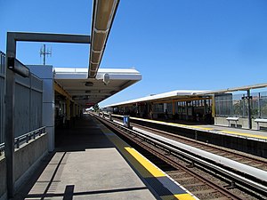
Union City station is a Bay Area Rapid Transit (BART) station in Union City, California. The station sits near Decoto Road east of Alvarado-Niles Road, directly behind the James Logan High School campus. The station is served by the Orange and Green lines.
Conley-Caraballo High School
Public continuation high school in Hayward, California, United States
Distance: Approx. 3267 meters
Latitude and longitude: 37.61469167,-122.02818889
Conley-Caraballo High School (CCHS), formerly El Rancho Verde High School, is a public 9-12 continuation high school in south Hayward, California, United States. It is part of the New Haven Unified School District (NHUSD), along with James Logan High School. The school was named after Jean Conley (d.
Dust Networks
American company
Distance: Approx. 3268 meters
Latitude and longitude: 37.617529,-122.054822
Dust Networks, Inc. is an American company that specializes in the design and manufacture of wireless sensor networks for industrial applications including process monitoring, condition monitoring, asset management, environment, health and safety (EHS) monitoring, and power management. They were acquired by Linear Technology, Inc in December 2011, which in turn was acquired by Analog Devices, Inc.
New Haven Adult School
California adult school in Union City, California, United States
Distance: Approx. 2582 meters
Latitude and longitude: 37.5998,-122.0202
New Haven Adult School is an adult education program in Union City, California. As part of the New Haven Unified School District, the school serves approximately 2,500 community members annually.
Rancho Potrero de los Cerritos
Mexican land grant in California
Distance: Approx. 2445 meters
Latitude and longitude: 37.57,-122.06
Rancho Potrero de los Cerritos was a 10,610-acre (42.9 km2) Mexican land grant in present day Alameda County, California given in 1844 by Governor Manuel Micheltorena to Augustin Alviso and Tomás Pacheco. The name means "pasture of the little hills" and included the Coyote Hills. The three square league grant, part of former Mission San José lands, encompassed present day Alvarado.

Chapel of the Chimes (Hayward, California)
Cemetery in Hayward, California
Distance: Approx. 3258 meters
Latitude and longitude: 37.61222222,-122.02361111
Chapel of the Chimes Memorial Park and Funeral Home is a 61-acre (25 ha) cemetery, mausoleum, crematorium, columbarium and funeral home complex in Hayward, California. The site was first established as a seven-acre cemetery in 1872. One of the memorial park's three mausoleums is circular in design, the only such one in California.
Union Landing Shopping Center
Distance: Approx. 2254 meters
Latitude and longitude: 37.6013,-122.0664
Union Landing Shopping Center is an open-air shopping mall in Union City, California with over 70 stores, restaurants, entertainment, hotels, and services. This is a 1,000,000 square-foot lifestyle center and is the largest shopping center in Union City. The majority of this area was occupied by Union City Drive-In Theater between 1966 and 1998.

California Beet Sugar Company
Historic site in Union City, California
Distance: Approx. 2507 meters
Latitude and longitude: 37.600533,-122.070517
The California Beet Sugar Company (also known as the Standard Sugar Refining Company, Pacific Coast Sugar Company, Alameda Sugar Company, and the Holly Sugar Company) was the first successful sugar beet factory in the United States. It was located in Alvarado, which has been incorporated into the city of Union City and its site is on the California Historical Landmarks list.
Purple Lotus Buddhist School
Defunct Buddhist school in California, USA
Distance: Approx. 2376 meters
Latitude and longitude: 37.59963,-122.022744
Purple Lotus Buddhist School was a K–12 school located in Union City, California. It was founded in July 1997. The school was accredited by the Western Association of Schools and Colleges.
Weather in this IP's area
clear sky
20 Celsius
19 Celsius
18 Celsius
22 Celsius
1014 hPa
38 %
1014 hPa
1014 hPa
10000 meters
3.09 m/s
310 degree
06:42:19
17:01:55
