198.245.194.76 - IP Lookup: Free IP Address Lookup, Postal Code Lookup, IP Location Lookup, IP ASN, Public IP
Country:
Region:
City:
Location:
Time Zone:
Postal Code:
IP information under different IP Channel
ip-api
Country
Region
City
ASN
Time Zone
ISP
Blacklist
Proxy
Latitude
Longitude
Postal
Route
Luminati
Country
Region
mi
City
newaygo
ASN
Time Zone
America/Detroit
ISP
NCATS
Latitude
Longitude
Postal
IPinfo
Country
Region
City
ASN
Time Zone
ISP
Blacklist
Proxy
Latitude
Longitude
Postal
Route
IP2Location
198.245.194.76Country
Region
michigan
City
walker
Time Zone
America/Detroit
ISP
Language
User-Agent
Latitude
Longitude
Postal
db-ip
Country
Region
City
ASN
Time Zone
ISP
Blacklist
Proxy
Latitude
Longitude
Postal
Route
ipdata
Country
Region
City
ASN
Time Zone
ISP
Blacklist
Proxy
Latitude
Longitude
Postal
Route
Popular places and events near this IP address

Walker, Michigan
City in Michigan, United States
Distance: Approx. 6323 meters
Latitude and longitude: 43.01444444,-85.6925
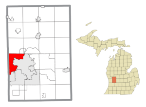
Walker is a city in Kent County in the U.S. state of Michigan. A suburb of Grand Rapids, Walker borders the city to the north and west. As of the 2020 census, the city had a population of 25,132.

Tallmadge Township, Michigan
Charter township in Michigan, United States
Distance: Approx. 5857 meters
Latitude and longitude: 42.99,-85.83833333
Tallmadge Charter Township is a charter township of Ottawa County in the U.S. state of Michigan. The population was 8,802 at the 2020 census.

Marne, Michigan
Unincorporated community in Michigan, United States
Distance: Approx. 6207 meters
Latitude and longitude: 43.03611111,-85.82777778
Marne () is an unincorporated community in Wright Township of Ottawa County in the U.S. state of Michigan.
Berlin Raceway
Racetrack
Distance: Approx. 6660 meters
Latitude and longitude: 43.03555556,-85.83527778
Berlin Raceway is a 0.438 mi (0.705 km) long paved oval race track in Marne, Michigan, near Grand Rapids. The track races weekly as part of the NASCAR Advance Auto Parts Weekly Series. It has also held touring series events on the ARCA Menards Series, ARCA Menards Series East, American Speed Association National Tour, USAC Stock Cars, USAC Silver Crown, World of Outlaws Sprint cars, and World of Outlaws Late Model Series tours.

West Catholic High School
Catholic college preparatory school in Grand Rapids, Michigan, United States
Distance: Approx. 4785 meters
Latitude and longitude: 42.99638889,-85.70972222
West Catholic High School is a private Catholic college preparatory secondary school in Grand Rapids, Michigan (U.S.). It opened in 1962 and is located within the Catholic Diocese of Grand Rapids.
WTRV
Radio station in Walker–Grand Rapids, Michigan
Distance: Approx. 2806 meters
Latitude and longitude: 43.016,-85.74
WTRV (100.5 FM) is a commercial radio station broadcasting an adult contemporary radio format. The station is licensed to Walker, Michigan, and serves the Grand Rapids metropolitan area radio market. WTRV is a Class A station, so it is limited to 3,000 watts.
Kenowa Hills Public Schools
Public school
Distance: Approx. 4653 meters
Latitude and longitude: 43.030479,-85.727037
Kenowa Hills Public Schools is a school district headquartered in Alpine Township, Michigan in Greater Grand Rapids. It serves portions of Alpine Township, the City of Walker, and Wright Township (including Marne).
Union High School (Grand Rapids, Michigan)
Public school in the United States
Distance: Approx. 5520 meters
Latitude and longitude: 42.97333333,-85.71222222
Union High School is one of the five high schools in Grand Rapids Public School district. Union has a student population of around 1,200 students for the 2010/2011 school year. The former principal was Justin Jennings, along with assistant principals Aida Toledo and Belinda Jimenez.

Kenowa Hills High School
Public secondary school in Grand Rapids, Michigan, United States
Distance: Approx. 3803 meters
Latitude and longitude: 43.032823,-85.74975
Kenowa Hills High School is a public secondary school in Alpine Township, Michigan, U.S. (near Grand Rapids). It serves grades 9-12 for the Kenowa Hills Public Schools district.

Villa Maria (Grand Rapids, Michigan)
United States historic place
Distance: Approx. 5845 meters
Latitude and longitude: 42.98361111,-85.70055556
Villa Maria is a retirement community located at 1315 Walker NW in Grand Rapids, Michigan. The campus was originally operated for the purpose of ministering to troubled young women. It was listed on the National Register of Historic Places in 1987.
Ahavas Israel Cemetery
Distance: Approx. 5615 meters
Latitude and longitude: 42.99627137,-85.69949495
Ahavas Israel Cemetery is located at 1801 Garfield Avenue in Grand Rapids, Michigan. It is the cemetery for the Conservative Ahavas Israel congregation. The Ahavas Achim Cemetery was created in 1916 by members of the Ahavas Achim and the Workmen's Circle.

Irving Andrew and Olive Crane Kendall Dean House
United States historic place
Distance: Approx. 3827 meters
Latitude and longitude: 42.98555556,-85.72638889
The Irving Andrew and Olive Crane Kendall Dean House, also known as Mayflower Place, is a single family home located at 2350 Leonard Street NW in Grand Rapids, Michigan. It was listed on the National Register of Historic Places in 2023.
Weather in this IP's area
light snow
-0 Celsius
-2 Celsius
-1 Celsius
1 Celsius
1009 hPa
81 %
1009 hPa
982 hPa
10000 meters
1.34 m/s
3.13 m/s
4 degree
100 %