198.241.158.154 - IP Lookup: Free IP Address Lookup, Postal Code Lookup, IP Location Lookup, IP ASN, Public IP
Country:
Region:
City:
Location:
Time Zone:
Postal Code:
IP information under different IP Channel
ip-api
Country
Region
City
ASN
Time Zone
ISP
Blacklist
Proxy
Latitude
Longitude
Postal
Route
Luminati
Country
Region
fl
City
miami
ASN
Time Zone
America/New_York
ISP
VISANET
Latitude
Longitude
Postal
IPinfo
Country
Region
City
ASN
Time Zone
ISP
Blacklist
Proxy
Latitude
Longitude
Postal
Route
IP2Location
198.241.158.154Country
Region
california
City
san francisco
Time Zone
America/Los_Angeles
ISP
Language
User-Agent
Latitude
Longitude
Postal
db-ip
Country
Region
City
ASN
Time Zone
ISP
Blacklist
Proxy
Latitude
Longitude
Postal
Route
ipdata
Country
Region
City
ASN
Time Zone
ISP
Blacklist
Proxy
Latitude
Longitude
Postal
Route
Popular places and events near this IP address

Millbrae, California
City in California, United States
Distance: Approx. 1615 meters
Latitude and longitude: 37.60083333,-122.40138889
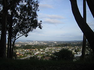
Millbrae is a city located in northern San Mateo County, California, United States. To the northeast is San Francisco International Airport; San Bruno is to the northwest, and Burlingame is to the southeast. It is bordered by San Andreas Lake to the southwest.

San Francisco International Airport
Airport in San Mateo County, California, United States
Distance: Approx. 1465 meters
Latitude and longitude: 37.61888889,-122.375
San Francisco International Airport (IATA: SFO, ICAO: KSFO, FAA LID: SFO) is the primary international airport serving the San Francisco Bay Area in the U.S. state of California. It is located in an unincorporated area of San Mateo County, and is about 12 miles southeast of San Francisco. SFO is the largest airport in the San Francisco Bay Area and the second-busiest in the US State of California, after Los Angeles International Airport (LAX).
Millbrae station
Train station in Millbrae, California, U.S.
Distance: Approx. 1047 meters
Latitude and longitude: 37.6003,-122.3867
Millbrae station is an intermodal transit station serving Bay Area Rapid Transit (BART) and Caltrain, located in Millbrae, California. The station is the terminal station for BART on the San Francisco Peninsula, served by two lines: The Red Line before 9 pm and the Yellow Line during the early morning and evening. It is served by all Caltrain services.
Guittard Chocolate Company
American chocolate company
Distance: Approx. 1509 meters
Latitude and longitude: 37.597452,-122.379557
The Guittard Chocolate Company is an American-based chocolate maker which produces couverture chocolate, using original formulas and traditional French methods. The company was founded in 1868 and is headquartered in Burlingame, California. It is the oldest continuously family-owned chocolate company in the United States, having been family-owned for more than four generations.

Mills High School
Public school in Millbrae, San Mateo, California, United States
Distance: Approx. 1802 meters
Latitude and longitude: 37.5937,-122.39
Mills High School is a public high school in Millbrae, California, one of eight in the San Mateo Union High School District. Mills was established in 1958. Mills High School has been named a California Distinguished School three times (1988, 1996, 2009).

San Francisco International Airport station
Rapid transit station in San Francisco Bay Area
Distance: Approx. 829 meters
Latitude and longitude: 37.6164,-122.391
San Francisco International Airport station (often abbreviated SFO or SFIA) is a Bay Area Rapid Transit (BART) terminal station located adjacent to Garage G inside the San Francisco International Airport. The elevated station is a transfer point to the AirTrain people mover system at Garage G/BART station. The station opened for AirTrain service in February 2003, with BART service beginning that June.

Capuchino High School
Public school in San Bruno, San Mateo County, California, United States
Distance: Approx. 1764 meters
Latitude and longitude: 37.6096,-122.4069
Capuchino High School is a public high school in San Bruno, California, United States. It is one of seven high schools in the San Mateo Union High School District, a division of the San Mateo County Office of Education.

2007 San Francisco International Airport runway incursion
Aircraft incident in Northern California in 2007
Distance: Approx. 1642 meters
Latitude and longitude: 37.62072,-122.37452
The 2007 San Francisco International Airport runway incursion occurred around 1:36 p.m. PDT on May 26, 2007, when SkyWest Airlines Flight 5741, an Embraer EMB 120 Brasilia turboprop aircraft, nearly collided with Republic Airways Flight 4912, an Embraer 170 Regional Jet, at the intersection of Runways 1L and 28R at San Francisco International Airport (SFO). There were no injuries to occupants and no damage to either aircraft.: 6 Federal Aviation Administration officials described the runway incursion as the most serious incident of its kind in at least a decade, and the National Transportation Safety Board carried out an investigation into the incident.
Lomita Park, California
Unincorporated community in California, United States
Distance: Approx. 1644 meters
Latitude and longitude: 37.61666667,-122.40333333
Lomita Park, California is a small unincorporated community adjacent to San Bruno in San Mateo County, just west of the San Francisco International Airport. It is roughly bounded by San Felipe Avenue, El Camino Real, San Juan Avenue, and the Southern Pacific railroad tracks. The Southern Pacific Railroad acquired the original San Francisco and San Jose Railroad, which was built in the 1860s.

Every Beating Second
Distance: Approx. 960 meters
Latitude and longitude: 37.6174,-122.382
Every Beating Second is a large netted sculpture designed by artist Janet Echelman. The sculpture is located in Terminal 2 of the San Francisco International Airport, which opened in April 2011. The piece is composed of three separate netted structures, each connected to a skylight, hanging from the ceiling of the terminal.

Pan Am Flight 843
1965 aviation incident
Distance: Approx. 1598 meters
Latitude and longitude: 37.61821389,-122.37231389
Pan Am Flight 843 was a scheduled domestic commercial flight from San Francisco, California, to Honolulu, Hawaii. On Monday, June 28, 1965, Clipper Friendship, the Boeing 707-321B operating this route, experienced an uncontained engine failure shortly after take-off, but was successfully able to make an emergency landing at nearby Travis Air Force Base. The engine failure had been caused by faulty installation and maintenance procedures.
Peninsula Museum of Art
Distance: Approx. 1711 meters
Latitude and longitude: 37.594782,-122.382228
The Peninsula Museum of Art (PMA) is a 501(c)(3) non-profit art museum located in San Bruno, California.
Weather in this IP's area
clear sky
12 Celsius
11 Celsius
10 Celsius
14 Celsius
1021 hPa
41 %
1021 hPa
1012 hPa
10000 meters
4.63 m/s
360 degree
