198.232.199.51 - IP Lookup: Free IP Address Lookup, Postal Code Lookup, IP Location Lookup, IP ASN, Public IP
Country:
Region:
City:
Location:
Time Zone:
Postal Code:
IP information under different IP Channel
ip-api
Country
Region
City
ASN
Time Zone
ISP
Blacklist
Proxy
Latitude
Longitude
Postal
Route
Luminati
Country
ASN
Time Zone
America/Chicago
ISP
OREGON
Latitude
Longitude
Postal
IPinfo
Country
Region
City
ASN
Time Zone
ISP
Blacklist
Proxy
Latitude
Longitude
Postal
Route
IP2Location
198.232.199.51Country
Region
oregon
City
salem
Time Zone
America/Los_Angeles
ISP
Language
User-Agent
Latitude
Longitude
Postal
db-ip
Country
Region
City
ASN
Time Zone
ISP
Blacklist
Proxy
Latitude
Longitude
Postal
Route
ipdata
Country
Region
City
ASN
Time Zone
ISP
Blacklist
Proxy
Latitude
Longitude
Postal
Route
Popular places and events near this IP address
Salem, Oregon
Capital city of Oregon, United States
Distance: Approx. 1809 meters
Latitude and longitude: 44.92305556,-123.02444444
Salem ( SAY-ləm) is the capital city of the U.S. state of Oregon, and the county seat of Marion County. It is located in the center of the Willamette Valley alongside the Willamette River, which runs north through the city. The river forms the boundary between Marion and Polk counties, and the city neighborhood of West Salem is in Polk County.
Walter Wirth Lake
Quarry Lake in Salem, Oregon
Distance: Approx. 1369 meters
Latitude and longitude: 44.91,-122.99
Walter Wirth Lake (aka Lake Wirth) is a lake in Salem, Oregon, United States. Walter Wirth Lake is wholly contained within Cascades Gateway Park. The park and lake began development in 1957 with the Salem Area Chamber of Commerce working with the State Highway Department to convert a gravel burrow pit into a park.

McNary Field
Airport
Distance: Approx. 491 meters
Latitude and longitude: 44.90944444,-123.0025
McNary Field (IATA: SLE, ICAO: KSLE, FAA LID: SLE) (Salem-Willamette Valley Airport, formerly Salem Municipal Airport) is in Marion County, Oregon, United States, two miles southeast of downtown Salem, which owns it. The airport is named for U.S. Senator Charles L. McNary of Oregon, who had died in February 1944, a couple of years after the airport became operational. McNary Field has had scheduled airline flights, including service on Delta Connection that ended in October 2008.
Oregon State Penitentiary
Prison in Salem, Oregon, U.S.
Distance: Approx. 2176 meters
Latitude and longitude: 44.932,-123.005
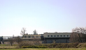
Oregon State Penitentiary (OSP), also known as Oregon State Prison, is a maximum security prison in the northwest United States in Salem, Oregon. Originally opened in Portland 173 years ago in 1851, it relocated to Salem fifteen years later. The 2,242-capacity prison is the oldest in the state; the all-male facility is operated by the Oregon Department of Corrections (ODOC).

Roberts High School
Alternative, secondary school in Salem, , Oregon, United States
Distance: Approx. 2224 meters
Latitude and longitude: 44.927787,-122.988834
Roberts High School is a high school in Salem, Oregon, United States. It provides non-traditional educational programs in the Salem-Keizer School District. Rather than a centralized campus, Roberts High School consists of departments at different sites in Salem and Keizer.
Walling Pond
Quarry Lake in Salem, Oregon
Distance: Approx. 1367 meters
Latitude and longitude: 44.918,-123.0225
Walling Pond is a privately owned pond that is open to the public for fishing. The pond, located in Salem, Oregon, is owned by the Walling family. The pond is located at the original site of their sand and gravel processing plant at the northeast corner of McGilchrist and 16th Streets, S.E. The pond is popular with bait anglers and produces stocked rainbow trout.
Shelton Ditch (Oregon)
Distance: Approx. 1511 meters
Latitude and longitude: 44.925953,-123.00954
Shelton Ditch is an artificial canal in Marion County, Oregon, United States. Built in the mid-19th century, it originates from Mill Creek east of Airport Road in Salem, passes through a corner of the Salem main Post Office property, and along the southern edge of downtown Salem. Shelton Ditch passes by the north side of Pringle Park before emptying into Pringle Creek.
Fairview Training Center
Hospital in Oregon, United States
Distance: Approx. 1709 meters
Latitude and longitude: 44.8978981,-123.0137063
The Fairview Training Center was a state-run facility for people with developmental disabilities in Salem, Oregon, United States. Fairview was established in 1907 as the State Institution for the Feeble-Minded. The hospital opened on December 1, 1908, with 39 patients transferred from the Oregon State Hospital for the Insane.
Robert S. Farrell High School
Public school in Salem, , Oregon, United States
Distance: Approx. 2130 meters
Latitude and longitude: 44.893454,-123.009539
Robert S. Farrell High School was a public high school in Salem, Oregon, United States. It was part of the Hillcrest Youth Correctional Facility before the facility closed in 2017.

Hillcrest Youth Correctional Facility
Juvenile correctional facility in Salem, Oregon
Distance: Approx. 2130 meters
Latitude and longitude: 44.893454,-123.009539
Hillcrest Youth Correctional Facility was a state-run juvenile correctional facility located in Salem, Oregon, United States, established in 1914. Hillcrest was run by the Oregon Youth Authority (OYA), Oregon's juvenile corrections agency. It was closed on September 1, 2017, and all youth, staff, and programs were moved to MacLaren Youth Correctional Facility in Woodburn as part of a major project to consolidate the two facilities.
Oregon State Forester's Office Building
United States historic place
Distance: Approx. 2072 meters
Latitude and longitude: 44.93111111,-123.00638889
The Oregon State Forester's Office Building is a historic building in Salem, Oregon, United States that is used by the head of the Oregon Department of Forestry. The 1938 building was listed on the National Register of Historic Places (NRHP) in 1982. It was designed by Linn A. Forrest in the "National Park Style".
Oregon Office of Emergency Management
State agency managing emergency services
Distance: Approx. 1298 meters
Latitude and longitude: 44.90137,-123.01192
Oregon Office of Emergency Management (OEM) is an emergency services system authorized by the U.S. state of Oregon legislature to coordinate efforts to "prevent, prepare for, respond to and recover from emergencies".
Weather in this IP's area
overcast clouds
10 Celsius
8 Celsius
10 Celsius
10 Celsius
1017 hPa
92 %
1017 hPa
1007 hPa
10000 meters
4.12 m/s
100 degree
100 %


