Country:
 USA
USARegion:
City:
Latitude and Longitude:
Time Zone:
Postal Code:
IP information under different IP Channel
ip-api
Country
Region
City
ASN
Time Zone
ISP
Blacklist
Proxy
Latitude
Longitude
Postal
Route
IPinfo
Country
Region
City
ASN
Time Zone
ISP
Blacklist
Proxy
Latitude
Longitude
Postal
Route
MaxMind
Country
Region
City
ASN
Time Zone
ISP
Blacklist
Proxy
Latitude
Longitude
Postal
Route
Luminati
Country
USASN
Time Zone
America/Chicago
ISP
CENTURYLINK-LEGACY-SAVVIS
Latitude
Longitude
Postal
db-ip
Country
Region
City
ASN
Time Zone
ISP
Blacklist
Proxy
Latitude
Longitude
Postal
Route
ipdata
Country
Region
City
ASN
Time Zone
ISP
Blacklist
Proxy
Latitude
Longitude
Postal
Route
Popular places and events near this IP address
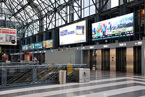
Ogilvie Transportation Center
Train station in Chicago
Distance: Approx. 199 meters
Latitude and longitude: 41.88269,-87.64029
The Richard B. Ogilvie Transportation Center (), on the site of the former Chicago and North Western Terminal, is a commuter rail terminal in downtown Chicago, Illinois. For the last century, this site has served as the primary terminal for the Chicago and North Western Railway and its successors Union Pacific and Metra. Intercity services had disappeared by the 1970s, but commuter services on the three ex-CNW mainlines, Metra's UP District lines, continue to terminate here.

Washington Street Tunnel (Chicago)
Distance: Approx. 137 meters
Latitude and longitude: 41.88319444,-87.63805556
The Washington Street Tunnel was the first traffic tunnel under the Chicago River. J.L. Lake was awarded the contract to construct the tunnel in July 1867 and its construction was completed January 1, 1869. This tunnel was 1605 feet long, from Franklin Street west to Clinton Street, and cost $517,000.
Navteq
Former provider of electronic navigable maps
Distance: Approx. 29 meters
Latitude and longitude: 41.88441667,-87.63919444
Navteq Corporation (styled as 'NAVTEQ') was an American Chicago-based provider of geographic information system (GIS) data and a major provider of base electronic navigable maps. The company was acquired by Nokia in 2007–2008, and fully merged into Nokia in 2011 to form part of the Here business unit. The unit was subsequently sold to a consortium of German auto makers in 2016.

Boeing Building
Skyscraper and headquarters of Boeing in Chicago
Distance: Approx. 23 meters
Latitude and longitude: 41.88411111,-87.63875
The Boeing Building (formerly known as the Boeing International Headquarters and previously to that as the Morton-Thiokol International Building) is a 36-floor skyscraper located in the Near West Side of Chicago. The building, at 100 North Riverside Plaza, is located on the west side of the Chicago River directly across from the downtown Loop. The building was designed with a structural system that uses steel trusses to support its suspended southwest corner in order to clear the Amtrak and Metra railroad tracks immediately beneath it.

Riverside Plaza (Chicago)
Building in Chicago
Distance: Approx. 185 meters
Latitude and longitude: 41.882548,-87.63922
The Riverside Plaza is considered one of Chicago's finest Art Deco buildings. It was originally known as the Chicago Daily News Building. At the time of its completion in 1929, the Daily News was one of the dominant newspapers in Chicago.

Randolph Street Bridge
Bridge in Chicago, Illinois, U.S.
Distance: Approx. 92 meters
Latitude and longitude: 41.884453,-87.637942
The Randolph Street Bridge is a bridge that crosses the Chicago River in downtown Chicago, Illinois.

Lake Street Bridge (Chicago)
Bridge in Chicago, Illinois, U.S.
Distance: Approx. 201 meters
Latitude and longitude: 41.88572,-87.637695
The Lake Street Bridge is a bridge that spans the Chicago River in downtown Chicago, Illinois, United States.
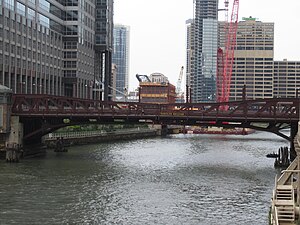
Washington Boulevard Bridge
Bridge in Chicago, Illinois, U.S.
Distance: Approx. 132 meters
Latitude and longitude: 41.883194,-87.638147
The Washington Boulevard Bridge is a bridge that spans the Chicago River in downtown Chicago, Illinois, United States.

The Gogo Building
Commercial in N. Canal Street, Chicago
Distance: Approx. 52 meters
Latitude and longitude: 41.883816,-87.639351
The Gogo Building, formerly known as the River Center, is an 840,000-square-foot (78,000 m2) commercial building located at 111 N. Canal Street in the West Loop community area of Chicago, Illinois. Originally constructed as a warehouse in the early 1900s, the vintage, loft-style building is now home to various commercial tenants, most notably Gogo Inflight Internet, which has its logo on the cube topping the building. Other tenants include Twitter, Uber, Vivid Seats, SAP Fieldglass, Potbelly Sandwich Works and Kin + Carta.

150 North Riverside
Skyscraper in Chicago, Illinois, US
Distance: Approx. 131 meters
Latitude and longitude: 41.885327,-87.638531
150 North Riverside Plaza is a highrise building in Chicago, Illinois, completed in 2017 and anchored by William Blair and Co. The building is 54 stories tall and was designed by Goettsch Partners. The building occupies a two-acre site on the west bank of the Chicago River, whose size and location demanded an unusually small base for the building.

110 North Wacker
Skyscraper in Chicago
Distance: Approx. 142 meters
Latitude and longitude: 41.88372222,-87.63741667
110 North Wacker, also known as the Bank of America Tower, is a 57-floor skyscraper in Chicago located at 110 North Wacker Drive. It was developed by the Howard Hughes Corporation and Riverside Investment & Development. It was designed by Goettsch Partners with construction by Clark Construction.

Randolph/Market station
Former station on the Chicago "L"
Distance: Approx. 173 meters
Latitude and longitude: 41.88443,-87.63693
Randolph/Market was a station on the Chicago "L"'s Lake Street Elevated, serving its Market Street stub between the main line and the Market Street Terminal. It was the only intermediate station on the Market Street stub, and on any of Chicago's terminal stubs. It opened with the rest of the Elevated on November 6, 1893.
Weather in this IP's area
clear sky
11 Celsius
10 Celsius
9 Celsius
12 Celsius
1027 hPa
62 %
1027 hPa
1005 hPa
10000 meters
2.57 m/s
200 degree
07:09:03
18:01:07