Country:
Region:
City:
Latitude and Longitude:
Time Zone:
Postal Code:
IP information under different IP Channel
ip-api
Country
Region
City
ASN
Time Zone
ISP
Blacklist
Proxy
Latitude
Longitude
Postal
Route
IPinfo
Country
Region
City
ASN
Time Zone
ISP
Blacklist
Proxy
Latitude
Longitude
Postal
Route
MaxMind
Country
Region
City
ASN
Time Zone
ISP
Blacklist
Proxy
Latitude
Longitude
Postal
Route
Luminati
Country
Region
va
City
arlington
ASN
Time Zone
America/New_York
ISP
UNITAS
Latitude
Longitude
Postal
db-ip
Country
Region
City
ASN
Time Zone
ISP
Blacklist
Proxy
Latitude
Longitude
Postal
Route
ipdata
Country
Region
City
ASN
Time Zone
ISP
Blacklist
Proxy
Latitude
Longitude
Postal
Route
Popular places and events near this IP address

Lauderdale, Minnesota
City in Minnesota, United States
Distance: Approx. 520 meters
Latitude and longitude: 44.99444444,-93.20277778
Lauderdale is a city in Ramsey County, Minnesota, United States. The population was 2,379 at the 2010 census. Lauderdale is part of the Minneapolis–St.

KBEM-FM
Radio station in Minneapolis, Minnesota
Distance: Approx. 1324 meters
Latitude and longitude: 44.998,-93.189
KBEM-FM (88.5 FM, "Jazz88") is a public radio station broadcasting a jazz format based in Minneapolis, Minnesota, United States, the station serves the Minneapolis-St. Paul area. The station is operated by the Minneapolis Public Schools system and has been partnering since 1989 with the Minnesota Department of Transportation (Mn/DOT), providing traffic congestion reports for commuters in the Minneapolis-St.

KUOM
College radio station of the University of Minnesota Twin Cities
Distance: Approx. 1375 meters
Latitude and longitude: 44.99833333,-93.18833333
KUOM (770 AM) – branded Radio K – is a daytime-only, non-commercial, college radio station licensed to Minneapolis, Minnesota. Owned by the University of Minnesota, Twin Cities, the station is operated by students and faculty. It mainly airs alternative rock with other genres of music.

Les Bolstad Golf Course
Distance: Approx. 1046 meters
Latitude and longitude: 44.992184,-93.196087
Les Bolstad Golf Course is a golf course owned by the University of Minnesota. The course is located in Falcon Heights, Minnesota on the St. Paul Campus of the University.

Luther Seminary
Seminary in Saint Paul, Minnesota, U.S.
Distance: Approx. 1713 meters
Latitude and longitude: 44.98472222,-93.19638889
Luther Seminary is a seminary of the Evangelical Lutheran Church in America (ELCA) in Saint Paul, Minnesota. It is the largest seminary of the ELCA. It also accepts and educates students of 41 other denominations and traditions. It is accredited by the Higher Learning Commission and the Association of Theological Schools.

Elizabeth Lyle Robbie Stadium
Distance: Approx. 1430 meters
Latitude and longitude: 44.99444444,-93.18861111
Elizabeth Lyle Robbie Stadium is located in Falcon Heights on the Saint Paul campus of the University of Minnesota. It is primarily used as the home of the Minnesota Golden Gophers women's soccer team. The stadium opened in 1999 and seats 1,000.

Como, Minneapolis
Neighborhood in Hennepin, Minnesota, United States
Distance: Approx. 1836 meters
Latitude and longitude: 44.985,-93.219
Como is a neighborhood within the Southeast quadrant of Minneapolis. The neighborhood is also sometimes referred to as Southeast Como to help differentiate it from the Como Park neighborhood in neighboring Saint Paul. Its boundaries are East Hennepin Avenue to the north, 33rd Avenue Southeast (the eastern city limit) to the east, the Southeast Industrial Area to the south, and Interstate 35W to the west.

Bell Museum of Natural History
Natural history museum of the University of Minnesota
Distance: Approx. 1611 meters
Latitude and longitude: 44.99138889,-93.18805556
The Bell Museum, formerly known as the James Ford Bell Museum of Natural History, is located at the University of Minnesota's Saint Paul campus. The museum's current location on the Saint Paul campus opened in 2018. The Minnesota wildlife dioramas showcase animal specimens from around the world.

Norway Lutheran Church
Historic church in Minnesota, United States
Distance: Approx. 1804 meters
Latitude and longitude: 44.98430556,-93.195
The Norway Lutheran Church or Old Muskego Church stands on the edge of the campus of Luther Seminary in Saint Paul, Minnesota.

Gibbs Museum of Pioneer and Dakotah Life
United States historic place
Distance: Approx. 1547 meters
Latitude and longitude: 44.99222222,-93.18833333
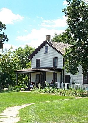
The Gibbs Farm is a museum in Falcon Heights, Minnesota, United States. The site was once the farmstead of Heman and Jane Gibbs, first built in 1854; the existing farmhouse includes the small, original cabin. The museum seeks to educate visitors on the lives of 19th-century Minnesota pioneers and the Dakota people who lived in southern Minnesota before the arrival of Europeans.
Newgate Education Center
Vocational-technical school in Minneapolis, MN
Distance: Approx. 977 meters
Latitude and longitude: 44.990989,-93.211968
Newgate School is a post-secondary non-profit automotive technical school providing tuition-free automotive technical training and career placement support for underserved young adults in the Twin Cities and surrounding areas. It offers professional automotive technical certification in both Auto Body repair and Auto Mechanics. Graduates are qualified to work as career apprentices in the auto services industry.

University Grove, Minnesota
Distance: Approx. 1461 meters
Latitude and longitude: 44.9891,-93.193
University Grove is a neighborhood of Falcon Heights, Minnesota, known for its 103 homes individually designed by architects. Owners have been required to use an architect since the neighborhood's creation by the University of Minnesota in 1928 to recruit and retain faculty; there is also a cap on costs, ensuring that homes would be of similar size.: 205 To balance the individuality of professors/administrators while keeping the properties in the intended group of buyers, each faculty/staff person owns the homes while the university owns the land upon which the home is situated and the faculty/staff person pays rent annually for that land use. The university retains title to the land.
Weather in this IP's area
clear sky
12 Celsius
11 Celsius
10 Celsius
13 Celsius
1019 hPa
83 %
1019 hPa
985 hPa
10000 meters
2.06 m/s
210 degree
06:43:55
19:37:04