198.231.30.5 - IP Lookup: Free IP Address Lookup, Postal Code Lookup, IP Location Lookup, IP ASN, Public IP
Country:
 USA
USARegion:
City:
Location:
Time Zone:
Postal Code:
ISP:
ASN:
language:
User-Agent:
Proxy IP:
Blacklist:
IP information under different IP Channel
ip-api
Country
Region
City
ASN
Time Zone
ISP
Blacklist
Proxy
Latitude
Longitude
Postal
Route
db-ip
Country
Region
City
ASN
Time Zone
ISP
Blacklist
Proxy
Latitude
Longitude
Postal
Route
IPinfo
Country
Region
City
ASN
Time Zone
ISP
Blacklist
Proxy
Latitude
Longitude
Postal
Route
IP2Location
198.231.30.5Country
usRegion
tennessee
City
alexandria
Time Zone
America/Chicago
ISP
Language
User-Agent
Latitude
Longitude
Postal
ipdata
Country
Region
City
ASN
Time Zone
ISP
Blacklist
Proxy
Latitude
Longitude
Postal
Route
Popular places and events near this IP address

Tennessee
U.S. state
Distance: Approx. 9081 meters
Latitude and longitude: 36,-86
Tennessee ( , locally ), is a landlocked state in the Southeastern region of the United States. It borders Kentucky to the north, Virginia to the northeast, North Carolina to the east, Georgia, Alabama, and Mississippi to the south, Arkansas to the southwest, and Missouri to the northwest. Tennessee is the 36th-largest by area and the 15th-most populous of the 50 states.
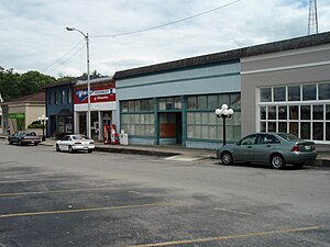
Alexandria, Tennessee
Town in Tennessee, United States
Distance: Approx. 68 meters
Latitude and longitude: 36.077214,-86.033446
Alexandria is a town in DeKalb County, Tennessee, United States. The population was 981 at the 2020 census.
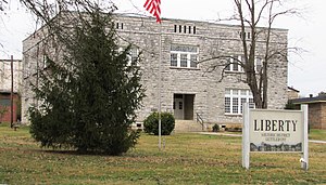
Liberty, Tennessee
Town in Tennessee, United States
Distance: Approx. 9708 meters
Latitude and longitude: 36.005,-85.97277778
Liberty is a town in DeKalb County, Tennessee, United States. The population was 367 at the 2000 census and 310 in 2010. Liberty's main street was listed on the National Register of Historic Places in 1987 as the Liberty Historic District.

Watertown, Tennessee
Town in Tennessee, United States
Distance: Approx. 9638 meters
Latitude and longitude: 36.1,-86.13722222
Watertown is a town located in Wilson County, Tennessee. The population was 1,477 at the 2010 census. The population then raised to 1,556 after the 2020 census.

Patterson Hotel (Watertown, Tennessee)
United States historic place
Distance: Approx. 9312 meters
Latitude and longitude: 36.0993,-86.1337
Patterson Hotel, also known as the Hale House, is a historic building located near the town square in Watertown, Tennessee. The building was added to the National Register of Historic Places in 1997. Completed in 1898, the Hale House originally served as a private residence.

Tennessee in the American Civil War
Distance: Approx. 9081 meters
Latitude and longitude: 36,-86
The American Civil War significantly affected Tennessee, with every county witnessing combat. During the War, Tennessee was a Confederate state, and the last state to officially secede from the Union to join the Confederacy. Tennessee had been threatening to secede since before the Confederacy was even formed, but didn’t officially do so until after the fall of Fort Sumter when public opinion throughout the state drastically shifted.

Watertown High School (Tennessee)
Public grades 9-12 school
Distance: Approx. 8586 meters
Latitude and longitude: 36.09655,-86.12626
Watertown High School (WHS) is a high school located in Watertown, Tennessee. WHS is part of the Wilson County School System. In addition to Watertown it serves Greenvale, Norene, and Statesville.
Liberty Hill, Wilson County, Tennessee
Unincorporated community in Tennessee, United States
Distance: Approx. 4551 meters
Latitude and longitude: 36.04333333,-86.06305556
Liberty Hill is an unincorporated community in Wilson County, Tennessee, United States. Liberty Hill is 5.5 miles (8.9 km) southeast of Watertown.
Brush Creek, Smith County, Tennessee
Unincorporated community in Tennessee, United States
Distance: Approx. 4534 meters
Latitude and longitude: 36.11722222,-86.02777778
Brush Creek is an unincorporated community in Smith County, Tennessee, United States. The zipcode is: 38547.
Commerce, Tennessee
Unincorporated community in Tennessee, United States
Distance: Approx. 9401 meters
Latitude and longitude: 36.14,-86.10333333
Commerce is an unincorporated community in Wilson County, Tennessee, United States. Commerce is located on Commerce Road 11.5 miles (18.5 km) east-southeast of Lebanon.
Weather in this IP's area
overcast clouds
7 Celsius
7 Celsius
5 Celsius
8 Celsius
1013 hPa
93 %
1013 hPa
985 hPa
10000 meters
0.89 m/s
3.13 m/s
82 degree
100 %