198.212.171.80 - IP Lookup: Free IP Address Lookup, Postal Code Lookup, IP Location Lookup, IP ASN, Public IP
Country:
Region:
City:
Location:
Time Zone:
Postal Code:
IP information under different IP Channel
ip-api
Country
Region
City
ASN
Time Zone
ISP
Blacklist
Proxy
Latitude
Longitude
Postal
Route
Luminati
Country
ASN
Time Zone
America/Chicago
ISP
CITYOFDUBUQUE-01
Latitude
Longitude
Postal
IPinfo
Country
Region
City
ASN
Time Zone
ISP
Blacklist
Proxy
Latitude
Longitude
Postal
Route
IP2Location
198.212.171.80Country
Region
iowa
City
dubuque
Time Zone
America/Chicago
ISP
Language
User-Agent
Latitude
Longitude
Postal
db-ip
Country
Region
City
ASN
Time Zone
ISP
Blacklist
Proxy
Latitude
Longitude
Postal
Route
ipdata
Country
Region
City
ASN
Time Zone
ISP
Blacklist
Proxy
Latitude
Longitude
Postal
Route
Popular places and events near this IP address

Sageville, Iowa
City in Iowa, United States
Distance: Approx. 1834 meters
Latitude and longitude: 42.55277778,-90.71222222
Sageville is a city in Dubuque County, Iowa, United States. The population was 95 at the time of the 2020 census, down from 203 in 2000.

Dubuque Arboretum and Botanical Gardens
Arboretum in Dubuque, Iowa, U.S.
Distance: Approx. 3569 meters
Latitude and longitude: 42.5323,-90.7177
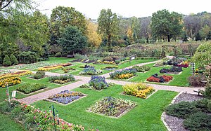
The Dubuque Arboretum and Botanical Gardens, or Marshall Park, is a 56 acres (230,000 m2) arboretum and botanical gardens established in 1980. The park's address is 3800 Arboretum Drive, Dubuque, Iowa. It is open, without charge, daily from dawn to dusk throughout the year.

Holy Ghost Catholic Church (Dubuque, Iowa)
Historic district in Iowa, United States
Distance: Approx. 3856 meters
Latitude and longitude: 42.52388889,-90.67944444
Holy Ghost Catholic Church is a Catholic parish located within the city of Dubuque, Iowa, United States. It is part of the Archdiocese of Dubuque. The church, school, rectory, and convent were listed together as a historic district on the National Register of Historic Places in 2011.
Xavier Hospital
Hospital in Iowa, United States
Distance: Approx. 3615 meters
Latitude and longitude: 42.52944444,-90.66861111
Xavier Hospital was a hospital located in Dubuque, Iowa. It was located in the northern part of the city at the intersection of Windsor Avenue and Davis Street. With Finley Hospital and Mercy Hospital Xavier Hospital was one of three hospital facilities in the city of Dubuque.
Eagle Point Park (Dubuque, Iowa)
Distance: Approx. 3782 meters
Latitude and longitude: 42.54055556,-90.65083333
Eagle Point Park is a 164-acre (0.66 km2) public park located in the northeast corner of the city of Dubuque, Iowa, United States. Eagle Point is mostly situated on a bluff that overlooks the Mississippi River and the Lock and Dam No. 11.
Heritage Trail (Iowa)
Distance: Approx. 1574 meters
Latitude and longitude: 42.553,-90.709
Heritage Trail is a 26-mile (42 km) long, multiuse rail trail connecting Dubuque and Dyersville, Iowa. It is maintained by the Dubuque County Conservation Board, and was converted from a segment of the former Chicago Great Western railroad line between Chicago and Oelwein, Iowa. It is mostly surfaced with compacted, crushed limestone.

Little Maquoketa River
River in Iowa, United States
Distance: Approx. 2315 meters
Latitude and longitude: 42.577,-90.681
The Little Maquoketa River is a 29.6-mile-long (47.6 km) direct tributary of the upper Mississippi River. The Little Maquoketa River is largely confined to Dubuque County, Iowa, and enters the Mississippi in the rural areas north of Dubuque. It may have previously flowed through the Couler Valley.
Little Maquoketa River Mounds State Preserve
Distance: Approx. 2034 meters
Latitude and longitude: 42.56077,-90.7152
The Little Maquoketa River Mounds State Preserve is a state-owned archaeological site and natural area located within the city of Sageville, Iowa, just north of Dubuque, on U.S. Highway 52. It is high up on a limestone ridge above the Little Maquoketa River, not too far from the river's mouth with the Upper Mississippi River. Covering about 42 acres (170,000 m2), it contains a fenced-in 3-acre (12,000 m2) burial area with 32 mounds.
St. John's Cemetery (Dubuque)
Cemetery in Dubuque County, Iowa, US
Distance: Approx. 3564 meters
Latitude and longitude: 42.5305479,-90.6673441
St. John's Cemetery is a cemetery located in Dubuque, Iowa.
Sinnipee, Wisconsin
Ghost town in Wisconsin, United States
Distance: Approx. 3409 meters
Latitude and longitude: 42.57527778,-90.65694444
Sinnipee (also called Sinipee) is a former settlement in Grant County, Wisconsin, United States. Sinnipee was a port community on the Mississippi River at the mouth of the Sinnipee Creek; it played a significant role in the lead trade. The community was first settled prior to 1832 by Payton Vaughan of North Carolina and was founded by the Sinnipee Company in 1835.

Four Mounds Estate Historic District
Historic district in Iowa, United States
Distance: Approx. 1198 meters
Latitude and longitude: 42.55305556,-90.6775
Four Mounds Estate Historic District is a nationally recognized historic district located in Dubuque, Iowa, United States. It was listed on the National Register of Historic Places in 2002. At the time of its nomination the district consisted of 19 resources, including 11 contributing buildings, two contributing sites, four non-contributing structures, and two non-contributing buildings.

Couler Valley
Valley in Iowa, United States
Distance: Approx. 1536 meters
Latitude and longitude: 42.55972,-90.70929
The Couler Valley is a valley near Dubuque, Iowa, and has the Bee Branch Creek, previously known as the Couler Creek, located in it. It is about 5 miles (8.0 km) long. It is found in the Driftless Area.
Weather in this IP's area
clear sky
-15 Celsius
-22 Celsius
-15 Celsius
-14 Celsius
1024 hPa
61 %
1024 hPa
989 hPa
10000 meters
5.14 m/s
280 degree
