198.203.255.94 - IP Lookup: Free IP Address Lookup, Postal Code Lookup, IP Location Lookup, IP ASN, Public IP
Country:
Region:
City:
Location:
Time Zone:
Postal Code:
IP information under different IP Channel
ip-api
Country
Region
City
ASN
Time Zone
ISP
Blacklist
Proxy
Latitude
Longitude
Postal
Route
Luminati
Country
ASN
Time Zone
America/Chicago
ISP
BRUNSWICKCORPORATION
Latitude
Longitude
Postal
IPinfo
Country
Region
City
ASN
Time Zone
ISP
Blacklist
Proxy
Latitude
Longitude
Postal
Route
IP2Location
198.203.255.94Country
Region
wisconsin
City
green bay
Time Zone
America/Chicago
ISP
Language
User-Agent
Latitude
Longitude
Postal
db-ip
Country
Region
City
ASN
Time Zone
ISP
Blacklist
Proxy
Latitude
Longitude
Postal
Route
ipdata
Country
Region
City
ASN
Time Zone
ISP
Blacklist
Proxy
Latitude
Longitude
Postal
Route
Popular places and events near this IP address

Fort Howard (Wisconsin)
Distance: Approx. 390 meters
Latitude and longitude: 44.51666667,-88.01666667
Fort Howard was a 19th-century fortification in the north central United States, built by the U.S. Army. It was located along the west bank of the Fox River in Green Bay, Wisconsin.

Saint Patrick's Oratory (Green Bay, Wisconsin)
Roman Catholic Church in Wisconsin, United States
Distance: Approx. 270 meters
Latitude and longitude: 44.51922222,-88.02330556
Saint Patrick's Oratory is a Roman Catholic oratory located in Green Bay, Brown County, Wisconsin, United States, in the Roman Catholic Diocese of Green Bay.

Oakland–Dousman Historic District
Historic district in Wisconsin, United States
Distance: Approx. 471 meters
Latitude and longitude: 44.51985,-88.02579
The Oakland–Dousman Historic District in Green Bay, Wisconsin is a 8 acres (3.2 ha) residential historic district which was listed on the National Register of Historic Places in 1988. The district consists of 22 large, originally single-family homes on spacious lots, with associated structures. Many of the houses were homes of prominent businessmen and financiers.
Fort Howard, Wisconsin
Distance: Approx. 76 meters
Latitude and longitude: 44.51944444,-88.02083333
Fort Howard was a city in Brown County, Wisconsin, United States. It was first incorporated as a "borough" of 664 acres on October 13, 1856. As the result of a referendum on the union of the two cities held on April 2, 1895, the city was entirely annexed to the City of Green Bay and ceased to exist.

Receiver (statue)
Distance: Approx. 127 meters
Latitude and longitude: 44.519031,-88.018343
The Receiver statue is a 22-foot (6.7 m) tall public statue in Green Bay, Wisconsin associated with the Green Bay Packers football team. Originally located outside the Green Bay Packers Hall of Fame, the statue was dedicated to the "great past, present and future enshrinees in the Green Bay Packers Hall of Fame" on June 8, 1985. The player on the statue had number 88 on his jersey and the name listed on the back jersey was "PACKER." The statue was sold in 2003 to Titletown Brewing and was moved to the corner of Dousman Street and Donald Driver Way in front of the old Chicago and North Western Railway Passenger Depot.

Neville Public Museum of Brown County
Museum in Green Bay, Wisconsin
Distance: Approx. 198 meters
Latitude and longitude: 44.51777778,-88.01861111
The Neville Public Museum of Brown County is an accredited cultural institution that champions history, science and art, named for Green Bay's 25th mayor, Arthur C. Neville. Located in downtown Green Bay, Wisconsin, the museum is dedicated to the collection and preservation of significant objects relevant to Northeast Wisconsin and the Upper Peninsula of Michigan. The museum seeks to bridge these multi-generational regional communities through engaging exhibits and dynamic programming.
CityDeck
Distance: Approx. 472 meters
Latitude and longitude: 44.5160815,-88.01602046
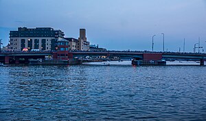
The CityDeck is a riverfront boardwalk/promenade along the edge of the Fox River in downtown Green Bay, Wisconsin. It is about one-quarter-mile in length and situated between the Walnut Street bridge and the Ray Nitschke Memorial Bridge with multiple platforms extending out over the Fox River. There is 720 lineal feet of dock space amongst the platforms.

Ray Nitschke Memorial Bridge
Bridge
Distance: Approx. 351 meters
Latitude and longitude: 44.5183,-88.0157
The Ray Nitschke Memorial Bridge is a twin-leaf bascule bridge over the Fox River on Main Street (US 141) in Green Bay, Wisconsin. It is named in honor of the former Green Bay Packer linebacker Ray Nitschke.

Green Bay station (Chicago and North Western Railway)
Distance: Approx. 217 meters
Latitude and longitude: 44.5199,-88.0173
The Chicago and North Western Railway Passenger Depot is a historic building located at 200 Dousman Street in the Broadway District of downtown Green Bay, Wisconsin, formerly served by the Chicago and North Western Railway. At its peak, it served trains such as the Flambeau 400 between Chicago and Ashland. The depot opened in 1899 and regular passenger service ended in 1971.

Broadway-Dousman Historic District
Historic district in Wisconsin, United States
Distance: Approx. 252 meters
Latitude and longitude: 44.52138889,-88.02111111
The Broadway-Dousman Historic District is located in Green Bay, Wisconsin. It was added to both the State and the National Register of Historic Places in 1999.

Broadway-Walnut Historic District
Historic district in Wisconsin, United States
Distance: Approx. 148 meters
Latitude and longitude: 44.51888889,-88.02166667
The Broadway-Walnut Historic District is located in Green Bay, Wisconsin. It was added to the State and the National Register of Historic Places in 1999. It included 20 contributing buildings and five deemed not to contribute to the historic character of the district.

Tarlton Theatre
Historic theater in Wisconsin, United States
Distance: Approx. 379 meters
Latitude and longitude: 44.51637,-88.02232
The Tarlton Theatre (formerly West Theater, West Pitcher Show, Historic West Theatre) is an Streamline Moderne theater built around 1925, located in Green Bay, Wisconsin. In 1999, it was listed on the National Register of Historic Places as a contributing property in the Broadway-Walnut Historic District.
Weather in this IP's area
overcast clouds
-5 Celsius
-11 Celsius
-6 Celsius
-5 Celsius
1022 hPa
73 %
1022 hPa
1000 hPa
10000 meters
4.02 m/s
6.26 m/s
318 degree
97 %