Country:
Region:
City:
Latitude and Longitude:
Time Zone:
Postal Code:
IP information under different IP Channel
ip-api
Country
Region
City
ASN
Time Zone
ISP
Blacklist
Proxy
Latitude
Longitude
Postal
Route
Luminati
Country
ASN
Time Zone
America/Chicago
ISP
WON-AS
Latitude
Longitude
Postal
IPinfo
Country
Region
City
ASN
Time Zone
ISP
Blacklist
Proxy
Latitude
Longitude
Postal
Route
db-ip
Country
Region
City
ASN
Time Zone
ISP
Blacklist
Proxy
Latitude
Longitude
Postal
Route
ipdata
Country
Region
City
ASN
Time Zone
ISP
Blacklist
Proxy
Latitude
Longitude
Postal
Route
Popular places and events near this IP address
Loyola Marymount University
Jesuit university in Los Angeles, California
Distance: Approx. 1095 meters
Latitude and longitude: 33.97,-118.418
Loyola Marymount University (LMU) is a private Jesuit and Marymount research university in Los Angeles, California. It is located on the west side of the city near Playa Vista. LMU is the parent school to Loyola Law School.

Playa Vista, Los Angeles
Neighborhood in California, US
Distance: Approx. 408 meters
Latitude and longitude: 33.97888889,-118.41472222
Playa Vista is a neighborhood in the Westside area of Los Angeles, California, United States. The area was the headquarters of Hughes Aircraft Company from 1941 to 1985 and the site of the construction of the Hughes H-4 Hercules "Spruce Goose" aircraft. The area began development in 2002 as a planned community with residential, commercial, and retail components.

Del Rey, Los Angeles
Neighborhood of Los Angeles in California, United States of America
Distance: Approx. 1171 meters
Latitude and longitude: 33.98943,-118.4241
Del Rey (Spanish for "of the King") is a neighborhood in the Westside of Los Angeles, surrounded on three sides by Culver City, California. Within it lie a police station, the largest public housing complex on the Westside, a public middle school and six public elementary schools. It is served by a neighborhood council and a residents association.

Hughes Airport (California)
US private airport operating 1940–1985
Distance: Approx. 565 meters
Latitude and longitude: 33.975,-118.417
The Hughes Airport (IATA: CVR) was a private airport owned by Howard Hughes for the Hughes Aircraft Company. It was located just north of the Westchester bluffs and district of Los Angeles, California, from 1940 until its closure in 1985. It was directly south of and along Jefferson Boulevard and Ballona Creek, the location of the present-day neighborhood of Playa Vista.

Mar Vista Gardens
Housing project in Los Angeles
Distance: Approx. 1412 meters
Latitude and longitude: 33.9915,-118.4131
Mar Vista Gardens is a housing project at 11965 Allin Street in Del Rey, a district of southwestern Los Angeles County, California near Culver City, bordering Ballona Creek and Sepulveda Creek Channel. It is operated by the Housing Authority of the City of Los Angeles (HACLA). Designed by architect Albert Criz, it was completed in 1954 as one of the slum clearance measures that were inspired by the Federal Housing Act of 1949.

Institute for Creative Technologies
Research institute of the University of Southern California
Distance: Approx. 1422 meters
Latitude and longitude: 33.983264,-118.404168
The Institute for Creative Technologies (ICT) is a University Affiliated Research Center at the University of Southern California located in Playa Vista, California. ICT was established in 1999 with funding from the US Army. Dr.

Gersten Pavilion
Sports arena at Loyola Marymount University
Distance: Approx. 1406 meters
Latitude and longitude: 33.9675,-118.41555556
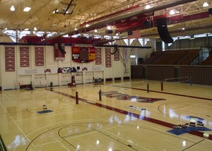
The Gersten Pavilion is a 3,900-seat multi-purpose arena in Los Angeles, California. It is the home of the Loyola Marymount University Lions. It was built in 1981 and has been used for home games by the university's men's basketball, women's basketball, and volleyball teams since January 1982.

Westside Neighborhood School
School in Los Angeles, California, United States
Distance: Approx. 405 meters
Latitude and longitude: 33.9775,-118.4224
Westside Neighborhood School is a private independent school in Los Angeles, California. Founded in 1980, the school operates preschool, elementary school, and middle school grades (K-8). WNS is notable for a program of "Family Groups," collections of students from all grades who meet several times a year during school hours to work as a team on projects such as dramatic programs, organizing school functions, and work on community service projects.

Alsace, California
Unincorporated community in California, United States
Distance: Approx. 344 meters
Latitude and longitude: 33.97861111,-118.41555556
Alsace is a place name designating what was originally an interurban trolley stop, and now an approximately five-block enclave of unincorporated Los Angeles County in the Westside region, surrounded by Del Rey, just north of the Playa Vista neighborhood of Los Angeles, California, United States.

George C. Page Stadium
Distance: Approx. 1468 meters
Latitude and longitude: 33.967055,-118.414921
George C. Page Stadium is a baseball venue in Los Angeles, California, USA. It is home to the Loyola Marymount Lions baseball team of the NCAA's Division I West Coast Conference. Opened in 1983, it has a capacity of 1,200 spectators. The stadium is named for George C. Page, head of the Incentive Aid Foundation, which covered much of the venue's construction costs.
Call of Duty: Experience 2011
Video game convention
Distance: Approx. 1054 meters
Latitude and longitude: 33.97277778,-118.42666667
Call of Duty: XP 2011 was the first annual convention hosted by Activision to celebrate their video game series Call of Duty. The convention was held in Los Angeles, California from September 2–3, 2011 in and around a 12-acre hangar where developer Infinity Ward (coupled with Sledgehammer Games) showcased their upcoming game, Call of Duty: Modern Warfare 3 and online service Call of Duty: Elite. The convention offered fans an opportunity to observe and participate in various events and attractions such as a $1 million tournament, live performances from various artists, Call of Duty: Modern Warfare 3 multiplayer, paintball, jeep off-roading, zip-lining, and a full-scale replica of Burger Town from Call of Duty: Modern Warfare 2.

Los Angeles Clippers Training Center
Training facility for the Los Angeles Clippers NBA team
Distance: Approx. 1830 meters
Latitude and longitude: 33.983212,-118.399606
The Honey Training Center is a 42,500 square foot (3,950 m2) two-story training facility for the Los Angeles Clippers of the National Basketball Association (NBA). Located in the planned community of Playa Vista in Los Angeles near Loyola Marymount University, the facility is at least 1 mile (1.6 km) away from nearby beaches (Playa Del Rey, Marina Del Rey, and Venice), 3 miles (4.8 km) north of Los Angeles International Airport, and 12 miles (19 km) southwest of Crypto.com Arena. While the team maintains some office functions at Crypto.com Arena, the Playa Vista facility serves as the official headquarters of the Clippers.
Weather in this IP's area
clear sky
17 Celsius
16 Celsius
15 Celsius
19 Celsius
1020 hPa
48 %
1020 hPa
1020 hPa
10000 meters
4.63 m/s
250 degree
06:19:13
16:55:37