Country:
 USA
USARegion:
City:
Latitude and Longitude:
Time Zone:
Postal Code:
IP information under different IP Channel
ip-api
Country
Region
City
ASN
Time Zone
ISP
Blacklist
Proxy
Latitude
Longitude
Postal
Route
IPinfo
Country
Region
City
ASN
Time Zone
ISP
Blacklist
Proxy
Latitude
Longitude
Postal
Route
MaxMind
Country
Region
City
ASN
Time Zone
ISP
Blacklist
Proxy
Latitude
Longitude
Postal
Route
Luminati
Country
USASN
Time Zone
America/Chicago
ISP
TVC-AS1
Latitude
Longitude
Postal
db-ip
Country
Region
City
ASN
Time Zone
ISP
Blacklist
Proxy
Latitude
Longitude
Postal
Route
ipdata
Country
Region
City
ASN
Time Zone
ISP
Blacklist
Proxy
Latitude
Longitude
Postal
Route
Popular places and events near this IP address

Traverse City, Michigan
City in Michigan, United States
Distance: Approx. 566 meters
Latitude and longitude: 44.76805556,-85.62222222
Traverse City ( TRAV-ərss) is a city in the U.S. state of Michigan. It is the county seat of Grand Traverse County, although it partly extends into Leelanau County. The population was 15,678 at the 2020 census, with 153,448 residents in the four-county Traverse City metropolitan area.

State Theatre (Traverse City, Michigan)
Distance: Approx. 150 meters
Latitude and longitude: 44.76419444,-85.6195
The State Theatre is a movie theater in Traverse City, Michigan. In its current iteration, it is operated by the Traverse City Film Festival, and presents a year-round schedule of film and live performances. The State is the fourth theatre on its site on East Front Street.

City Opera House (Traverse City, Michigan)
United States historic place
Distance: Approx. 193 meters
Latitude and longitude: 44.76388889,-85.62277778
The City Opera House is located at 106-112 Front Street in Traverse City, Michigan. It was designated a Michigan State Historic Site in 1971 and listed on the National Register of Historic Places in 1972.

National Cherry Festival
Annual food festival in Traverse City, Michigan, U.S.
Distance: Approx. 362 meters
Latitude and longitude: 44.76555556,-85.62361111
The National Cherry Festival is a food festival held annually in Traverse City, Michigan, United States. The eight-day festival celebrates cherry production in the Grand Traverse Bay region surrounding Traverse City, which is nicknamed the "Cherry Capital of the World". The festival was inaugurated in 1925 as the "Blessing of the Blossoms Festival".
Great Lakes Maritime Academy
Public college in Traverse City, Michigan
Distance: Approx. 1106 meters
Latitude and longitude: 44.76527778,-85.60694444
The Great Lakes Maritime Academy at Northwestern Michigan College is located on West Grand Traverse Bay in Traverse City, Michigan. The academy was established in 1969 as a Maritime college to train men and women to be licensed mariners on ships of unlimited tonnage or horsepower; including research vessels, cruise ships, freighters, tankers and more. One of six state-operated maritime academies in the United States, the Great Lakes Maritime Academy is the only maritime academy that offers graduates the opportunity to earn First Class Great Lakes Pilotage, and the only maritime academy located on fresh water.

St. Francis High School (Traverse City, Michigan)
Private, coeducational school in Traverse City, Michigan, United States
Distance: Approx. 797 meters
Latitude and longitude: 44.75611111,-85.62277778
St. Francis High School is a private, Roman Catholic high school in Traverse City, Michigan. It is located in the Roman Catholic Diocese of Gaylord.

South Union Street–Boardman River Bridge
United States historic place
Distance: Approx. 271 meters
Latitude and longitude: 44.76194444,-85.62361111
The South Union Street–Boardman River Bridge, also known as the Trunk Line Bridge, is a bridge located on South Union Street over the Boardman River in Traverse City, Michigan. It was listed on the National Register of Historic Places in 2000.

Boardman Neighborhood Historic District
Historic district in Michigan, United States
Distance: Approx. 660 meters
Latitude and longitude: 44.76166667,-85.6125
The Boardman Neighborhood Historic District is a residential historic district in Traverse City, Michigan, United States, roughly bounded by State Street, Webster Street, Railroad Avenue, and Boardman Avenue. It was listed on the National Register of Historic Places in 1978.

Central Neighborhood Historic District
Historic district in Michigan, United States
Distance: Approx. 680 meters
Latitude and longitude: 44.7625,-85.62916667
The Central Neighborhood Historic District is a residential historic district, roughly bounded by 5th, Union, 9th, and Division Streets in Traverse City, Michigan. It was listed on the National Register of Historic Places in 1979. It includes the separately-listed Perry Hannah House.

Perry Hannah House
Historic house in Michigan, United States
Distance: Approx. 528 meters
Latitude and longitude: 44.76111111,-85.62666667
The Perry Hannah House, also known as the Reynolds-Jonkhoff Funeral Home, is a house located at 305 6th Street in Traverse City, Michigan. It was designated a Michigan State Historic Site in 1971 and listed on the National Register of Historic Places in 1972.
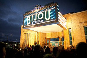
Bijou by the Bay
Movie theater in Traverse City, Michigan, United States
Distance: Approx. 284 meters
Latitude and longitude: 44.7656,-85.6213
The Bijou by the Bay () is a 150-seat nonprofit movie theater in a city park on Grand Traverse Bay in Michigan, next to the multi-use TART Trail. It is one of the venues for the Traverse City Film Festival.

Park Place Hotel
Distance: Approx. 215 meters
Latitude and longitude: 44.76247222,-85.61802778
Park Place Hotel is a historic hotel in Traverse City, Michigan. Completed in 1930 by Benjamin H. Marshall, the 10-story building rises to a height of 125 feet (38 m) and is the tallest structure in the city.
Weather in this IP's area
scattered clouds
12 Celsius
11 Celsius
11 Celsius
13 Celsius
1029 hPa
75 %
1029 hPa
1007 hPa
10000 meters
2.06 m/s
160 degree
40 %
08:02:14
18:52:29