Country:
Region:
City:
Latitude and Longitude:
Time Zone:
Postal Code:
IP information under different IP Channel
ip-api
Country
Region
City
ASN
Time Zone
ISP
Blacklist
Proxy
Latitude
Longitude
Postal
Route
Luminati
Country
ASN
Time Zone
America/Chicago
ISP
OREGON
Latitude
Longitude
Postal
IPinfo
Country
Region
City
ASN
Time Zone
ISP
Blacklist
Proxy
Latitude
Longitude
Postal
Route
db-ip
Country
Region
City
ASN
Time Zone
ISP
Blacklist
Proxy
Latitude
Longitude
Postal
Route
ipdata
Country
Region
City
ASN
Time Zone
ISP
Blacklist
Proxy
Latitude
Longitude
Postal
Route
Popular places and events near this IP address
Salem, Oregon
Capital city of Oregon, United States
Distance: Approx. 1801 meters
Latitude and longitude: 44.92305556,-123.02444444
Salem ( SAY-ləm) is the capital city of the U.S. state of Oregon, and the county seat of Marion County. It is located in the center of the Willamette Valley alongside the Willamette River, which runs north through the city. The river forms the boundary between Marion and Polk counties, and the city neighborhood of West Salem is in Polk County.
Walter Wirth Lake
Quarry Lake in Salem, Oregon
Distance: Approx. 2027 meters
Latitude and longitude: 44.91,-122.99
Walter Wirth Lake (aka Lake Wirth) is a lake in Salem, Oregon, United States. Walter Wirth Lake is wholly contained within Cascades Gateway Park. The park and lake began development in 1957 with the Salem Area Chamber of Commerce working with the State Highway Department to convert a gravel burrow pit into a park.

McNary Field
Airport
Distance: Approx. 1855 meters
Latitude and longitude: 44.90944444,-123.0025
McNary Field (IATA: SLE, ICAO: KSLE, FAA LID: SLE) (Salem-Willamette Valley Airport, formerly Salem Municipal Airport) is in Marion County, Oregon, United States, two miles southeast of downtown Salem, which owns it. The airport is named for U.S. Senator Charles L. McNary of Oregon, who had died in February 1944, a couple of years after the airport became operational. McNary Field has had scheduled airline flights, including service on Delta Connection that ended in October 2008.
Oregon State Penitentiary
Prison in Salem, Oregon, U.S.
Distance: Approx. 698 meters
Latitude and longitude: 44.932,-123.005
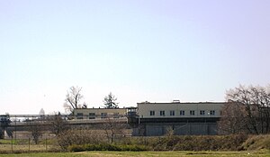
Oregon State Penitentiary (OSP), also known as Oregon State Prison, is a maximum security prison in the northwest United States in Salem, Oregon. Originally opened in Portland 173 years ago in 1851, it relocated to Salem fifteen years later. The 2,242-capacity prison is the oldest in the state; the all-male facility is operated by the Oregon Department of Corrections (ODOC).

Oregon State Hospital
United States historic place
Distance: Approx. 1528 meters
Latitude and longitude: 44.93979,-123.00348
Oregon State Hospital is a public psychiatric hospital in the U.S. state of Oregon, located in the state's capital city of Salem with a smaller satellite campus in Junction City opened in 2014. Founded in 1862 and constructed in the Kirkbride Plan design in 1883, it is the oldest operating psychiatric hospital in the state of Oregon, and one of the oldest continuously operated hospitals on the West Coast. The hospital was established after the closure of the Oregon Hospital for the Insane in Portland, located 47 miles (76 km) north of Salem.

Roberts High School
Alternative, secondary school in Salem, , Oregon, United States
Distance: Approx. 1055 meters
Latitude and longitude: 44.927787,-122.988834
Roberts High School is a high school in Salem, Oregon, United States. It provides non-traditional educational programs in the Salem-Keizer School District. Rather than a centralized campus, Roberts High School consists of departments at different sites in Salem and Keizer.
Lee Mission Cemetery
Pioneer cemetery in Salem, Oregon
Distance: Approx. 1918 meters
Latitude and longitude: 44.9425,-123.00944444
Lee Mission Cemetery is a pioneer cemetery in Salem, Oregon, United States.
Walling Pond
Quarry Lake in Salem, Oregon
Distance: Approx. 1850 meters
Latitude and longitude: 44.918,-123.0225
Walling Pond is a privately owned pond that is open to the public for fishing. The pond, located in Salem, Oregon, is owned by the Walling family. The pond is located at the original site of their sand and gravel processing plant at the northeast corner of McGilchrist and 16th Streets, S.E. The pond is popular with bait anglers and produces stocked rainbow trout.
Oregon State Hospital Historic District
Historic district in Oregon, United States
Distance: Approx. 1539 meters
Latitude and longitude: 44.93992,-123.0026
The Oregon State Hospital Historic District is a National Historic District in Salem, Oregon, United States. It was added to the National Register of Historic Places on February 28, 2008, and encompasses many of the buildings of the present-day Oregon State Hospital. The district is roughly bounded by D Street, Park Avenue, 24th Street and Bates Drive and includes the main hospital building as well as the headquarters of the Oregon Department of Corrections, known as the Dome Building, across the street.
Shelton Ditch (Oregon)
Distance: Approx. 595 meters
Latitude and longitude: 44.925953,-123.00954
Shelton Ditch is an artificial canal in Marion County, Oregon, United States. Built in the mid-19th century, it originates from Mill Creek east of Airport Road in Salem, passes through a corner of the Salem main Post Office property, and along the southern edge of downtown Salem. Shelton Ditch passes by the north side of Pringle Park before emptying into Pringle Creek.
Willamette Town Center
Shopping mall in Oregon, United States
Distance: Approx. 2132 meters
Latitude and longitude: 44.9418,-122.9865
Willamette Town Center, formerly Lancaster Mall, is an exterior entrance shopping center located in Salem, Oregon, United States. Opened in 1971, the main part of the center has 550,000 square feet (51,000 m2) of space. The regional mall is located on Lancaster Drive and is bordered on the West by Interstate 5, making Willamette Town Center a retail hub for the city of Salem.
Oregon State Forester's Office Building
United States historic place
Distance: Approx. 656 meters
Latitude and longitude: 44.93111111,-123.00638889
The Oregon State Forester's Office Building is a historic building in Salem, Oregon, United States that is used by the head of the Oregon Department of Forestry. The 1938 building was listed on the National Register of Historic Places (NRHP) in 1982. It was designed by Linn A. Forrest in the "National Park Style".
Weather in this IP's area
light rain
7 Celsius
5 Celsius
6 Celsius
8 Celsius
1015 hPa
86 %
1015 hPa
1008 hPa
10000 meters
3.13 m/s
4.02 m/s
157 degree
100 %
07:11:46
16:42:18


