198.164.153.128 - IP Lookup: Free IP Address Lookup, Postal Code Lookup, IP Location Lookup, IP ASN, Public IP
Country:
Region:
City:
Location:
Time Zone:
Postal Code:
ISP:
ASN:
language:
User-Agent:
Proxy IP:
Blacklist:
IP information under different IP Channel
ip-api
Country
Region
City
ASN
Time Zone
ISP
Blacklist
Proxy
Latitude
Longitude
Postal
Route
db-ip
Country
Region
City
ASN
Time Zone
ISP
Blacklist
Proxy
Latitude
Longitude
Postal
Route
IPinfo
Country
Region
City
ASN
Time Zone
ISP
Blacklist
Proxy
Latitude
Longitude
Postal
Route
IP2Location
198.164.153.128Country
Region
new brunswick
City
fredericton
Time Zone
America/Moncton
ISP
Language
User-Agent
Latitude
Longitude
Postal
ipdata
Country
Region
City
ASN
Time Zone
ISP
Blacklist
Proxy
Latitude
Longitude
Postal
Route
Popular places and events near this IP address

New Brunswick Sports Hall of Fame
Sports hall of fame in New Brunswick, Canada
Distance: Approx. 999 meters
Latitude and longitude: 45.9622,-66.6404
The New Brunswick Sports Hall of Fame (French: Temple de la Renommée Sportive du Nouveau-Brunswick) is a provincial sports hall of fame and museum in Fredericton, New Brunswick. The sports hall of fame honours athletes, teams, and sport builders that are from the Canadian province of New Brunswick. New nominees to the hall of fame are inducted to the hall of fame on an annual basis.
New Brunswick Community College
College in New Brunswick, Canada
Distance: Approx. 57 meters
Latitude and longitude: 45.96152222,-66.65380278
New Brunswick Community College (NBCC) is a public college located throughout various locations in New Brunswick, Canada, including Moncton, Miramichi, Fredericton (its head office), Saint John, St. Andrews, and Woodstock. New Brunswick Community College provides over 90 programs, offered at six campuses, First Nations sites, and regional delivery sites throughout the province of New Brunswick.

Westmorland Street Bridge
Bridge in Canada
Distance: Approx. 1119 meters
Latitude and longitude: 45.968692,-66.642637
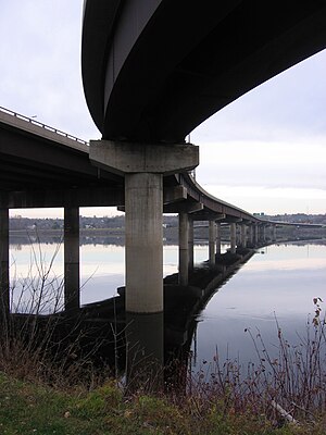
The Westmorland Street Bridge is a bridge crossing the Saint John River in Fredericton, New Brunswick, Canada. Opened on 19 September 1981, the Westmorland Street Bridge is an extension of Westmorland Street in Fredericton's central business district and connects with Route 105 (or the Ring Road) in Nashwaaksis, a neighbourhood of Fredericton since municipal amalgamation in the 1970s.

Fredericton South (electoral district)
Provincial electoral district in New Brunswick, Canada
Distance: Approx. 1104 meters
Latitude and longitude: 45.953,-66.647
Fredericton South (French: Fredericton-Sud) was a provincial electoral district for the Legislative Assembly of New Brunswick, Canada. It was first contested in the 2014 general election, having been created in the 2013 redistribution of electoral boundaries by combining portions of the former districts of Fredericton-Lincoln and Fredericton-Silverwood. The district included the downtown and uptown areas of the southside of the City of Fredericton, including Fredericton City Hall, the Legislative Assembly of New Brunswick, the University of New Brunswick and Saint Thomas University.
Fredericton Public Library
New Brunswick library
Distance: Approx. 1046 meters
Latitude and longitude: 45.96261,-66.63982
The Fredericton Public Library is a public library located in Fredericton, New Brunswick, Canada; it is the province's most used public library, with over 700 visitors each day. Established in 1955, the current building, designed by Architect Keith L. Graham, was built in June 1975 and remodelled and expanded in 1990. Another extensive renovation took place in 2013 and 2014 which increased the size of all departments and collections.

Fredericton station
Railway station in New Brunswick, Canada
Distance: Approx. 733 meters
Latitude and longitude: 45.9564,-66.6481
The Fredericton station, also known as York Street station is a former Canadian Pacific Railway station located on York Street in Fredericton, New Brunswick, Canada. The station opened in 1923 and is a brick structure with sandstone trim; it is distinguished by a tapestry brick patterning which is rare in Fredericton. The station has a hip-roof profile typical of CPR stations of the era and is one of the few brick railway stations remaining in New Brunswick.
University of Fredericton
Online University based in Fredricton, New Brunswick
Distance: Approx. 799 meters
Latitude and longitude: 45.963,-66.6431
The University of Fredericton is a private for-profit online university established in 2005 in Fredericton, New Brunswick. The university's first verified degrees were offered in 2007. It offers MBA, EMBA and Master’s Certificates through its Sandermoen School of Business.

St. Anne's Chapel (Fredericton)
Chapel in Fredricton, New Brunswick
Distance: Approx. 407 meters
Latitude and longitude: 45.961,-66.6482
St. Anne's Chapel is a Gothic Revival Anglican chapel of ease in Fredericton, New Brunswick. Constructed between 1846 and 1847, it was designed by British-born architect Frank Wills.
Fredericton Region Museum
Non-profit museum in Canada
Distance: Approx. 1075 meters
Latitude and longitude: 45.962054,-66.63941
The Fredericton Region Museum, formerly known as the York Sunbury Museum, is a small, non-profit museum founded in 1934 by the York Sunbury Historical Society. The museum was housed in several different locations until 1959, when it moved into Officers' Square on Queen Street in Fredericton, New Brunswick. The Fredericton Region Museum focuses on preserving the history of the York and Sunbury region as well as central New Brunswick.

Siege of Fort Nashwaak
Action of King William's War
Distance: Approx. 810 meters
Latitude and longitude: 45.96358333,-66.64311111
The siege of Fort Nashwaak occurred during King William's War when New England forces from Boston attacked the capital of Acadia, Fort Nashwaak, at present-day Fredericton, New Brunswick. The siege was in retaliation for the French and Indian Siege of Pemaquid (1696) at present day Bristol, Maine. In the English Province of Massachusetts Bay.

Fredericton City Hall
Historic site in Fredericton, New Brunswick
Distance: Approx. 799 meters
Latitude and longitude: 45.96348011,-66.64322269
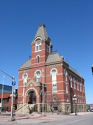
The Fredericton City Hall is the meeting place of the Fredericton City Council in Fredericton, New Brunswick, Canada. The three-storey building was constructed between 1875 and 1876 by architects McKean and Fairweather and built by H. B. Crosby and O. M. Campbell in the Second Empire style. It is located near Phoenix Square in Downtown Fredericton.

Greater Fredericton
Metropolitan area in New Brunswick, Canada
Distance: Approx. 815 meters
Latitude and longitude: 45.96361111,-66.64305556
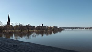
Greater Fredericton is the name given to the area encompassing the City of Fredericton in New Brunswick, Canada and its surroundings. Most of this area is along the Saint John River mainly on portions of Route 105, Route 102 and Route 101. Some of the areas mentioned below are included in the area of Greater Fredericton.
Weather in this IP's area
few clouds
-8 Celsius
-13 Celsius
-8 Celsius
-7 Celsius
1020 hPa
59 %
1020 hPa
1009 hPa
10000 meters
2.57 m/s
290 degree
20 %