Country:
Region:
City:
Latitude and Longitude:
Time Zone:
Postal Code:
IP information under different IP Channel
ip-api
Country
Region
City
ASN
Time Zone
ISP
Blacklist
Proxy
Latitude
Longitude
Postal
Route
Luminati
Country
Region
qc
City
montreal
ASN
Time Zone
America/Toronto
ISP
FIBRENOIRE-INTERNET
Latitude
Longitude
Postal
IPinfo
Country
Region
City
ASN
Time Zone
ISP
Blacklist
Proxy
Latitude
Longitude
Postal
Route
db-ip
Country
Region
City
ASN
Time Zone
ISP
Blacklist
Proxy
Latitude
Longitude
Postal
Route
ipdata
Country
Region
City
ASN
Time Zone
ISP
Blacklist
Proxy
Latitude
Longitude
Postal
Route
Popular places and events near this IP address

Montreal Locomotive Works
Defunct Canadian locomotive manufacturer
Distance: Approx. 1192 meters
Latitude and longitude: 45.56929167,-73.53106389
Montreal Locomotive Works (MLW) was a Canadian railway locomotive manufacturer that existed under several names from 1883 to 1985, producing both steam and diesel locomotives. For many years it was a subsidiary of the American Locomotive Company. MLW's headquarters and manufacturing facilities were in Montreal, Quebec.

Cadillac station
Montreal Metro station
Distance: Approx. 1245 meters
Latitude and longitude: 45.57694444,-73.54666667
Cadillac station is a Montreal Metro station in the borough of Mercier–Hochelaga-Maisonneuve in Montreal, Quebec, Canada. It is operated by the Société de transport de Montréal (STM) and serves the Green Line. It is in the district of Mercier-Ouest.

Langelier station
Montreal Metro station
Distance: Approx. 967 meters
Latitude and longitude: 45.58277778,-73.54305556
Langelier station is a Montreal Metro station in the borough of Mercier–Hochelaga-Maisonneuve in Montreal, Quebec, Canada. It is operated by the Société de transport de Montréal (STM) and serves the Green Line. It is in the district of Mercier-Ouest.
Radisson station
Montreal Metro station
Distance: Approx. 1175 meters
Latitude and longitude: 45.58888889,-73.53944444
Radisson station is a Montreal Metro station in the borough of Mercier–Hochelaga-Maisonneuve in Montreal, Quebec, Canada. It is operated by the Société de transport de Montréal (STM) and serves the Green Line. It is in the district of Saint-Jean-de-Dieu.

Mercier–Hochelaga-Maisonneuve
Borough of Montreal in Quebec, Canada
Distance: Approx. 1460 meters
Latitude and longitude: 45.567542,-73.525435
Mercier–Hochelaga-Maisonneuve is a borough of Montreal, Quebec, Canada located in the southeastern end of the island.

Hochelaga (village)
Village in Quebec, Canada
Distance: Approx. 1251 meters
Latitude and longitude: 45.56980556,-73.53805556
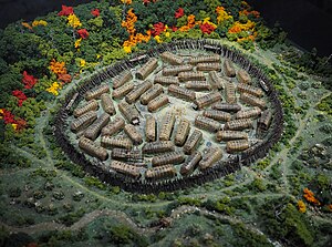
Hochelaga (French pronunciation: [ɔʃlaɡa]) was a St. Lawrence Iroquois 16th century fortified village on or near Mount Royal in present-day Montreal, Quebec, Canada. Jacques Cartier arrived by boat on October 2, 1535; he visited the village on the following day.
CFB Montreal
Military base in Montreal, Canada
Distance: Approx. 775 meters
Latitude and longitude: 45.57611111,-73.52305556
2nd Canadian Division Support Base Valcartier, Detachment Montreal, formerly known as and commonly referred to as Canadian Forces Base Montreal (also CFB Montreal or Longue-Pointe) is a Canadian Forces Base network located in Montreal, Quebec. The address of CFB Montreal is 6769 Notre-Dame Street.

Camille-Laurin (electoral district)
Provincial electoral district in Quebec, Canada
Distance: Approx. 1067 meters
Latitude and longitude: 45.589,-73.536
Camille-Laurin is a provincial electoral district in Quebec, Canada that elects members to the National Assembly of Quebec. The district is located within the Mercier–Hochelaga-Maisonneuve borough of Montreal. It includes territory between the boundary with Pointe-aux-Trembles borough and the Canadian National railway and between mostly Sherbrooke Street and the Anjou borough and the Saint Lawrence River.
Place Versailles
Shopping mall
Distance: Approx. 1504 meters
Latitude and longitude: 45.5918,-73.5407
Place Versailles is a shopping mall located at the corner of Sherbrooke Street East and Highway 25 in the Mercier–Hochelaga-Maisonneuve borough of Montreal, Quebec, Canada. With its 225 stores, it is the largest enclosed shopping centre on the Island of Montreal. Its anchors are Canadian Tire, Maxi, Winners/HomeSense and Bureau en Gros.

Dominion Park
Theme Park in Montreal
Distance: Approx. 1315 meters
Latitude and longitude: 45.57725,-73.51488889
Dominion Park was an amusement park in Montreal, Quebec, Canada, situated between Notre-Dame Street (near Haig Avenue) and the Saint Lawrence River in the early twentieth century. The park opened on June 2, 1906 and was shuttered in 1937, surviving two fires, in 1913 and 1919. It was owned by the Montreal Suburban Tramway and Power company.

Longue-Pointe
Place
Distance: Approx. 1199 meters
Latitude and longitude: 45.58333333,-73.51666667
Longue-Pointe (French pronunciation: [lɔ̃g pwɛ̃t]) was a Montreal neighbourhood now located in the borough of Mercier-Hochelaga-Maisonneuve. The neighborhood was permanently divided by the construction of the Louis-Hippolyte Lafontaine Tunnel. Most of its territory is now part of the Mercier-Ouest while some of the area that fell east of the highway is now within Mercier-Est.

Institut universitaire en santé mentale de Montréal
Hospital in Quebec, Canada
Distance: Approx. 974 meters
Latitude and longitude: 45.5886,-73.529
Institut universitaire en santé mentale de Montréal is a psychiatric hospital in Montreal, Quebec, Canada. It is located at 7401 Hochelaga Street in the borough of Mercier–Hochelaga-Maisonneuve. It was established in 1873 and is affiliated with the Université de Montréal Faculty of Medicine.
Weather in this IP's area
overcast clouds
12 Celsius
12 Celsius
12 Celsius
13 Celsius
1016 hPa
88 %
1016 hPa
1013 hPa
10000 meters
7.72 m/s
10.29 m/s
170 degree
100 %
06:40:02
16:35:25
