198.151.199.172 - IP Lookup: Free IP Address Lookup, Postal Code Lookup, IP Location Lookup, IP ASN, Public IP
Country:
Region:
City:
Location:
Time Zone:
Postal Code:
IP information under different IP Channel
ip-api
Country
Region
City
ASN
Time Zone
ISP
Blacklist
Proxy
Latitude
Longitude
Postal
Route
Luminati
Country
ASN
Time Zone
America/Chicago
ISP
TWC-12271-NYC
Latitude
Longitude
Postal
IPinfo
Country
Region
City
ASN
Time Zone
ISP
Blacklist
Proxy
Latitude
Longitude
Postal
Route
IP2Location
198.151.199.172Country
Region
new york
City
stone ridge
Time Zone
America/New_York
ISP
Language
User-Agent
Latitude
Longitude
Postal
db-ip
Country
Region
City
ASN
Time Zone
ISP
Blacklist
Proxy
Latitude
Longitude
Postal
Route
ipdata
Country
Region
City
ASN
Time Zone
ISP
Blacklist
Proxy
Latitude
Longitude
Postal
Route
Popular places and events near this IP address

Marbletown, New York
Town in New York, United States
Distance: Approx. 3032 meters
Latitude and longitude: 41.85333333,-74.15583333
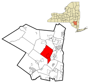
Marbletown is a town in Ulster County, New York, United States. The population was 5,658 at the 2020 census. It is located near the center of Ulster County, southwest of the City of Kingston.

Stone Ridge, New York
CDP in New York, United States
Distance: Approx. 3743 meters
Latitude and longitude: 41.84583333,-74.15638889
Stone Ridge is a hamlet (and census-designated place) in Ulster County, New York, United States. The population was 1,234 at the 2020 census. Stone Ridge is located in the Town of Marbletown, along US 209 where it overlaps NY 213.
SUNY Ulster
Community college in Stone Ridge, New York, U.S.
Distance: Approx. 4504 meters
Latitude and longitude: 41.852925,-74.13115
SUNY Ulster (Ulster County Community College) is a public community college with its main campus in Stone Ridge, New York, in Ulster County. It is part of the State University of New York (SUNY) system. The college also maintains facilities in Kingston at the Kingston Center of SUNY Ulster (KCSU).

Catskill Aqueduct
Aqueduct supplying New York City with water
Distance: Approx. 4424 meters
Latitude and longitude: 41.84861111,-74.13722222
The Catskill Aqueduct, part of the New York City water supply system, brings water from the Catskill Mountains to Yonkers where it connects to other parts of the system.

Cornelius Wynkoop Stone House
United States historic place
Distance: Approx. 4142 meters
Latitude and longitude: 41.84666667,-74.14527778
The Cornelius Wynkoop Stone House is located along US 209 in the hamlet of Stone Ridge, New York, United States. It is a stone house in the Georgian style, built from 1767 to 1772 for Cornelius Evert Wynkoop. It is a contributing property to the Main Street Historic District, and was added to the National Register of Historic Places in its own right in 1996.

Ashokan Bridge
United States historic place
Distance: Approx. 5935 meters
Latitude and longitude: 41.92658056,-74.19933889
Ashokan Bridge (also known as the Turnwood Bridge or New Paltz Campus Bridge) is a wooden covered bridge over Esopus Creek on the grounds of the Ashokan Center, in Ulster County, New York, United States. It was built in 1885, and is a single span, gable roofed, covered timber bridge. It measures 72 feet, 6 inches, long and 16 feet, 4 inches, wide.
Krumville, New York
Distance: Approx. 5632 meters
Latitude and longitude: 41.88472222,-74.2425
Krumville (also Kromville) is a hamlet in the southeastern corner of the town of Olive in Ulster County, New York, United States. It takes its name from one of the most prominent of the early Dutch families who settled the area. Krumville is bordered on the northwest by the Olive hamlet of Samsonville, on the north by the hamlet of Olivebridge, on the southeast by the town of Marbletown and on the southwest by the town of Rochester.

Main Street Historic District (Stone Ridge, New York)
Historic district in New York, United States
Distance: Approx. 4088 meters
Latitude and longitude: 41.84777778,-74.14444444
The Main Street Historic District in Stone Ridge, New York, United States, is located along US 209/NY 213 in that hamlet, part of the Town of Marbletown in Ulster County. It is a strip from the southern end of the unincorporated community to a short distance north of the intersection at Cooper Street, where the 209/213 concurrency ends. The latter highway turns left (northwest) towards the Catskill Mountains.

Sahler Stone House and Dutch Barn
Historic house in New York, United States
Distance: Approx. 5914 meters
Latitude and longitude: 41.82583333,-74.19777778
Sahler Stone House and Dutch Barn is a historic home and Dutch barn located at Rochester in Ulster County, New York. The house was built about 1780 and is a five-bay, 1+1⁄2-story linear plan stone and frame gable ended house. It was restored in 1957.
J. Sahler House
Historic house in New York, United States
Distance: Approx. 5911 meters
Latitude and longitude: 41.82444444,-74.19083333
J. Sahler House, also known as Elm Rock, is a historic home located at Rochester in Ulster County, New York. It is a 1+1⁄2-story, Federal-style brick house built about 1807. Also on the property is a small barn.

Jacob F. Markle Stone House
Historic house in New York, United States
Distance: Approx. 5942 meters
Latitude and longitude: 41.83305556,-74.2175
Jacob F. Markle Stone House is a historic home located at Rochester in Ulster County, New York. It is a 1+1⁄2-story, five-bay stone dwelling built about 1770 upon a linear plan. Also on the property is a 1+1⁄2-story gable-front frame shed.

Kripplebush Historic District
Historic district in New York, United States
Distance: Approx. 4353 meters
Latitude and longitude: 41.83833333,-74.18805556
Kripplebush Historic District is a national historic district located at Marbletown in Ulster County, New York. The district includes 33 contributing buildings. It encompasses a variety of stone and frame dwellings and outbuildings at the hamlet of Kripplebush.
Weather in this IP's area
light snow
-3 Celsius
-7 Celsius
-4 Celsius
-2 Celsius
1013 hPa
74 %
1013 hPa
982 hPa
266 meters
2.68 m/s
2.68 m/s
22 degree
100 %