198.144.12.40 - IP Lookup: Free IP Address Lookup, Postal Code Lookup, IP Location Lookup, IP ASN, Public IP
Country:
Region:
City:
Location:
Time Zone:
Postal Code:
IP information under different IP Channel
ip-api
Country
Region
City
ASN
Time Zone
ISP
Blacklist
Proxy
Latitude
Longitude
Postal
Route
Luminati
Country
Region
mn
City
minneapolis
ASN
Time Zone
America/Chicago
ISP
ENVENTIS
Latitude
Longitude
Postal
IPinfo
Country
Region
City
ASN
Time Zone
ISP
Blacklist
Proxy
Latitude
Longitude
Postal
Route
IP2Location
198.144.12.40Country
Region
minnesota
City
duluth
Time Zone
America/Chicago
ISP
Language
User-Agent
Latitude
Longitude
Postal
db-ip
Country
Region
City
ASN
Time Zone
ISP
Blacklist
Proxy
Latitude
Longitude
Postal
Route
ipdata
Country
Region
City
ASN
Time Zone
ISP
Blacklist
Proxy
Latitude
Longitude
Postal
Route
Popular places and events near this IP address

Saint Louis River (Lake Superior tributary)
River in Minnesota and Wisconsin
Distance: Approx. 1925 meters
Latitude and longitude: 46.75,-92.1
The Saint Louis River (abbreviated St. Louis River) is a river in the U.S. states of Minnesota and Wisconsin that flows into Lake Superior. The largest U.S. river to flow into the lake, it is 192 miles (309 km) in length and starts 13 miles (21 km) east of Hoyt Lakes, Minnesota.

USCGC Sundew
U.S. Coast Guard cutter
Distance: Approx. 1532 meters
Latitude and longitude: 46.77633333,-92.10444444
USCGC Sundew (WLB-404) was a 180-foot (55 m) sea going buoy tender (WLB). An Iris, or C-class tender, it was built by Marine Iron and Shipbuilding Corporation in Duluth, Minnesota, United States. Sundew's preliminary design was completed by the United States Lighthouse Service and the final design was produced by Marine Iron and Shipbuilding Corporation in Duluth for the U.S. Coast Guard.

North Shore Scenic Railroad
Heritage Railroad
Distance: Approx. 2067 meters
Latitude and longitude: 46.78138889,-92.10361111
The North Shore Scenic Railroad (reporting mark LSRX) is a heritage railroad that operates between Duluth and Two Harbors, Minnesota, United States, along 28 miles (45 km) of the Lakefront Line, once part of the Duluth, Missabe and Iron Range Railroad. Owned by the Lake Superior Railroad Museum, the NSSR operates out of the former Duluth Union Depot, now the St. Louis County Depot.

Lincoln Park (Duluth)
Neighborhood of Duluth, Minnesota
Distance: Approx. 1815 meters
Latitude and longitude: 46.7673,-92.1376
Lincoln Park is a neighborhood in Duluth, Minnesota, United States. Located between Garfield Avenue and Carlton Street (34th Avenue West), it stretches up the hillside to Skyline Parkway. The neighborhood is named after the municipal park within its boundaries.

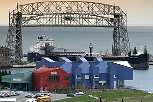
Great Lakes Aquarium
Public aquarium in Duluth, Minnesota, United States
Distance: Approx. 1975 meters
Latitude and longitude: 46.77926667,-92.10027778
The Great Lakes Aquarium opened in 2000 and is located on the Duluth waterfront. A 501(c)(3) private nonprofit, Great Lakes Aquarium features animals and habitats found within the Great Lakes basin and other worldwide ecosystems such as the Amazon River or Pacific reefs. The aquarium houses 205 different species of fish, birds, reptiles, amphibians, and mammals.

John A. Blatnik Bridge
Highway bridge connecting Duluth, MN and Superior, WI
Distance: Approx. 1955 meters
Latitude and longitude: 46.749133,-92.101286
The John A. Blatnik Bridge is the bridge that carries Interstate 535 (I-535) and U.S. Highway 53 (US 53) over the Saint Louis River, a tributary of Lake Superior, between Duluth, Minnesota, and Superior, Wisconsin. The bridge is 7,975 feet (2,431 m) long and rises up nearly 120 feet (37 m) above the water to accommodate the seaway shipping channel. It was dedicated on December 2, 1961, but was renamed for Congressman John Blatnik on September 24, 1971, to commemorate Blatnik's role in making the bridge a reality.

U.S. Army Corps of Engineers Duluth Vessel Yard
United States historic place
Distance: Approx. 2059 meters
Latitude and longitude: 46.77555556,-92.09277778
The U.S. Army Corps of Engineers Duluth Vessel Yard is a federal port facility in Duluth, Minnesota, United States. It houses the United States Army Corps of Engineers (USACE) resources used to maintain the harbors of the Twin Ports of Duluth and Superior, Wisconsin. It was established on Minnesota Point in 1903, though most of its present configuration dates to a flurry of construction in 1941.

Enger Tower
Building in Duluth, Minnesota
Distance: Approx. 1551 meters
Latitude and longitude: 46.77611111,-92.125
Enger Tower is an 80-foot (24 m), five-story stone observation tower atop Enger Hill in Duluth, Minnesota.

Duluth Depot
Arts and Culture Center in Minnesota, United States
Distance: Approx. 2058 meters
Latitude and longitude: 46.78138889,-92.10388889
The St. Louis County Depot is a historic railroad station in Duluth, Minnesota, United States. It was built as a union station in 1892, serving seven railroads at its peak.
Veterans' Memorial Hall (Duluth, Minnesota)
Distance: Approx. 2039 meters
Latitude and longitude: 46.78130556,-92.10425
Veterans Memorial Hall, or VMH, located in Duluth, Minnesota, is a program of the Saint Louis County, Minnesota, Historical Society. It is located at the Saint Louis County Heritage and Arts Center (the Depot). Its mission is to collect veterans' stories and artifacts, to maintain a permanent exhibit recognizing the military service of local veterans and units, and to educate the public about local veteran history.

Lincoln Branch Library
United States historic place
Distance: Approx. 1163 meters
Latitude and longitude: 46.76675,-92.12902778
The Lincoln Branch Library is a former Carnegie library building in the Lincoln Park neighborhood of Duluth, Minnesota, United States. It was constructed from 1915 to 1917 as the first permanent home of a Duluth Public Library branch first established in 1892. The Lincoln Branch Library was built of brick and limestone in the Late Gothic Revival style.

Bent Paddle Brewing Company
Distance: Approx. 707 meters
Latitude and longitude: 46.767726,-92.12201
Bent Paddle Brewing Company is a microbrewery located in Duluth, Minnesota. In May 2013, their brewery and taproom opened to the public with distribution of kegs and cans in the Duluth area beginning shortly thereafter. In November 2013, limited distribution of cans to liquor stores in the Minneapolis-St.
Weather in this IP's area
mist
-2 Celsius
-7 Celsius
-2 Celsius
-1 Celsius
1023 hPa
86 %
1023 hPa
988 hPa
10000 meters
5.14 m/s
170 degree
100 %