Country:
Region:
City:
Latitude and Longitude:
Time Zone:
Postal Code:
IP information under different IP Channel
ip-api
Country
Region
City
ASN
Time Zone
ISP
Blacklist
Proxy
Latitude
Longitude
Postal
Route
Luminati
Country
Region
nh
City
dunbartoncenter
ASN
Time Zone
America/New_York
ISP
GSINET
Latitude
Longitude
Postal
IPinfo
Country
Region
City
ASN
Time Zone
ISP
Blacklist
Proxy
Latitude
Longitude
Postal
Route
db-ip
Country
Region
City
ASN
Time Zone
ISP
Blacklist
Proxy
Latitude
Longitude
Postal
Route
ipdata
Country
Region
City
ASN
Time Zone
ISP
Blacklist
Proxy
Latitude
Longitude
Postal
Route
Popular places and events near this IP address

Weare, New Hampshire
Town in New Hampshire, United States
Distance: Approx. 9518 meters
Latitude and longitude: 43.09472222,-71.73055556
Weare is a town in Hillsborough County, New Hampshire, United States. The population was 9,092 at the 2020 census. It is close to two important New Hampshire cities, Manchester and Concord.

Bow, New Hampshire
Town in New Hampshire, United States
Distance: Approx. 6038 meters
Latitude and longitude: 43.13194444,-71.54916667
Bow is a town in Merrimack County, New Hampshire, United States. The population was 8,229 at the 2020 census, up from 7,519 at the 2010 census, an increase of 9.4%.

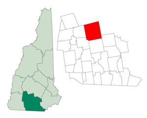
Dunbarton, New Hampshire
Town in New Hampshire, United States
Distance: Approx. 429 meters
Latitude and longitude: 43.1025,-71.61638889
Dunbarton is a town in Merrimack County, New Hampshire, United States. The population was 3,005 at the 2020 census, up from 2,758 at the 2010 census.

Turkey Ponds
Distance: Approx. 8065 meters
Latitude and longitude: 43.17527778,-71.585
Turkey Pond and Little Turkey Pond are a connected pair of water bodies located in Merrimack County in central New Hampshire, United States, in the city of Concord. The two ponds' elevations are controlled by a single dam at the outlet of Little Turkey Pond. The combined surface area of the two ponds is 332 acres (1.34 km2).

South Branch Piscataquog River
River in New Hampshire, United States
Distance: Approx. 9271 meters
Latitude and longitude: 43.02305556,-71.62305556
The South Branch of the Piscataquog River is a 20.5-mile-long (33.0 km) river located in southern New Hampshire in the United States. It is a tributary of the Piscataquog River, part of the Merrimack River watershed. The South Branch of the Piscataquog begins at the outlet of Pleasant Pond in Francestown, New Hampshire.

Bow High School
Public high school
Distance: Approx. 7563 meters
Latitude and longitude: 43.15388889,-71.54833333
Bow High School is a four-year public high school in Bow, New Hampshire, United States, and is part of the Bow School District (SAU 67). The principal is Matt Fisk and the vice principal is Brenda Barth. As of the 2022-2023 school year, the school had an approximate enrollment of 604 students and 35 classroom teachers (on an FTE basis), for a student-teacher ratio of 17.26.

Dimond Hill Farm
United States historic place
Distance: Approx. 9460 meters
Latitude and longitude: 43.19105,-71.61769
The Dimond Hill Farm is a historic farm at 314 Hopkinton Road (U.S. Route 202) in the western rural section of Concord, New Hampshire. Established on land that was first farmed by Ezekiel Dimond in the mid-18th century, this area has been farmed by the members of the Abbott-Presby family since 1827, and is one of the few remaining working farms in the city. The main house is an 1892 rambling structure that connects the family living space with the large barn, which dates to c.

Howe-Quimby House
Historic house in New Hampshire, United States
Distance: Approx. 9091 meters
Latitude and longitude: 43.15805556,-71.70083333
The Howe-Quimby House is a historic house on Sugar Hill Road in Hopkinton, New Hampshire. Built about 1780, it is a well-preserved example of a rural 18th-century farmhouse with later stylistic modifications. The house was listed on the National Register of Historic Places in 1980.

Parker's Store
United States historic place
Distance: Approx. 8975 meters
Latitude and longitude: 43.02611111,-71.62833333
Parker's Store is a historic retail building at 18 Parker Station Road in Goffstown, New Hampshire. The two-story wood-frame structure was built before 1804, and is one of the state's few surviving early retail structures. It has been home to the Goffstown Historical Society since 1973, when it was donated by the Parker family.

Weare Town House
United States historic place
Distance: Approx. 9524 meters
Latitude and longitude: 43.09583333,-71.73083333
The Weare Town House is a historic New England meeting house on New Hampshire Route 114 in Weare, New Hampshire. Built in 1837, it is a good example of a period town hall/church combination with Federal and Gothic Revival features. Although its religious use has ended, it continues to be used for town offices as well as civic and social functions.

Clough State Park
State park in Hillsborough County, New Hampshire
Distance: Approx. 3609 meters
Latitude and longitude: 43.0967,-71.657
Clough State Park is a public recreation area on the east side of Everett Lake, a 150-acre (60 ha) reservoir formed by a dam on the Piscataquog River, in Weare, New Hampshire. The state park has a 900-foot (270 m) sandy beach, playing fields, and picnic area and offers opportunities for swimming, hiking, fishing, picnicking, and non-motorized boating.

Upton-Morgan State Forest
State forest in Merrimack County, New Hampshire
Distance: Approx. 8754 meters
Latitude and longitude: 43.17666667,-71.56694444
Upton-Morgan State Forest is a 21-acre (8.5 ha) state forest in Concord, New Hampshire. It has a short interpretive trail. It is located in the southwest part of Concord off Silk Farm Road and is bordered to the northwest by New Hampshire Route 13 (Clinton Street) and to the northeast by Interstate 89.
Weather in this IP's area
clear sky
3 Celsius
1 Celsius
2 Celsius
4 Celsius
1031 hPa
63 %
1031 hPa
1004 hPa
10000 meters
2.06 m/s
310 degree
06:24:17
16:35:41