Country:
 South Africa
Region:
City:
Latitude and Longitude:
Time Zone:
Postal Code:
IP information under different IP Channel
ip-api
Country
Region
City
ASN
Time Zone
ISP
Blacklist
Proxy
Latitude
Longitude
Postal
Route
IPinfo
Country
Region
City
ASN
Time Zone
ISP
Blacklist
Proxy
Latitude
Longitude
Postal
Route
MaxMind
Country
Region
City
ASN
Time Zone
ISP
Blacklist
Proxy
Latitude
Longitude
Postal
Route
Luminati
Country
ZAASN
Time Zone
Africa/Johannesburg
ISP
Hetzner Online GmbH
Latitude
Longitude
Postal
db-ip
Country
Region
City
ASN
Time Zone
ISP
Blacklist
Proxy
Latitude
Longitude
Postal
Route
ipdata
Country
Region
City
ASN
Time Zone
ISP
Blacklist
Proxy
Latitude
Longitude
Postal
Route
Popular places and events near this IP address
Kraaifontein
Town in Western Cape, South Africa
Distance: Approx. 3378 meters
Latitude and longitude: -33.84416667,18.69861111
Kraaifontein is a town in the Western Cape province of South Africa and is located on the north-eastern outskirts of the City of Cape Town Metropolitan Municipality. The name originated from large number of crows (Kraai in Afrikaans) that nest in the region.

Monument Park High School
School in Kraaifontein, Western Cape, South Africa
Distance: Approx. 4553 meters
Latitude and longitude: -33.838532,18.714577
Monument Park High School is a public funded government school in Kraaifontein, Western Cape, South Africa

Brackenfell
Town in the Western Cape, South Africa
Distance: Approx. 4400 meters
Latitude and longitude: -33.86666667,18.68333333
Brackenfell is a town in the Western Cape province of South Africa, situated on the N1 about 30 km (17 mi) north-east of Cape Town and 35 km (22 mi) south-west of Paarl. Regarded as the “gateway” to the Cape Winelands, the town marks the start of the Bottelary Hills Wine Route which follows the scenic Bottelary Road to Stellenbosch, about 22 kilometres (14 mi) to the south-east.

Durbanville
Town in Western Cape, South Africa
Distance: Approx. 1784 meters
Latitude and longitude: -33.8325,18.6475
Durbanville, previously called Pampoenkraal, is a town in the Western Cape province of South Africa, part of the greater Cape Town metropolitan area. It is a semi-rural residential suburb on the north-eastern outskirts of the metropolis surrounded by farms producing wine and wheat.

Uitkamp Wetlands
Wetland reserve in Durbanville in the Western Cape
Distance: Approx. 2846 meters
Latitude and longitude: -33.8159,18.6406
Uitkamp Wetland Nature Reserve is a 32-hectare (79-acre) wetland reserve located in Durbanville in the Western Cape province of South Africa . A wetland valley that was proclaimed a nature reserve in 2001, this park lies within a region of Swartland Shale Renosterveld.
Durbanville Nature Reserve
Piece of protected land next to the Durbanville Racecourse
Distance: Approx. 2459 meters
Latitude and longitude: -33.84082,18.64352
Durbanville Nature Reserve is a 6-hectare (15-acre) piece of protected land, located next to the Hollywoodbets Durbanville Racecourse in the Western Cape, South Africa.

Stellenberg High School
School in Cape Town, Western Cape, South Africa
Distance: Approx. 3808 meters
Latitude and longitude: -33.8637,18.662
Stellenberg High School is a public dual-medium (Afrikaans and English), co-educational high school located in Stellenberg, Bellville in the Western Cape province of South Africa. It is one of the top and prestigious schools in the Western Cape. The high school was established in 1986.
Durbanville College
College in South Africa
Distance: Approx. 1812 meters
Latitude and longitude: -33.834,18.6476
Durbanville College was an institution for higher education and registered under South African law. It was situated in Durbanville, South Africa and affiliated with the University of South Africa. It was a private institution.
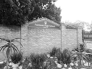
Fairmont High School, Durbanville
School in Durbanville, Western Cape, South Africa
Distance: Approx. 3582 meters
Latitude and longitude: -33.8537,18.6407
Fairmont High School is a public English medium co-educational high school situated in the town of Durbanville in the Western Cape province of South Africa.

Durbanville High School
High school in Durbanville, South Africa
Distance: Approx. 2169 meters
Latitude and longitude: -33.830579,18.643065
Hoërskool Durbanville is a public Afrikaans medium co-educational high school situated in the town of Durbanville in the Western Cape province of South Africa. It is a public school. It is the oldest High School in the Northern Suburbs of Cape Town, and the only other school older in the Greater Cape Town metropolitan area is Simons Town School in the southern suburbs.
Brackenfell High School
Public high school in Brackenfell, Western Cape, South Africa
Distance: Approx. 5029 meters
Latitude and longitude: -33.87152778,18.68705556
Brackenfell High School (Afrikaans: Hoërskool Brackenfell) is a public, co-educational high school in Brackenfell, Western Cape, South Africa. It was established on 26 January 1976 on a 1-acre (0.40 ha) plot of land donated by Janet Brink, the widow of Andries Brink.

Dutch Reformed Church, Durbanville
Church in Durbanville, South Africa
Distance: Approx. 1997 meters
Latitude and longitude: -33.83665,18.64659
The Dutch Reformed Church in Durbanville is a church building of the Dutch Reformed Church in Durbanville, South Africa, built in 1825 in the Cape Dutch style. The village was then still called Pompoenkraal. A separate bell tower has been built near the church with a bell visible from the outside.
Weather in this IP's area
clear sky
14 Celsius
13 Celsius
13 Celsius
14 Celsius
1021 hPa
62 %
1021 hPa
1007 hPa
10000 meters
4.63 m/s
130 degree
06:03:23
18:58:22