197.189.185.71 - IP Lookup: Free IP Address Lookup, Postal Code Lookup, IP Location Lookup, IP ASN, Public IP
Country:
Region:
City:
Location:
Time Zone:
Postal Code:
IP information under different IP Channel
ip-api
Country
Region
City
ASN
Time Zone
ISP
Blacklist
Proxy
Latitude
Longitude
Postal
Route
Luminati
Country
ASN
Time Zone
Africa/Maseru
ISP
VODACOM-LESOTHO
Latitude
Longitude
Postal
IPinfo
Country
Region
City
ASN
Time Zone
ISP
Blacklist
Proxy
Latitude
Longitude
Postal
Route
IP2Location
197.189.185.71Country
Region
leribe
City
leribe
Time Zone
Africa/Maseru
ISP
Language
User-Agent
Latitude
Longitude
Postal
db-ip
Country
Region
City
ASN
Time Zone
ISP
Blacklist
Proxy
Latitude
Longitude
Postal
Route
ipdata
Country
Region
City
ASN
Time Zone
ISP
Blacklist
Proxy
Latitude
Longitude
Postal
Route
Popular places and events near this IP address

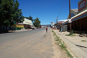
Hlotse
Place in Leribe District, Lesotho
Distance: Approx. 376 meters
Latitude and longitude: -28.87336111,28.04158333
Hlotse (also Leribe) is an important market town in Lesotho. It is situated on the Hlotse River, near the South African border. The town was founded in 1876 by a British missionary, Reverend John Widdicombe.
Roman Catholic Diocese of Leribe
Roman Catholic diocese in Lesotho
Distance: Approx. 9171 meters
Latitude and longitude: -28.9005,27.9568
The Roman Catholic Diocese of Leribe (Latin: Leriben(sis)) is a diocese located in the city of Leribe in the ecclesiastical province of Maseru in Lesotho.
Sandstone Estates
Distance: Approx. 5120 meters
Latitude and longitude: -28.8449,28.0024
Sandstone Estates (Pty) Ltd is a large commercial agricultural enterprise covering over 7,000 hectares (17,000 acres), located on the border with Lesotho in South Africa's Eastern Free State province, close to the Maluti Mountains. The nearest town is Ficksburg, 14 kilometres (8.7 mi) away on the R26. It is a hub of transport preservation.
Leribe Airport
Airport in Lesotho
Distance: Approx. 1961 meters
Latitude and longitude: -28.85555556,28.05277778
Leribe Airport (IATA: LRB, ICAO: FXLR) is an airport serving Hlotse, the camptown (capital) of the Leribe District of Lesotho. The runway is in a large, open field with many cross trails, but does have some side markers along its length. It is less than 2 kilometres (1.2 mi) from the border with South Africa.
Weather in this IP's area
overcast clouds
24 Celsius
23 Celsius
24 Celsius
24 Celsius
1008 hPa
52 %
1008 hPa
838 hPa
10000 meters
2.41 m/s
3.81 m/s
23 degree
100 %