197.158.241.12 - IP Lookup: Free IP Address Lookup, Postal Code Lookup, IP Location Lookup, IP ASN, Public IP
Country:
Region:
City:
Location:
Time Zone:
Postal Code:
ISP:
ASN:
language:
User-Agent:
Proxy IP:
Blacklist:
IP information under different IP Channel
ip-api
Country
Region
City
ASN
Time Zone
ISP
Blacklist
Proxy
Latitude
Longitude
Postal
Route
db-ip
Country
Region
City
ASN
Time Zone
ISP
Blacklist
Proxy
Latitude
Longitude
Postal
Route
IPinfo
Country
Region
City
ASN
Time Zone
ISP
Blacklist
Proxy
Latitude
Longitude
Postal
Route
IP2Location
197.158.241.12Country
Region
baie sainte anne
City
cote d'or
Time Zone
Indian/Mahe
ISP
Language
User-Agent
Latitude
Longitude
Postal
ipdata
Country
Region
City
ASN
Time Zone
ISP
Blacklist
Proxy
Latitude
Longitude
Postal
Route
Popular places and events near this IP address

Praslin
Island in the Seychelles, Somali Sea
Distance: Approx. 1341 meters
Latitude and longitude: -4.33,55.74666667
Praslin (French pronunciation: [pʁalɛ̃]) is the second largest island (38.5 km2) of the Inner Seychelles, lying 44 km (27 mi) northeast of Mahé. Praslin has a population of around 7,533 people and comprises two administrative districts: Baie Sainte Anne and Grand' Anse. The main settlements are the Baie Ste Anne, Anse Volbert and Grand' Anse.
Curieuse Island
Island & national park in the Seychelles
Distance: Approx. 5253 meters
Latitude and longitude: -4.28333333,55.72361111
Curieuse Island is a small granitic island 1.13 sq mi (2.9 km2) in the Seychelles close to the north coast of the island of Praslin. Curieuse is notable for its bare red earth intermingled with the unique coco de mer palms, one of the cultural icons of the Seychelles, only growing on the two neighboring islands.

Baie Saint Anne
District in Seychelles
Distance: Approx. 2262 meters
Latitude and longitude: -4.31667,55.7333
Baie Sainte Anne (French pronunciation: [bɛ sɛ̃t an]) is an administrative district of Seychelles located mostly on the island of Praslin, but also administers Curieuse Island and some other smaller islands.

Grand'Anse Praslin
District in Seychelles
Distance: Approx. 3675 meters
Latitude and longitude: -4.33111111,55.72222222
Grand'Anse Praslin is an administrative district of Seychelles located mostly on the island of Praslin, but also administers Cousin Island, Cousine Island, Booby Island, and Aride Island.

Vallée de Mai
Protected area
Distance: Approx. 2039 meters
Latitude and longitude: -4.32916667,55.7375
Vallée de Mai Nature Reserve ("May Valley") is a nature park and UNESCO World Heritage Site on the island of Praslin, Seychelles. It consists of a well-preserved palm forest, flagship species made up of the island endemic coco de mer, as well as five other endemic palms. The coco de mer (Lodoicea maldivica), a monocot tree in the Arecaceae (palm family), has the largest seeds (double nut seed) of any plant in the world.
Anse Lazio
Beach situated in the northwest of Praslin Island, Seychelles
Distance: Approx. 6450 meters
Latitude and longitude: -4.29361111,55.70166667
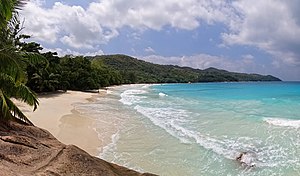
Anse Lazio is a beach situated in the northwest of Praslin Island, Seychelles, considered by Lonely Planet to be the "best beach on Praslin", and one of the "best in the archipelago".

Praslin National Park and surrounding areas Important Bird Area
National park in the Seychelles
Distance: Approx. 2677 meters
Latitude and longitude: -4.33333333,55.73333333
The Praslin National Park and surrounding areas Important Bird Area lies in the southern part of the island of Praslin in the Seychelles archipelago of the western Indian Ocean.
Eve Island, Seychelles
Island in Seychelles
Distance: Approx. 2629 meters
Latitude and longitude: -4.342,55.762
Eve is an island in Seychelles, lying east of Praslin and west of Round Island, Seychelles. It has an area of 0.29 km2.
Chauve Souris, Praslin
Distance: Approx. 1383 meters
Latitude and longitude: -4.31019444,55.74575
Chauve Souris is an island in Seychelles, lying 400 m northeast of the island of Praslin. Another nearby island - Saint-Pierre Island is located immediately in the north. The island is a granite island covered with tropical forest.
St. Pierre Island, Praslin
Distance: Approx. 1712 meters
Latitude and longitude: -4.305,55.75
Ile St. Pierre is an uninhabited island of the Seychelles. It is located north of the island of Praslin in the east of Curieuse Island on the edge of the Curieuse Marine National Park.
Stade d'Amitié
Distance: Approx. 7118 meters
Latitude and longitude: -4.3216,55.6893
Stade d’Amitié or Amitié Stadium is a multi-purpose stadium located in Praslin, Seychelles. It is used mostly for football matches and is the home stadium of Seychellois football clubs Revengers FC and Côte d'Or FC. In 2006 and 2010, two Goal Projects by FiFA were approved at the stadium. The first one replaced the natural grass pitch with artificial turf, and the second one included the construction of terraces, dressing rooms, toilets, and lights.
Praslin Power Station
Diesel-fueled power plant in Baie Saint Anne, Seychelles
Distance: Approx. 2225 meters
Latitude and longitude: -4.33977778,55.75630556
The Praslin Power Station or Baie Ste Anne Power Station is a fossil fuel power station in Baie Saint Anne, Seychelles.
Weather in this IP's area
clear sky
27 Celsius
29 Celsius
27 Celsius
27 Celsius
1011 hPa
73 %
1011 hPa
1009 hPa
10000 meters
2.51 m/s
2.41 m/s
345 degree
8 %
