196.97.1.39 - IP Lookup: Free IP Address Lookup, Postal Code Lookup, IP Location Lookup, IP ASN, Public IP
Country:
Region:
City:
Location:
Time Zone:
Postal Code:
IP information under different IP Channel
ip-api
Country
Region
City
ASN
Time Zone
ISP
Blacklist
Proxy
Latitude
Longitude
Postal
Route
Luminati
Country
Region
30
City
nairobi
ASN
Time Zone
Africa/Nairobi
ISP
SAFARICOM-LIMITED
Latitude
Longitude
Postal
IPinfo
Country
Region
City
ASN
Time Zone
ISP
Blacklist
Proxy
Latitude
Longitude
Postal
Route
IP2Location
196.97.1.39Country
Region
kajiado
City
kiserian
Time Zone
Africa/Nairobi
ISP
Language
User-Agent
Latitude
Longitude
Postal
db-ip
Country
Region
City
ASN
Time Zone
ISP
Blacklist
Proxy
Latitude
Longitude
Postal
Route
ipdata
Country
Region
City
ASN
Time Zone
ISP
Blacklist
Proxy
Latitude
Longitude
Postal
Route
Popular places and events near this IP address

Ngong Hills
Range of hills in Kenya
Distance: Approx. 6662 meters
Latitude and longitude: -1.4,36.63333333
The Ngong Hills are peaks in a ridge along the Great Rift Valley, located southwest near Nairobi, in southern Kenya. The word "Ngong" is an Anglicization of a Maasai phrase "enkong'u emuny" meaning rhinoceros spring, and this name derives from a spring located near Ngong Town. The Ngong Hills, from the eastside slopes, overlook the Nairobi National Park and, off to the north, the city of Nairobi.

Giraffe Centre
Zoo in Langata, Kenya
Distance: Approx. 8570 meters
Latitude and longitude: -1.374469,36.742324
The Giraffe Centre is located in Lang'ata, approximately 20 kilometres (12 mi) from the centre of Nairobi, Kenya. It was established in order to protect the vulnerable giraffe, that is found only in the grasslands of East Africa. In 1979, the Giraffe Center, a nature sanctuary for visiting and including wildlife conservation education for urban school children, was started by Jock Leslie Melville, the Kenyan grandson of a Scottish Earl, when he and his wife Betty captured two baby giraffe to start a programme of breeding giraffe on their Langata property, site of the present Centre.
Adventist University of Africa
Pan-African postgraduate University
Distance: Approx. 4968 meters
Latitude and longitude: -1.401239,36.722595

Giraffe Manor
Small hotel in Nairobi, Kenya
Distance: Approx. 8679 meters
Latitude and longitude: -1.3756,36.7447
Giraffe Manor is a small hotel in the Lang'ata suburb of Nairobi, Kenya which, together with its associated Giraffe Centre, serves as a home to a number of endangered Rothschild's giraffes, and operates a breeding programme to reintroduce breeding pairs back into the wild to secure the future of the subspecies.

Kiserian
Place in Rift Valley Province, Kenya
Distance: Approx. 284 meters
Latitude and longitude: -1.43,36.687
Kiserian is a town in Kenya's Rift Valley Province, Kajiado County. Kiserian Town is bordered by Ongata Rongai, Ngong Town, Enoomatasiani Town and Kisamis Town. It is located on the boundary between Kajiado North and Kajiado West constituencies.
Matathia
Place in Rift Valley Province, Kenya
Distance: Approx. 3146 meters
Latitude and longitude: -1.4,36.68
Matasia is a settlement in Kenya's Rift Valley Province.

2012 Kenya Police helicopter crash
2012 aviation accident in Kenya
Distance: Approx. 7963 meters
Latitude and longitude: -1.37361111,36.63944444
On 10 June 2012, an aviation accident occurred involving a Kenya Police helicopter. The Eurocopter AS350 crashed on a hill, killing all six people on board. Among the fatalities were Kenya's Interior Security Minister George Saitoti and his Assistant Minister Joshua Orwa Ojode.

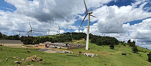
Ngong Hills Wind Power Station
Wind power station in Kenya
Distance: Approx. 7669 meters
Latitude and longitude: -1.38111111,36.63555556
Ngong Hills Wind Power Station, also Ngong Hills Wind Farm, is a wind-powered power station in Kenya.

Kiserian Dam
Distance: Approx. 1606 meters
Latitude and longitude: -1.4379,36.6965
Kiserian Dam is a water catchment project by the government of Kenya located in Kiserian Town, Keekonyokie Ward. The dam construction started in 2008 and ended in 2013. The dam has a height of 18 metres and a capacity of 1.8 million litres.
Choice Microfinance Bank
Distance: Approx. 8599 meters
Latitude and longitude: -1.39766667,36.75777778
Choice Microfinance Bank, whose full name is Choice Microfinance Bank Kenya Limited or CMBKL, is a deposit-taking microfinance bank in Kenya, licensed by the Central Bank of Kenya, the national banking regulator.
Oloolua Forest
Urban forest in Nairobi, Kenya
Distance: Approx. 7427 meters
Latitude and longitude: -1.36194444,36.69888889
Oloolua Forest is an urban forest in the Karen area of Nairobi, Kenya. The forest, immediately adjacent to the Karen Blixen Farm, was gazetted in 1932 and is managed by the Kenya Forest Service. The forest is 618 hectares consisting of eight blocks separated by the Standard Gauge Railway and several road projects cutting through it.
Ngong Hills Forest Reserve
Protected area in Kenya
Distance: Approx. 5156 meters
Latitude and longitude: -1.41508333,36.64186111
Ngong Hills Forest Reserve is the protected area of the larger Ngong Hills, Ngong, Kenya. The reserve is located on the southern tip of the Rift Valley region, 25 kilometres (16 miles) away from Kenya's capital, Nairobi. With the tallest peak standing at an altitude of 2,460 meters (8,070 ft) above sea level, it is the highest point in Ngong.
Weather in this IP's area
few clouds
15 Celsius
14 Celsius
15 Celsius
15 Celsius
1018 hPa
77 %
1018 hPa
823 hPa
10000 meters
20 %