Country:
Region:
City:
Latitude and Longitude:
Time Zone:
Postal Code:
IP information under different IP Channel
ip-api
Country
Region
City
ASN
Time Zone
ISP
Blacklist
Proxy
Latitude
Longitude
Postal
Route
Luminati
Country
ASN
Time Zone
Africa/Accra
ISP
Ecoband
Latitude
Longitude
Postal
IPinfo
Country
Region
City
ASN
Time Zone
ISP
Blacklist
Proxy
Latitude
Longitude
Postal
Route
db-ip
Country
Region
City
ASN
Time Zone
ISP
Blacklist
Proxy
Latitude
Longitude
Postal
Route
ipdata
Country
Region
City
ASN
Time Zone
ISP
Blacklist
Proxy
Latitude
Longitude
Postal
Route
Popular places and events near this IP address

Parliament of Ghana
Parliament in Ghana since 1950
Distance: Approx. 1134 meters
Latitude and longitude: 5.55666667,-0.19
The Parliament of Ghana is the legislative body of the Government of Ghana.

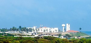
Ghana-India Kofi Annan Centre of Excellence in ICT
Advanced Information Technology Institute
Distance: Approx. 1344 meters
Latitude and longitude: 5.55958333,-0.19205556
The Ghana-India Kofi Annan Centre of Excellence in ICT (AITI-KACE) is Ghana's first Advanced Information Technology Institute (AITI). It was established in 2003, through a partnership between the government of Ghana and the government of India. The centre also houses West Africa's first supercomputer.

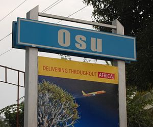
Osu, Accra
Suburb of Accra
Distance: Approx. 763 meters
Latitude and longitude: 5.55388889,-0.175
Located about 3 kilometres (1.9 mi) east of the central business district, Osu is a neighborhood in central Accra, Ghana, West Africa . It is locally known as the "West End" of Accra. Bounded to the south by the Gulf of Guinea, Osu's western boundary is the Independence Avenue.

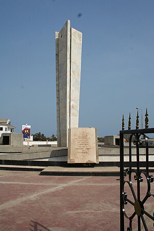
Liberation Day Monument
Distance: Approx. 1471 meters
Latitude and longitude: 5.55,-0.19
Liberation Day monument is a monument in Accra, Ghana. It stands in honour of several veterans of the Burma campaign conducted during the Second World War by Commonwealth forces in which the veterans fought for the British Empire. After returning to the Gold Coast, some of the veterans began a peaceful protest and marched towards Christiansborg Castle.

Osu Castle
Colonial fort in Ghana
Distance: Approx. 1333 meters
Latitude and longitude: 5.54694444,-0.1825
Osu Castle (also known as Fort Christiansborg or the Castle) is a castle located in Osu, Ghana, on the coast of the Gulf of Guinea in Africa. A substantial fort was built by Denmark-Norway in the 1660s; thereafter, the fort changed ownership between Denmark-Norway, Portugal, the Akwamu, Britain, and finally post-Independence Ghana. Under Denmark–Norway control it was the capital of the Danish Gold Coast, and held and dispatched enslaved people overseas.

East Ridge, Accra
Historic site in N: Tenth Road, E: Sir Charles Quist Street
Distance: Approx. 935 meters
Latitude and longitude: 5.5615,-0.1879
East Ridge is a neighborhood of Accra, Ghana bounded to the south and East by Sir Charles Quist Street. Independence Avenue serves as the district's western boundary. Castle Road separates East Ridge from the northern neighborhood of Osu.
Open University of West Africa
Educational institution in Ghana
Distance: Approx. 904 meters
Latitude and longitude: 5.5586,-0.1718
Open University of West Africa (OUWA) was founded in Ghana in November 2011 by John Roberts and Patrick Steele. With the goal to break the poverty cycle in West Africa through online education, John Roberts and his co-founder were inspired by a simple but contradictory observation: at the moment, higher education penetration in Africa was very low, many of the best universities around the world were beginning to put their courses online through platforms like Coursera, edX, Udacity etc. The two founders became driven by the idea of harnessing this “perfect storm” of free Open Educational Resources (OER), cheaper access to mobile technology, and the profound need to spur development through higher-ed in West African countries.
Labone Senior High School
Public high school
Distance: Approx. 1209 meters
Latitude and longitude: 5.564925,-0.171051
Labone Senior High School (popularly known as L-A Bone) is a public senior high school located in Labone in the Greater Accra Region of Ghana. It is noted for its success in the National Science and Maths Quiz, athletics, music and cultural activities.
Access Bank Ghana Plc
Ghanaian commercial bank
Distance: Approx. 1306 meters
Latitude and longitude: 5.5525,-0.19
Access Bank Ghana Plc, formerly Access Bank Ghana Limited, is a full service commercial bank in Ghana, licensed by the Bank of Ghana, the central bank and national banking regulator.

Ebenezer Presbyterian Church, Osu
Presbyterian church in Accra, Ghana
Distance: Approx. 714 meters
Latitude and longitude: 5.5542,-0.1846
The Ebenezer Presbyterian Church, formerly known as the Basel Mission Church, Christiansborg, is a historic Protestant church located in the suburb of Osu in Accra, Ghana. The church was founded by the Basel Evangelical Missionary Society in 1847. Previously near the Christiansborg Castle at a hamlet called Osu Amanfong, where a commemorative monument now stands, the church relocated northwards to its present location near the Salem School when a new chapel was constructed and consecrated in 1902.

Korle-Klottey Municipal District
Municipal District in Ghana
Distance: Approx. 763 meters
Latitude and longitude: 5.55388889,-0.175
Korle-Klottey Municipal District is one of the twenty-nine districts in Greater Accra Region, Ghana. Originally it was formerly part of the then-larger Accra Metropolitan District in 1988, until a small portion of the district was split off to create Korle-Klottey Municipal District on 19 February 2019; thus the remaining part has been retained as Accra Metropolitan District. The municipality is located in the central part of Greater Accra Region and has Osu as its capital town.

Assault on Osu
1678 Attack on Osu between Akwamu and Accrans forces
Distance: Approx. 763 meters
Latitude and longitude: 5.55388889,-0.175
The Assault on Osu (Danish: Angrebet på Orsu) was an assault on the coastal village of Osu Castle by the Kingdom of Akwamu against local Accrans, who received support from the Danes at Fort Christiansborg. The assault resulted in military failure for the Akwamu, mainly due to Danish artillery, and the Akwamu were forced to retreat.
Weather in this IP's area
mist
28 Celsius
33 Celsius
28 Celsius
28 Celsius
1011 hPa
83 %
1011 hPa
1009 hPa
5000 meters
1.03 m/s
20 %
05:49:28
17:41:30