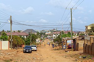
Country:
 Ghana
GhanaRegion:
City:
Latitude and Longitude:
Time Zone:
Postal Code:
IP information under different IP Channel
ip-api
Country
Region
City
ASN
Time Zone
ISP
Blacklist
Proxy
Latitude
Longitude
Postal
Route
IPinfo
Country
Region
City
ASN
Time Zone
ISP
Blacklist
Proxy
Latitude
Longitude
Postal
Route
MaxMind
Country
Region
City
ASN
Time Zone
ISP
Blacklist
Proxy
Latitude
Longitude
Postal
Route
Luminati
Country
GHASN
Time Zone
Africa/Accra
ISP
KNet
Latitude
Longitude
Postal
db-ip
Country
Region
City
ASN
Time Zone
ISP
Blacklist
Proxy
Latitude
Longitude
Postal
Route
ipdata
Country
Region
City
ASN
Time Zone
ISP
Blacklist
Proxy
Latitude
Longitude
Postal
Route
Popular places and events near this IP address
Carl Reindorf Park Stadium
Stadium in Dansoman, Ghana
Distance: Approx. 4740 meters
Latitude and longitude: 5.557904,-0.2721
Carl Reindorf Park Stadium, also called Dansoman Park Stadium, is a multi-use stadium in Dansoman, a suburb of Accra in Ghana.
University College of Management Studies
Private higher-education institution in Ghana
Distance: Approx. 4570 meters
Latitude and longitude: 5.5467,-0.3383
The University College of Management Studies is a private university college in Accra and Kumasi, Ghana. The school is affiliated with the School of Business of Kwame Nkrumah University of Science and Technology, Kumasi and the University of Education Winneba, Kumasi Campus.
Awoshie
Place in Greater Accra Region, Ghana
Distance: Approx. 3080 meters
Latitude and longitude: 5.58333333,-0.28333333
Awoshie is a town located in Ga central and Ablekuma North Municipal Districts of the Greater Accra Region of Ghana.

Mallam Interchange
Distance: Approx. 2980 meters
Latitude and longitude: 5.571264,-0.284093
The Mallam Interchange is a dual carriage road system flyover in Accra in the Greater Accra Region of Ghana. It is part of the six-lane, 14-kilometre (8.7 mi) George Walker Bush Highway funded by the United States' Millennium Challenge Corporation.
Gbawe
Town in Greater Accra Region, Ghana
Distance: Approx. 58 meters
Latitude and longitude: 5.57666667,-0.31083333
Gbawe is a town in the Greater Accra Region of southeastern Ghana near the capital Accra. Gbawe is the twenty-third largest settlement in Ghana, in terms of population, with a population of 74,403 people. Gbawe is located a few kilometres west of Accra in the Ga South Municipal Assembly.
Weija
District Capital in Greater Accra Region, Ghana
Distance: Approx. 2787 meters
Latitude and longitude: 5.56666667,-0.33333333
Weija is a small town and is the capital of Ga South Municipal District, a district in the Greater Accra Region of Ghana. Weija has become a hotspot for economic activity because of the ultra modern shopping center, the West Hills Mall, which has been built there.
Christian Methodist Senior High School
Mixed second cycle school in New Aplaku, Greater Accra Region, Ghana
Distance: Approx. 4316 meters
Latitude and longitude: 5.5445956,-0.3318889
Christian Methodist Senior High School is a co-educational and public secondary school located at New Aplaku in the Ga South Municipality of the Greater Accra Region of Ghana. In March 2024, students of the school were involved in a brawl with students of Ngleshie Amanfro Senior High School which resulted in the death of two students.
West Hills Mall
Shopping centre in Ghana
Distance: Approx. 4986 meters
Latitude and longitude: 5.54583333,-0.34277778
The West Hills Mall is a shopping centre located at Dukonah, near Weija along the Accra – Cape Coast Highway in the Greater Accra Region of Ghana.
Weija Dam
Dam in Accra, Greater Accra Region
Distance: Approx. 3828 meters
Latitude and longitude: 5.56972222,-0.34416667
Weija Dam is a dam on the Densu River which supports the main water treatment plant for Accra in the Greater Accra Region of Ghana. It is operated by the Ghana Water Company.This supplies about 80 percent of the potable water for the entire city of Accra and its surrounding environs. Its construction began in 1974 and was completed in 1978 by Messrs Tahi, an Italian Company.
Odorkor
Town in Greater Accra Region, Ghana
Distance: Approx. 5032 meters
Latitude and longitude: 5.575,-0.265
Odorkor is a town in the Accra Metropolitan district, a district of the Greater Accra Region of Ghana.
Sakaman
Town in Greater Accra Region, Ghana
Distance: Approx. 4976 meters
Latitude and longitude: 5.56666667,-0.26666667
Sakaman is a town in the Accra Metropolitan district, a district of the Greater Accra Region of Ghana.

Weija Gbawe Municipal District
Municipal District in Ghana
Distance: Approx. 2807 meters
Latitude and longitude: 5.5666,-0.3335
Weija Gbawe Municipal District is one of the twenty-nine districts in Greater Accra Region, Ghana. Originally it was formerly part of the then-larger Ga West District in 2004, until the western part of the district was split off to create the first Ga South Municipal District on 29 February 2008, with Weija as its capital town; thus the remaining part was elevated to municipal district assembly status to become Ga West Municipal District. Later, a small portion of the district was split off to create Ga Central Municipal District on 28 June 2012; thus the remaining part has been retained as Ga South Municipal District.
Weather in this IP's area
overcast clouds
26 Celsius
26 Celsius
26 Celsius
26 Celsius
1015 hPa
82 %
1015 hPa
1011 hPa
10000 meters
4.2 m/s
6.06 m/s
270 degree
89 %
05:47:05
17:47:53