196.249.102.67 - IP Lookup: Free IP Address Lookup, Postal Code Lookup, IP Location Lookup, IP ASN, Public IP
Country:
Region:
City:
Location:
Time Zone:
Postal Code:
IP information under different IP Channel
ip-api
Country
Region
City
ASN
Time Zone
ISP
Blacklist
Proxy
Latitude
Longitude
Postal
Route
Luminati
Country
Region
02
City
daressalaam
ASN
Time Zone
Africa/Dar_es_Salaam
ISP
Viettel-Tanzania
Latitude
Longitude
Postal
IPinfo
Country
Region
City
ASN
Time Zone
ISP
Blacklist
Proxy
Latitude
Longitude
Postal
Route
IP2Location
196.249.102.67Country
Region
mwanza
City
mwanza
Time Zone
Africa/Dar_es_Salaam
ISP
Language
User-Agent
Latitude
Longitude
Postal
db-ip
Country
Region
City
ASN
Time Zone
ISP
Blacklist
Proxy
Latitude
Longitude
Postal
Route
ipdata
Country
Region
City
ASN
Time Zone
ISP
Blacklist
Proxy
Latitude
Longitude
Postal
Route
Popular places and events near this IP address

Mwanza
City of Mwanza Region in Tanzania
Distance: Approx. 4 meters
Latitude and longitude: -2.51666667,32.9
Mwanza City, also known as Rock City to the residents, is a port city and capital of Mwanza Region on the southern shore of Lake Victoria in north-western Tanzania. With an urban population of 3,699,872 in 2022, it is Tanzania's second largest city, after Dar es Salaam. It is also the second largest city in the Lake Victoria basin after Kampala, Uganda and ahead of Kisumu, Kenya at least in population size.
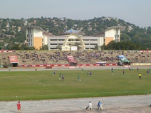
CCM Kirumba Stadium
Multi-purpose stadium in Mwanza, Tanzania
Distance: Approx. 1869 meters
Latitude and longitude: -2.499921,32.89949
CCM Kirumba Stadium is a multi-purpose stadium in Mwanza, Tanzania.
Roman Catholic Archdiocese of Mwanza
Roman Catholic archdiocese in Tanzania, Africa
Distance: Approx. 998 meters
Latitude and longitude: -2.5244,32.9046
The Roman Catholic Archdiocese of Mwanza (Latin: Archidioecesis Mvanzaënsis) is the Metropolitan See for the ecclesiastical province of Mwanza in Tanzania.
Isamilo International School Mwanza
School in Tanzania
Distance: Approx. 1193 meters
Latitude and longitude: -2.508425,32.90681944
Isamilo International School Mwanza, founded in 1956, is an international school for students aged 3 to 18 in Mwanza, Tanzania. The school has been known as The Government European School, Isamilo Primary School and Isamilo School Mwanza before being renamed in 2008 to its present name, Isamilo International School Mwanza. The school teaches subjects in accordance with the British National Curriculum.
Mwanza International School
School in Tanzania
Distance: Approx. 1503 meters
Latitude and longitude: -2.5281697,32.892867
Mwanza International School is a primary and secondary school teaching the British National Curriculum (Cambridge) to local and expatriate children in Mwanza, Tanzania. The school was founded in 2012 by Barry and Ruth Clement and is situated on the Capri Point promontory overlooking the shores of Lake Victoria.
Catholic University of Health and Allied Sciences
Private university in Mwanza, Tanzania
Distance: Approx. 1540 meters
Latitude and longitude: -2.52833333,32.9075
Catholic University of Health and Allied Sciences (CUHAS) is a private university in Mwanza, Tanzania.

Saanane Island National Park
Tanzanian National Park is an island in Lake Victoria
Distance: Approx. 3285 meters
Latitude and longitude: -2.54436389,32.88972222
Saanane Island National Park is a Tanzanian national park in Mwanza. The park is located on an island in Lake Victoria and can be reached by boat from the TANAPA offices on Capri Point in Mwanza town. It is named after the local farmer and fisherman Mzee Saanane Chavandi.
Ibungilo
Ward in Ilemela, Mwanza, Tanzania
Distance: Approx. 3078 meters
Latitude and longitude: -2.489638,32.90568
Ibungilo is an administrative ward and the headquarter of the Ilemela District in Mwanza Region Tanzania.
Kirumba
Ward in Mwanza, Tanzania
Distance: Approx. 1874 meters
Latitude and longitude: -2.50154798,32.89266307
Kurumba is an administrative ward in Ilemela District, Mwanza Region, Tanzania.
Mecco
Ward in Mwanza, Tanzania
Distance: Approx. 1961 meters
Latitude and longitude: -2.51651624,32.9176345
Mecco is an administrative ward in Ilemela District, Mwanza Region, Tanzania.
Nyamanoro
Ward in Mwanza, Tanzania
Distance: Approx. 2859 meters
Latitude and longitude: -2.4924125,32.9083714
Nyamanoro is an administrative ward in Ilemela District, Mwanza Region, Tanzania. In 2016 the Tanzania National Bureau of Statistics report there were 27,010 people in the ward, from 51,456 in 2012 when Nyamagana District split.
Bugando Medical Centre
Hospital in Mwanza Region, Tanzania
Distance: Approx. 1514 meters
Latitude and longitude: -2.52805556,32.9075
Bugando Medical Centre (BMC) is a tertiary care medical facility owned by the Episcopal Conference of the Catholic Bishops of Tanzania. The hospital is operated in collaboration with the Tanzania Ministry of Health and Social Welfare.
Weather in this IP's area
light rain
21 Celsius
21 Celsius
21 Celsius
21 Celsius
1012 hPa
84 %
1012 hPa
887 hPa
10000 meters
0.5 m/s
0.66 m/s
173 degree
100 %
