196.216.13.89 - IP Lookup: Free IP Address Lookup, Postal Code Lookup, IP Location Lookup, IP ASN, Public IP
Country:
Region:
City:
Location:
Time Zone:
Postal Code:
ISP:
ASN:
language:
User-Agent:
Proxy IP:
Blacklist:
IP information under different IP Channel
ip-api
Country
Region
City
ASN
Time Zone
ISP
Blacklist
Proxy
Latitude
Longitude
Postal
Route
db-ip
Country
Region
City
ASN
Time Zone
ISP
Blacklist
Proxy
Latitude
Longitude
Postal
Route
IPinfo
Country
Region
City
ASN
Time Zone
ISP
Blacklist
Proxy
Latitude
Longitude
Postal
Route
IP2Location
196.216.13.89Country
Region
nkhotakota
City
nkhotakota
Time Zone
Africa/Blantyre
ISP
Language
User-Agent
Latitude
Longitude
Postal
ipdata
Country
Region
City
ASN
Time Zone
ISP
Blacklist
Proxy
Latitude
Longitude
Postal
Route
Popular places and events near this IP address

Nkhotakota
Place in Central Region, Malawi
Distance: Approx. 1268 meters
Latitude and longitude: -12.91666667,34.3
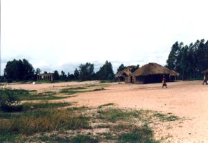
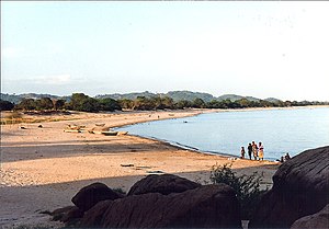
Nkhotakota (Un-kho-tah-kho-tuh) (formerly Kota Kota) (name derived from the Chichewa for "Corner Corner") is a town and one of the districts in the Central Region of Malawi. It is on the shore of Lake Malawi (formerly Lake Nyasa) and is one of the main ports on Lake Malawi. As of 2018, Nkhotakota had a population estimated at 28,350.

Makuta, Malawi
Place in Central Region, Malawi
Distance: Approx. 1829 meters
Latitude and longitude: -12.91666667,34.28333333
Makuta is a village in central Malawi on Lake Malawi. It is located in Salima District in the Central Region approximately 1.5 kilometres (1 mile) north of Nkhotakota.

Kapeta
Place in Central Region, Malawi
Distance: Approx. 4924 meters
Latitude and longitude: -12.88333333,34.3
Kapeta is a village in central Malawi on Lake Malawi. It is Moin Salima District in the Central Region approximately 3 kilometres (2 mi) north of Nkhotakota.

Mbaluko
Place in Central Region, Malawi
Distance: Approx. 784 meters
Latitude and longitude: -12.93333333,34.3
Mbaluko is a village in central Malawi near Lake Malawi. It is located in Salima District in the Central Region approximately 1 mile (1.6 km) north of Nkhotakota.

Mtenje
Village in Central Region, Malawi
Distance: Approx. 784 meters
Latitude and longitude: -12.93333333,34.3
Mtenje is a village in central Malawi near Lake Malawi. It is located in Nkhotakota District in the Central Region approximately 1 mile (1.6 km) north of Nkhotakota.
Nkhotakota Solar Power Station
Malawian solar farm
Distance: Approx. 3374 meters
Latitude and longitude: -12.95722222,34.29055556
Nkhotakota Solar Power Station, is an operational, 21 MW (28,000 hp) solar power plant in Malawi. The solar farm, whose first phase, with capacity of 21 MW, was commercially commissioned in March 2023, is under expansion to 38 MW by a consortium comprising independent power producers Phanes Group and Serengeti Energy Limited (formerly responsAbility Renewable Energy Holding - rAREH).
Weather in this IP's area
overcast clouds
23 Celsius
23 Celsius
23 Celsius
23 Celsius
1012 hPa
77 %
1012 hPa
956 hPa
10000 meters
2.25 m/s
3.7 m/s
269 degree
100 %