196.192.165.164 - IP Lookup: Free IP Address Lookup, Postal Code Lookup, IP Location Lookup, IP ASN, Public IP
Country:
 South Africa
Region:
City:
Location:
Time Zone:
Postal Code:
ISP:
ASN:
language:
User-Agent:
Proxy IP:
Blacklist:
IP information under different IP Channel
ip-api
Country
Region
City
ASN
Time Zone
ISP
Blacklist
Proxy
Latitude
Longitude
Postal
Route
db-ip
Country
Region
City
ASN
Time Zone
ISP
Blacklist
Proxy
Latitude
Longitude
Postal
Route
IPinfo
Country
Region
City
ASN
Time Zone
ISP
Blacklist
Proxy
Latitude
Longitude
Postal
Route
IP2Location
196.192.165.164Country
zaRegion
western cape
City
hout bay
Time Zone
Africa/Johannesburg
ISP
Language
User-Agent
Latitude
Longitude
Postal
ipdata
Country
Region
City
ASN
Time Zone
ISP
Blacklist
Proxy
Latitude
Longitude
Postal
Route
Popular places and events near this IP address

Hout Bay
Seaside suburb of Cape Town, Western Cape, South Africa
Distance: Approx. 150 meters
Latitude and longitude: -34.03333333,18.35
Hout Bay (Afrikaans: Houtbaai, meaning "Wood Bay") is a seaside suburb of Cape Town in the Western Cape province of South Africa. It is situated in a valley on the Atlantic seaboard of the Cape Peninsula, twenty kilometres south of the Central business district of Cape Town. The name "Hout Bay" can refer to the town, the bay on which it is situated, or the entire valley.
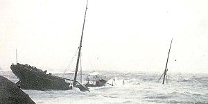
SS Maori (1893)
Shoreline historical wreck in Leeugat Bay on the Cape Peninsula west coast
Distance: Approx. 3238 meters
Latitude and longitude: -34.03444444,18.31333333
Maori was a British refrigerated cargo steamship built in 1893 by C.S. Swan & Hunter of Wallsend-on-Tyne for Shaw, Savill & Albion Co. of London with intention of transporting frozen meat and produce from Australia and New Zealand to the United Kingdom. The vessel stayed on this trade route through her entire career.

Red Bull Big Wave Africa
Distance: Approx. 3691 meters
Latitude and longitude: -34.06,18.325
The Red Bull Big Wave Africa is a surfing competition held annually in Cape Town, Western Cape, South Africa. The event is held at "Dungeons", just east of The Sentinel, a peak in Hout Bay, Cape Town. The reef has been known since the 80's as a site for large Atlantic swells breaking over a reef.

Llandudno, Western Cape
Seaside town in the Western Cape, South Africa
Distance: Approx. 2593 meters
Latitude and longitude: -34.01027778,18.34277778
Llandudno is a seaside suburb of Cape Town on the Atlantic seaboard of the Cape Peninsula in the Western Cape, South Africa. There are no street lights, shops or commercial activities, and the town has some of the most expensive residential property in South Africa. Llandudno Beach is one of the Cape's most naturally diverse beaches, surrounded by large granite boulders and overlooked by mountains.
Sandy Bay, Cape Town
Beach in Cape Town, South Africa
Distance: Approx. 1952 meters
Latitude and longitude: -34.02333333,18.33083333
Sandy Bay is a nudist beach just south of Llandudno. It is on the west side of the Karbonkelberg, and cannot be seen from the main road to Hout Bay, which turns inland above Llandudno. Sandy Bay is not easily accessible.

Karbonkelberg
Distance: Approx. 2928 meters
Latitude and longitude: -34.03333333,18.31666667
Karbonkelberg is a small peak forming part of the Table Mountain National Park in Cape Town, South Africa.

Hout Bay Museum
History museum in Cape Town, South Africa
Distance: Approx. 1335 meters
Latitude and longitude: -34.040278,18.36
Hout Bay Museum is a province-aided museum at 4 Andrews Road in Hout Bay near Cape Town, South Africa. Opened on 5 April 1979, the museum has displays on the history of the Hout Bay valley and its people, focusing on forestry, mining, and the fishing industry up to modern times. The museum also organises weekly guided nature walks into the surrounding mountains.

Duiker Island
Small island seal colony off Hout Bay, South Africa
Distance: Approx. 3461 meters
Latitude and longitude: -34.05861111,18.32694444
Duiker Island or Duikereiland (Afrikaans), also known as Seal Island (not to be confused with the nearby Seal Island), is an island off Hout Bay near Cape Town South Africa. It is 77 by 95 metres in size, with an area of about 0.4 hectare. The island is renowned for its marine wildlife, including the Cape fur seals and marine bird species such as the common cormorants and kelp gulls.

Imizamo Yethu
Place in Western Cape, South Africa
Distance: Approx. 1835 meters
Latitude and longitude: -34.01666667,18.35
Imizamo Yethu (Xhosa, meaning "Our Efforts" and commonly known as Mandela Park or IY) is an informal settlement in the greater Hout Bay Valley area. The 18 hectare settlement houses approximately 33 600 people..

World of Birds Wildlife Sanctuary and Monkey Park
Wildlife sanctuary in Hout Bay, Cape Town, South Africa
Distance: Approx. 2170 meters
Latitude and longitude: -34.0175,18.3625
World of Birds Wildlife Sanctuary and Monkey Park (often shortened to World of Birds) is an avian, reptilian and wildlife sanctuary in Hout Bay, a suburb of Cape Town in South Africa. As suggested by its name, the focus is primarily on birds and monkeys. It is the largest African bird park and among the bird parks in the world with the higher number of species.

The Sentinel (Hout Bay)
Distance: Approx. 3091 meters
Latitude and longitude: -34.059081,18.336578
The Sentinel or Hangberg is a peak marking the western end of the mouth of Hout Bay in South Africa. It has a sheer cliff dropping towards the sea, and a coastal hiking path is accessible at low tide. It is adjacent to Hout Bay Harbour and the Hangberg settlement, and to the higher Karbonkelberg peak.

Lichtenstein Castle (South Africa)
Building in Hout Bay, South Africa
Distance: Approx. 1177 meters
Latitude and longitude: -34.04217,18.34185
Lichtenstein Castle (German: Schloss Lichtenstein, Afrikaans: Lichtenstein Kasteel) is a castle in Hout Bay, Western Cape, South Africa, built on the Karbonkelberg and modelled after Lichtenstein Castle in Württemberg, Germany.
Weather in this IP's area
clear sky
27 Celsius
27 Celsius
27 Celsius
27 Celsius
1010 hPa
52 %
1010 hPa
1007 hPa
10000 meters
8.7 m/s
10.71 m/s
195 degree