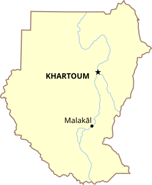
Country:
Region:
City:
Latitude and Longitude:
Time Zone:
Postal Code:
IP information under different IP Channel
ip-api
Country
Region
City
ASN
Time Zone
ISP
Blacklist
Proxy
Latitude
Longitude
Postal
Route
Luminati
Country
Region
nu
City
malakal
ASN
Time Zone
Africa/Juba
ISP
DELTANET-FIBER
Latitude
Longitude
Postal
IPinfo
Country
Region
City
ASN
Time Zone
ISP
Blacklist
Proxy
Latitude
Longitude
Postal
Route
db-ip
Country
Region
City
ASN
Time Zone
ISP
Blacklist
Proxy
Latitude
Longitude
Postal
Route
ipdata
Country
Region
City
ASN
Time Zone
ISP
Blacklist
Proxy
Latitude
Longitude
Postal
Route
Popular places and events near this IP address

Malakal
City in Greater Upper Nile, South Sudan
Distance: Approx. 2178 meters
Latitude and longitude: 9.55,31.65
Malakal is a city in South Sudan, serving as the capital of Upper Nile State in the Greater Upper Nile region of South Sudan, along the White Nile River. It also serves as the headquarter of Malakal County and it used to be the headquarter of Upper Nile Region from the 1970s to the late 1990s.

Battle of Malakal
Distance: Approx. 2178 meters
Latitude and longitude: 9.55,31.65
The Battle of Malakal occurred at the end of November 2006 in the southern Sudanese town of Malakal. The clashes between Sudanese government forces and the Sudan People's Liberation Army were the most serious breach of a 2005 deal to end the Second Sudanese Civil War.
Malakal Airport
Airport in South Sudan
Distance: Approx. 2979 meters
Latitude and longitude: 9.55888889,31.65222222
Malakal Airport (IATA: MAK, ICAO: HJMK) is an airport serving Malakal, a city in Malakal County in the Upper Nile State of South Sudan. The airport is located just north of the city's central business district, adjacent to the main campus of Upper Nile University. Malakal is near the international border with the Republic of Sudan and the border with Ethiopia.

Roman Catholic Diocese of Malakal
Roman Catholic diocese in South Sudan
Distance: Approx. 1153 meters
Latitude and longitude: 9.533333,31.65
The Roman Catholic Diocese of Malakal (Latin: Malakalen(sis)) is a diocese in Malakal in the ecclesiastical province of Juba in South Sudan.
Upper Nile University
Distance: Approx. 1863 meters
Latitude and longitude: 9.55,31.65833333
Upper Nile University (UNU) is a university in South Sudan.
Malakal Stadium
Building in South Sudan
Distance: Approx. 793 meters
Latitude and longitude: 9.53555556,31.65361111
Malakal Stadium is a multi-use stadium in Malakal, South Sudan. It was built with the help of UN Peacekeeping Forces (INDBATT).

1986 Sudan Airways Fokker F-27 shootdown
1986 airliner shootdown
Distance: Approx. 5625 meters
Latitude and longitude: 9.57498333,31.68960833
On 16 August 1986 a Sudan Airways Fokker F-27 Friendship 400M was performing a scheduled domestic passenger flight from Malakal (in present South Sudan) to Khartoum in Sudan, when it was shot down by the SPLA militants. All 60 people on board the aircraft were killed. As of February 2024, the shootdown remains the deadliest incident involving a Fokker F-27 and the deadliest aviation incident in South Sudan.

2024 Malakal Airport collision
2024 aviation accident
Distance: Approx. 2664 meters
Latitude and longitude: 9.552428,31.645778
On 31 March 2024, a Boeing 727-200 operated by Safe Air Company scheduled to fly from Juba International Airport to Malakal Airport, South Sudan, undershot the runway after experiencing technical issues. The plane collided with a disabled McDonnell Douglas MD-82 that had crashed around two months earlier in the same airport. Out of the seven occupants on board, everyone survived with only one injured.
Weather in this IP's area
broken clouds
30 Celsius
30 Celsius
30 Celsius
30 Celsius
1006 hPa
43 %
1006 hPa
962 hPa
10000 meters
2.1 m/s
4.44 m/s
128 degree
71 %
05:47:52
17:28:44