196.1.31.15 - IP Lookup: Free IP Address Lookup, Postal Code Lookup, IP Location Lookup, IP ASN, Public IP
Country:
Region:
City:
Location:
Time Zone:
Postal Code:
IP information under different IP Channel
ip-api
Country
Region
City
ASN
Time Zone
ISP
Blacklist
Proxy
Latitude
Longitude
Postal
Route
Luminati
Country
Region
kh
City
windhoek
ASN
Time Zone
Africa/Windhoek
ISP
Paratus
Latitude
Longitude
Postal
IPinfo
Country
Region
City
ASN
Time Zone
ISP
Blacklist
Proxy
Latitude
Longitude
Postal
Route
IP2Location
196.1.31.15Country
Region
hardap
City
rehoboth
Time Zone
Africa/Windhoek
ISP
Language
User-Agent
Latitude
Longitude
Postal
db-ip
Country
Region
City
ASN
Time Zone
ISP
Blacklist
Proxy
Latitude
Longitude
Postal
Route
ipdata
Country
Region
City
ASN
Time Zone
ISP
Blacklist
Proxy
Latitude
Longitude
Postal
Route
Popular places and events near this IP address

Rehoboth, Namibia
Town in Hardap Region, Namibia
Distance: Approx. 5 meters
Latitude and longitude: -23.31666667,17.08333333
Rehoboth is a town in the Hardap Region of central Namibia, just north of the Tropic of Capricorn. It had a population of 40,788 people in 2023. Rehoboth is intersected from north to south by the national road B1, which also serves as the border of the two electoral constituencies in the town, Rehoboth Urban West and Rehoboth Urban East.

Rehoboth (homeland)
Distance: Approx. 267 meters
Latitude and longitude: -23.31593333,17.08082222
Rehoboth (or Basterland) was a bantustan in South West Africa (present-day Namibia) intended by the apartheid-era government to be a self-governing homeland for the Baster people in the area around the town of Rehoboth. The Bantustan existed until 29 July 1989, a few months prior to the Independence of Namibia.

Rehoboth Rural
Electoral constituency in Hardap region, Namibia
Distance: Approx. 5 meters
Latitude and longitude: -23.31666667,17.08333333
Rehoboth Rural is an electoral constituency in the Hardap region of Namibia. It had a population of 7,288 in 2011, down from 7,524 in 2001. Rehoboth Rural covers an area of 10,959 km2 (4,231 sq mi).

Rehoboth Urban West
Electoral constituency in Namibia
Distance: Approx. 167 meters
Latitude and longitude: -23.31666667,17.08166667
Rehoboth Urban West is an electoral constituency in the Hardap region of Namibia, comprising the suburbs of Rehoboth that are situated to the west of the national road B1, covering an area of 325 km2 (125 sq mi). It had a population of 11,197 in 2011, up from 9,238 in 2001. As of 2020 the constituency had 8,324 registered voters.

Rehoboth Urban East
Electoral constituency in Namibia
Distance: Approx. 167 meters
Latitude and longitude: -23.31666667,17.08166667
Rehoboth Urban East is an electoral constituency in the Hardap region of Namibia, comprising the suburbs of Rehoboth that are situated to the east of the national road B1, covering an area of 288 km2 (111 sq mi). It had a population of 18,035 in 2011, up from 12,891 in 2001. As of 2020 the constituency had 12,112 registered voters.

Rehoboth railway station
Railway station in Namibia
Distance: Approx. 5 meters
Latitude and longitude: -23.31666667,17.08333333
Rehoboth railway station is a railway station serving the town of Rehoboth in Namibia. It is part of the TransNamib Railway, and is located along the Windhoek to Upington line.

Oanob Dam
Dam in Hardap, Namibia
Distance: Approx. 6031 meters
Latitude and longitude: -23.325,17.025
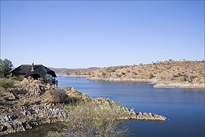
Oanob Dam is a dam outside Rehoboth, Hardap Region, Namibia. Located 7 kilometres (4.3 mi) outside Rehoboth, it dams the Oanob River and supplies the town with the majority of its water. It has a capacity of 34,505,000 cubic metres (1.2185×10⁹ cu ft) and was completed in 1990, the year of Namibia's independence.
Weather in this IP's area
clear sky
33 Celsius
31 Celsius
33 Celsius
33 Celsius
1005 hPa
11 %
1005 hPa
863 hPa
10000 meters
2.58 m/s
4.31 m/s
166 degree